Getting Maps Right for the Color-blind Naturalist

Rainbow at dusk near Tarcoles, Costa Rica, 17 February 2010. Photo by Richard Brewer

The January 2010 issue of The Auk published my review of the Atlas of Breeding Birds of Ontario, 2001-2005.  It’s a fine book. It may be a little heavy for some readers–it weighs more than seven pounds.

The next (April) issue of The Auk published a Letter to the Editor that made reference to the review.  The letter from Wayne E. Thogmartin (with the U.S. Geological Survey at its LaCrosse, Wisconsin, center) was prompted, he wrote, by “a peculiar aside proffered by the author.”  He then quoted the following passage from my review:

A word about the colors of the maps:  Like nearly 10% of males in the United States (a similar prevalence in Canada, I suspect), I have red-green color blindness.  Though it may seem unfair that maps and other color-coded graphics should be designed with 10% of one-half of the human population in mind, I suggest that it is unwise to design materials that will be unintelligible or at best ambiguous for this segment of the population. My wife, like 99% of the female population, has good color vision.  She informs me that the breeding evidence maps use the following colors–gold, orange, red, yellow, and dark gray (plus white). I can separate all these colors, whether I can identify them or not.

I have more trouble with the relative abundance maps; they use white, yellow, gold, light orange, orange, and red.  In areas where the abundance level marches in orderly progression from low to high, I can pretty much distinguish the six abundance classes.  But an isolated blob might require considerable study in very good light.

At least these maps do not intermix red and green.

The emphasis was added by Thogmartin.

He calculated that at 8% prevalence in the general (male) population, about 140 members of the AOU are likely to have red-green color blindness, or “color-vision impairment.” He went on to say, “Any failure to produce a color legend that is informative to the full spectrum of ornithologists is unfortunate,” because methods are available that allow map-makers to produce maps with color schemes everyone can interpret. He cited several sources that can be consulted by the map-maker who aspires to inclusiveness and social equity.

I’m indebted to Thogmartin for making my aside operational.  I admit I’m puzzled by his characterization of it as “peculiar.”  But it does seem odd, if not peculiar, that one of the most important students of getting map colors right for the color-blind, as cited by Thogmartin, is also named Brewer.  That would be Cynthia A., professor of geography at Penn State (no relation).

Cynthia A.  has an online tool for map design, ColorBrewer, that looks very useful for designing color schemes. On the other hand, just having the cartographer confer with a color-vision impaired person might do the trick almost as well.  The map Presettlement Vegetation of Kalamazoo County, Michigan (Thomas W. Hodler, Richard Brewer, Lawrence G. Brewer (also no relation), and Henry A. Raup, 1981, Western Michigan University Department of Geography) has a color scheme anyone can readily interpret because a color-vision impaired person (me) chose the colors for the cartographer.

I noticed a couple of days ago that the National Weather Service’s on-line radar maps have a downloadable Color Blindness Tool (located on the left side of the screen under Additional Info:)  On-line radar has always looked like multicolored hash to me, so I’m hoping the tool (Visolve) will prove usable and useful.

The 2010 American Columbo Census

Last week I finished my annual American columbo census.  Every year in June, I check up on a marked population of American columbo (Frasera caroliniensis) plants in the oak woods near where my wife and I live in Oshtemo Township. Here in southwest Michigan, columbo was an oak savanna plant. I suspect that today this township, which was mostly savanna at settlement, has more columbo remaining than anywhere else in Kalamazoo County.

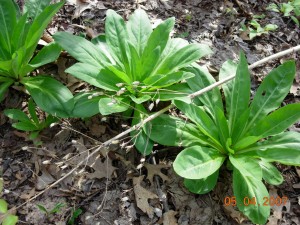
Rosettes of American columbo. Last year's dried flowering stalk from another plant is the diagonal between the two rosettes. Photo by Richard Brewer

Rosettes of American columbo. Last year's dried flowering stalk from another plant is the diagonal between the two rosettes. Photo by Richard Brewer

The usual way a person encounters columbo is to find one or a group of its basal rosettes.  These look rather like the basal rosettes of the well-known biennial weed common mullein except that the elongate oval leaves of columbo are thin, smooth, and green instead of thick, furry, and silvery like mullein.

Occasionally one sees a columbo flowering stalk.  It’s an impressive sight, often six or even eight feet tall, smooth and green, with several whorls of leaves and a great number of branches in the upper whorls bearing dozens or hundreds of small flowers on slim stems.  Though small, the flowers are striking looking, symmetrical with greenish-white, purple-dotted petals.  Long ago, in southern Illinois, when my friend Kenny Stewart and I found a blooming columbo, he described the flower as looking like a botany text book diagram of flower structure.  Calyx, corolla, stamens, a pistil, all the parts are laid out just as they should be, plus in the middle of each petal, a fringed nectar-producing gland.

A single flower of Am. columbo. Photo by Richard Brewer

Seven years ago, I decided to follow the fortunes of one patch of 121 columbo plants spread over an acre or so of oak woods. Two other patches of similar size exist several hundred feet away, one to the east and one to the west.   Ralph Babcock, a friend and former student, joined me to spend a day marking each plant by means of an orange plastic flag on a wire.  We gave each plant a number, written on the flag using a marking pen with super-permanent ink, and I recorded each location using direction and distance to landmarks and nearby plants. A little later in the summer, we recorded size and other information about each rosette.

Giving each plant an identifying number allows me to follow what happens to each one individually, like birds in a banded population.  Every June, I check to see which plants are still there and their size and condition and to replace weathered and missing flags.

Am. columbo plant number 52. On 23 June 2009, the rosette was composed of 30 leaves and had a diameter of 54 cm. Photo by Richard Brewer

The census usually takes me four or five days, a few hours each day.  Last year I postponed replacing  fading and tattered flags because I wanted to record what other plant species were within a meter or so around each plant and to note something about the topography and litter depth for each point.  So this year’s census took a little longer than usual because I had to make 39 new flags and renew the writing on many others.

As to the plants in the neighborhood, the big trees are mostly white oak, black oak, sassafras, wild black cherry, pignut hickory, and red maple  A few of the herbs are sweet cicely (which went from flowers to fruit just in the week when I was censusing), white avens ( in flower now), Indian pipe (not quite up yet this year), rattlesnake fern, spotted wintergreen, and lopseed.  There’s a fair amount of poison ivy and Virginia creeper on the ground too, more every year.

Some of the birds I hear singing or calling while I work on the columbo are Wild Turkey (pretty quiet lately), Ovenbird, Wood Pewee, Great Crested Flycatcher, Black-capped Chickadee, Tufted Titmouse, White-breasted Nuthatch, Rose-breasted Grosbeak, Blue Jay, Red-eyed Vireo, and Scarlet Tanager.

Other vertebrates are sparse.  A few days ago, I saw something hop close to one of my points and was able to find it and see the cross on its back.  It was a spring peeper back from the ponds a few hundred yards away, where they were peeping and mating in April.

There are plenty of deer, though less in evidence now than most of the year. The deer do not eat the columbo and also avoid stepping on them.  Of course, the rosettes die back above ground in the winter, leaving the crown of the large taproot just below the soil surface, so the deer have no visual clues of the columbo from fall to spring.  The deer do blunder into the orange flags, occasionally dislodging them and often bending the wires.  Nothing else seems very interested in the columbo foliage either–not the chipmunks, fox squirrels or even insects. Most plants show little or no sign of insect damage.

Of the original 121 plants, 11 have flowered in 7 years.  The plant then dies, just like the second-year mullein plant.  Some columbo have died without ever flowering, but many of the original plants are still alive, reappearing year after year as a basal rosette.

So, American columbo looks like it could be a biennial like mullein, basal rosette one year, flowering stalk the next, then gone;  but it’s not.  I don’t know how long columbo takes from germination to flowering here in the oak woods, but it’s a good many years at best.

Basal rosette of the biennial common mullein. Photo by Richard Brewer

If you’d like a name for plants with life cycles like columbo you could call them long-lived monocarpic perennials. Long-lived perennial monocarp is OK also. You may think you never heard of such a thing, but you have.  Some species of bamboos and century plants (Agave) act pretty much the same way.  Also a few animals–sockeye salmon and the 17-year cicada, for example.

Michigan League of Conservation Voters: Rep. Robert Jones-100, Colony Farm Orchard-0

The League of Conservation Voters is a national environmental group that is best known for its Environmental Scorecard, where the league tallies the pro- and anti-environmental votes cast by our elected representatives.  I’m glad the organization exists; I strongly support the idea that we should know how politicians vote on conservation issues and hold them accountable .

Logo of the Michigan League of Conservation Voters

About a week ago, the Michigan League of Conservation Voters (LCV) produced its Environmental Scorecard for the state legislature’s 2009-2010 session.  The scores were based on 18 bills in the House and 10 in the Senate.  Much of the report  was interesting and informative.  However, there was one serious omission–House Bill 5207.   This bill, introduced by Representative Robert Jones (D-Kalamazoo) and fast-tracked by him through the Commerce Committee of which he was chair, was as strongly anti-conservation, anti-environment, and anti-sustainability as any measure taken up this session.

The bill was not named “House Anti-conservation Bill 5207;” nevertheless, it was straightforwardly a bill to strip the open space/public use restriction from the Colony Farm Orchard, a semi-natural area adjacent to the Asylum Lake Preserve, in order to allow Western Michigan University to develop the site for expansion of its BTR Park.  Perhaps we ought to see the language of the restriction one more time:

“The conveyance shall provide that Western Michigan University may utilize the property solely for public park, recreation, or open space purposes, except that the legislature, by statute, may authorize Western Michigan University to utilize the property for some other public purpose.”

The anti-environment nature of the bill was brought to the attention of Michigan LCV staff by more than one person and on more than one occasion.  The conservation problems with HB 5207 were repeatedly brought to the attention of House and Senate members and the Governor  by letters, e-mails, phone calls, FAXes, personal visits , and e-mailed links to a documentary movie (The Colony Farm Orchard: Here We Go Again by Matt Clysdale) on YouTube.  By means of a couple of dozen published letters to the Kalamazoo Gazette, many news articles, public meetings and presentations of Matt Clysdale’s movie in Kalamazoo and elsewhere, the environmental controversy became widely known.

Nevertheless, the Michigan LCV did not include HB 5207 on its list of environmentally significant votes.

Because of this omission the LCV was able to award Representative Robert Jones a score of 100% and an “Honorable Mention” on its Environmental Scorecard.  As it turned out, 32 state representatives and 11 senators received 100% scores.  All were Democrats.

It is possible that  Rep. Jones introduced HB 5207 without knowledge of its conservation implications, or even its content.  But he certainly knew the problems well before his Commerce Committee took it up, well before the House passed it, and well before the Senate passed it–which was late at night just before the legislature broke for Christmas.

Dozens of people talked with Jones, asking him to withdraw HB 5207 or modify it.  But perhaps they weren’t the right people. They were WMU Environmental Studies students, local conservationists, members of community groups, and ordinary people who think that promises made should be promises kept.

We should note that with this bill included, no legislator would have received 100%.  All the 100% Democrats either voted for it, or took to the hills when the question was called. The only legislators who voted against the bill were two Republicans in the House and one Republican Senator. Clearly, no one in the Michigan legislature deserved a perfect score.  Without knowing how many other serious omissions there were from the list of “environmental” bills, it is impossible to know what the true highest score might have been.

Michigan LCV needs to consider seriously–and then let us know–why HB 5207 was omitted from the list of environmental bills.  Was it simple ignorance on the part of the staff that did the evaluation?  Was a decision made to overlook the anti-environment nature of the bill because WMU was marketing the bill as a job creation measure?  The politicians looked the other way when it became clear that any jobs created would be few and years away.  Perhaps LCV also looked away, afraid it might be seen as putting environment and business in conflict.

I suppose it could even be possible that HB 5207 was seen as too local an issue to be included.  If so, how many other bills of environmental importance might be missing from the evaluation?

But the conservation impact of HB 5207 reaches far beyond Kalamazoo. It sets a precedent for the legislature to tamper with conservation covenants on any land held by the state or state institutions.  What will happen if the Michigan Department of Natural Resources decides that we could get along without a few of our state parks and persuades a friendly legislator to introduce a bill to sell them for development?

A lawyer for a land-owner who wants to get out of a conservation easement that has become inconvenient could be thought remiss if the lawyer doesn’t say, Talk to your local representative.  The rules for conservation easements are just part of a state statute; they can be changed.

The Michigan League of Conservation Voters has some explaining to do.

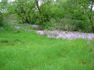
View in Colony Farm Orchard early June 2010. Photo by Richard Brewer

Why are Yellow-headed Blackbirds rare in Michigan?

Male Yellow-headed Blackbird singing, Wolf Lake Fish Hatchery. Photo 1 May 2010 by Tim Tesar.

A Yellow-headed Blackbird, a rare bird in Michigan, was seen near the end of April at Wolf Lake Fish Hatchery.  The Fish Hatchery is west of Kalamazoo, a few miles over the Kalamazoo-Van Buren County line.  The bird was first reported on 30 April.   I drove out Sunday morning, 2 May, to try to get a look.

It wasn’t hard.  The bird was on territory, hence easy to locate, and also easy to identify with its bold yellow, black, and white plumage.  On the perched bird, the white is seen as a narrow stripe on his side, but when he flies it flashes as a sizable patch on the leading edge of the wing.  Females don’t have the patch, but there were no females evident.

I watched the bird fly back and forth between several perches, singing fairly often, occasionally chasing a Red-winged Blackbird.  Male Yellow-headed Blackbirds are handsome birds, but their song is not handsome exactly, or pretty or melodious–more like odd, but well worth hearing for its oddity.  The recordings readily available on the web don’t quite do justice to the long, loud, vibratory parts of the performance, but you can get a general idea from the example included at the Bird Watcher’s Digest website.

Yellow-headed Blackbirds tend to be polygynous and colonial.  I wasn’t sure whether one lone male would be able to attract a female but I was hoping he’d get lucky.  But as far as I know no female was ever seen, and by some time around the middle of May, the male was gone.

Michigan accounts of the Yellow-headed Blackbird tend to start with a statement to the effect that species is relatively new as a breeding species in the state. It’s true that the first confirmed nesting in the state didn’t occur until 1956.  Four birders visiting the Upper Peninsula in late June followed up a report of Yellow-headed Blackbirds in a large marsh in Gogebic County, a few miles from the Wisconsin border.  They found two males and five females and spent some time hunting for nests but didn’t find any. However, one of the birders returned the next morning and found two nests.

The finder of the nest was Larry Walkinshaw.  Who else would it have been? Walkinshaw was a Battle Creek dentist who was also one of the great field ornithologists of the era. Part of his research repertoire was a seemingly uncanny ability to locate nests.  I wrote about Walkinshaw in an earlier post.

Discovery of the first Lower Peninsula nest followed four years later.  A colony of seven nests at a cat-tail marsh in Saginaw Bay was found in early June 1960 by Bob Grefe and fellow birders in Bay County near Quanicassee.

By the mid-1980s (1983-1988) The Atlas of Breeding Birds of Michigan (Brewer, McPeek, and Adams, 1991, Michigan State University Press) showed confirmed nesting in 13 townships–4 around Saginaw Bay and 2 more not far away, 4 in the Upper Peninsula, and 3 in Muskegon County on the west side of the Lower Peninsula.  Six more townships had summer birds that were probably nesting, but confirmation was lacking, and 10 more townships had birds possibly nesting.  (The uniform breeding codes and criteria for breeding-bird atlases are here.)

These observations could fit a pattern of arrival as a breeding species in Michigan sometime in the 1950s followed by spread and establishment as a regular but rare and local member of the breeding avifauna in the next 30 years or so.  But in preparing the chapter “Original Avifauna and Postsettlement Changes”  (pp 33-58) in the first Michigan breeding-bird atlas, I realized that the view of Yellow-headed Blackbird as a recent immigrant was incorrect or at least incomplete.

The blackbird, I concluded, is one of a small group of Great Plains species that occur in the grasslands and grassland marshes and that extend their geographic ranges when there are severe droughts in the Great Plains. It seems likely that carrying capacities for these birds drop as ponds and marshes shrink and grassland habitats deteriorate. Surplus birds disperse, some coming east.

The important droughts of the 20th century were the Great Drought of 1933-1940 and the 1950s drought, which was most severe in the Great Plains from about 1953-1957.  The first recorded nests of the Yellow-headed Blackbird in Michigan came during the invasion of the 1950s.  What happened in the 1930s drought?

During and just after the drought years of the 1930s, Yellow-headed Blackbirds were seen in the breeding season at a few places around Michigan after being virtually absent through the early part of the 20th century.  No nesting was recorded, but nesting did occur just to the southeast, in Ohio, at a site that has since become much more famous for other reasons–Magee Marsh (Lucas Co.). Nesting was first confirmed there in 1938, but summering birds were present from 1934 to 1941. After that, no summer birds were reported from the area around Sandusky Bay until 1960.

What of other, earlier droughts?  As we go back in time, the ornithological evidence gets scantier but follows the pattern of a bird that, except for occasional stragglers, is only here in the eastern part of the Midwest during tough environmental times in the Great Plains (and for a few years thereafter).

Here’s some more evidence.

Morris Gibbs, one of Michigan’s earliest ornithologists, a Kalamazoo resident, and a very smart guy, wrote in the early 1890s that the Yellow-headed Blackbird occurred in extreme southwestern Michigan and probably bred.  This statement was discounted by most later compilers of Michigan bird lists, although a specimen, the first for Michigan, was taken on 17 May 1890 in the Upper Peninsula adjoining Wisconsin (Dickinson Co.).

What is definitely true is that the species nested commonly in the 1870s-1890s in the large marshes around Chicago, Illinois, including Indiana marshes very close to the southwest corner of Michigan. In the summer of 1871, one egg collector took over a hundred Yellow-headed Blackbird eggs in the marshes along the Calumet River in Indiana southeast of Chicago and within 30 miles of the Michigan line.

This period of relative abundance in northwest Indiana and possible nesting in southwest Michigan was a time of two 19th century  droughts, one in the 1870s, and one from the late 1880s to about 1896. Then, in the early 20th century, populations in the marshes of northwestern Indiana faded to zero.

The second drought, the one from the late 1880s to 1896, was the one that gave rise to the slogan, “In God we trusted, in Kansas we busted” and led to the sod-busters dispersing from their Great Plains farms like Yellow-headed Blackbirds from a dried-up prairie slough.

2.  As we’ve noted, the first Michigan breeding bird atlas documented a substantial Yellow-headed Blackbird population.  But the atlas period included the third and last of the 20th-century droughts (1987-1989).  So the comparative abundance of the bird at that time fits our model very well.

I mentioned that other species seemed to follow a similar pattern of breeding season occurrence in Michigan corresponding to a cluster of drought years in the Great Plains.  The others that I noticed were Wilson’s Phalarope, Western Meadowlark, and perhaps a few more, such as Western Kingbird and Brewer’s Blackbird.

I would add one more thing:  Michigan is as much a part of the geographical range of these birds as it is for the robins and chickadees that are here in numbers every year.  Droughts are an expectable occurrence in the Great Plains.  When habitats deteriorate there, the lakes and marshes of Michigan, Illinois, and Ohio are important refuges for birds that would fail to breed and possibly would perish if the wetlands of the eastern Midwest were unavailable.

Asylum Lake Preserve: What Kalamazoo ought to do, part 2

My last post several days ago repeated and updated some remarks I’d made on Earth Day 2004.   It ended with the following comment about the Asylum Lake Preserve situation at that time:

Today’s Gazette (24 April 2004) had more good news. After a long process, a Declaration of Conservation Restrictions and Management Framework for the Asylum Lake Preserve was approved last Friday by the Western Michigan University (WMU) Board of Trustees. This way of protecting such land is not as strong as a conservation easement held by a land trust provided with an adequate defense endowment. But all in all, I’d say that the Asylum Lake property is now more secure than at any time since 1985. Continued vigilance by area citizens will still be needed. In the long run, their outrage at proposed violations is the only permanent protection.

Asylum Lake Preserve Winchell Avenue entrance. Photo by Richard Brewer

These statements are still basically correct.  However, the passage of six years has shown some weaknesses.  Some are structural, stemming from the arrangement that was worked out by the 20-member Focus Group from 1999 to 2004, others are operational shortfalls.  Following are a few I’ve observed.

Omission of  the Colony Farm Orchard

The failure of the non-university members of the Focus Group to insist on the explicit inclusion of the Colony Farm Orchard in the Declaration of Conservation Restrictions was a mistake. However, it’s likely that some element of the WMU administration was already tightly committed to future development of the Orchard land, despite its protection by a conservation covenant. By 2004, the Focus Group had already been meeting for about five years. It’s possible that if the community and other non-university members had been as intransigent on this matter as they should have been–that is, as intransigent as WMU–any resolution might have been several more years away.

Weak Focus on Conservation

The Policy and Management Council set up to oversee the management of the Preserve seems to spend too much time dealing with house-keeping and not enough with conservation.  To an outsider like me, some of the causes for this seem evident, but there may also be other non-obvious reasons.  The first problem is that the composition of the council is stacked in a way that makes any action counter to the WMU administration’s wishes difficult or, perhaps, impossible.  The by-laws specify the composition of the board:

University Members
a. Campus Planning
b. Environmental Institute
c. Environmental Studies
d. Physical Plant
e. VP Business and Finance.
f. 3 At-large members selected by the VP for Business and Finance

Community Members
a. Asylum Lake Preservation Association (ALPA)
b. Environmental Concerns Committee of the City of Kalamazoo (ECC)
c. Kalamazoo Environmental Council (KEC)
d. Oakland Drive/Winchell Neighborhood Association (ODWNA)
e. Parkview Neighborhood Association
f. Parkwyn Village Neighborhood Association

A near-automatic WMU majority of 8 to 6 is built in, if all members are present and voting.  It could be argued that this is the way it should be.  After all, it’s WMU’s land; shouldn’t they be able to do what they want to with it?  Who knows what a bunch of community activists might vote for?

It’s conceivable that on some crucial environmental issue one or more of the University delegates might be persuaded by the arguments of the Community delegates, resulting in a tie or even a majority against the WMU position.  (Perhaps the Environmental Studies delegate might be swayed.) I don’t know that any such thing has ever happened, but it would be interesting to see the WMU administration’s response if it did.

However, my guess is that that the Council meetings will be models of seeming tranquility until such time as every appointee from the Community groups becomes willing to (1) engage the whole Council on every matter related to  conservation purposes, including matters being neglected, and (2) scrutinize and debate every proposal so as to eliminate those that fail to advance conservation mandates or are less than prudent in the use of the Asylum Lake Preservation endowment.

Examples

Sidewalk along Parkview Avenue (looking east) and new parking lot under construction. Photo by Richard Brewer

I do not question the seriousness or good intentions of the Council: nevertheless, I think some actions or the neglect of some actions needed more rigorous examination.  Here are a few examples.

Shrinkage of Preserve. Reduction in size of the preserve has occurred through such actions as widening Drake and Parkview, adding sidewalks which turned the outer acres of the preserve into narrow strips isolated beyond an 8-foot expanse of concrete, and the current construction of a large parking area within the main body of the preserve.  Although WMU refers to the Preserve as 274 acres, that’s what it used to be.  Someone should subtract the land lost and provide  an accurate figure. No more shrinkage should occur.  Explicitly including the Colony Farm Orchard as a part of the Asylum Lake Preserve would be one way to restore lost acres.

Proliferation of Trails. The preserve needs to regain control of its trail system.   The current network seems to consist of paths to everywhere any visitor ever decided to go. The proliferation  is confusing, it contributes to soil erosion, and it opens almost every part of the preserve to disturbance by people and dogs.  I suspect that few if any ground-nesting birds are able to bring off successful broods today.  Every path plus a several-foot zone on each side is, ecologically, a loss from the preserve.  Preserves need trails but they should be short, mostly narrow, and based primarily on considerations of environmental and nature education.

Extravagant and Unnecessary Construction. Some completed and proposed construction probably needed more debate more focused on conservation and prudence.  Of course, we all like to see the old Preserve looking good, but which of these projects have been necessary and a reasonable use of the endowment fund?

Colony Farm Orchard. The Council should have taken up the Colony Farm Orchard’s role in the ecological functioning of Asylum Lake Preserve. A series of special meetings would have been appropriate. After assembling the relevant information, including hosting a forum for public debate, the Council should have made its own recommendation to WMU as to the Orchard’s best use in terms of the conservation values of the Preserve.

How Secure is the Asylum Lake Preserve?

There were faint earlier signals that we should have heeded, but for many of us the alarm bells really began to ring when we read Paula Davis’s article in the 3 July 2009 Gazette reporting that the WMU board had authorized paying Michigan State University up to $985,000 to give up its lease to do insect research at the Colony Farm Orchard.

Possibly the WMU administration and board knew so little history that they didn’t understand how the citizenry would react to a threat to the Orchard property.  But to the many Kalamazoo area residents who had fought the BTR park battles of the 1990s, the news about the Orchard was like the crew of a WW II cruiser sighting a U-boat periscope in the North Atlantic. Somebody involved in the maneuver would seem to have anticipated a negative response, judging by the stealth involved in the introduction of the legislation (to strip the Orchard’s open space/public use covenant) and the attempt–successful–to hustle it through the House.

Many people were, of course, unhappy with WMU’s designs on the Orchard.  Their letters of protest showed that most of them also believed that WMU’s willingness to break this covenant was evidence that its pledge to protect the Asylum Lake Preserve was also suspect.

Was WMU surprised that people drew this inference?  Only the administration and board could say, and they have managed to say remarkably little through the whole process from July 2009 to the present. One thing WMU administrators have said, in various permutations, is,  “We have made a decision to sustain our commitment to the Asylum Lake property.” Sometimes the statements were more forceful, but few people I’ve met were persuaded by any of them. The very fact of the reiteration–coupled with the plain fact that WMU was disregarding identical protections carried  by the Orchard–usually provoked the “The lady doth protest too much” reflex.

Here is a quote from the Declaration of Conservation Restrictions:

This Declaration…is intended to run with the land and shall be binding upon WMU, its present and future boards, its successors and assigns and shall constitute a servitude upon the Preserve.

This a strong statement.  However, it is somewhat undercut by the next clause in the document, Termination:

The intention to terminate this Declaration must be announced at an open meeting of the Policy and Management Council (“the Council”). See Section 8 herein. A hearing on said intention shall occur at the next meeting of the Council, which shall be scheduled within a reasonable time. At least 15 days and not more than 30 days before any hearing to terminate this Declaration, WMU shall place a public notice in the major local paper noticing the public hearing of said meeting at which public comment will be allowed concerning the intention to terminate. The Council shall make findings of fact regarding said intention to terminate this Declaration. A vote to support termination shall require a 3/4 vote of the Council. The action of the Council shall be presented to the WMU Board of Trustees at its next scheduled meeting within Kalamazoo County and at which public comment shall be allowed.

So, how secure is the Asylum Lake Preserve?  We see that the Declaration can be terminated  by a 3/4 vote of the council followed by WMU Board action.  A 3/4 vote of a 14-member Council would require 11 yeas. It would take only four no votes to block it.

Might the Council vote to terminate?  You be the judge.  And you might ponder this question at the same time: If WMU proposed terminating the Declaration and lost in the Council, what would be the administration’s next move?

I’ll return to the status of the Colony Farm Orchard in a future  post.

[23 June 2010.  I rearranged the order of this post to make it more descriptive.]

A Cleaner, Greener Land: What Kalamazoo Ought to Do. 2010, Part 1.

I made the following remarks at the 24 April 2004 Earth Day celebration at Kalamazoo Valley Community College and included them on the earlier version of my website as Conservation Letter 2 . Today, in boldface , I look at the same topics six years later.
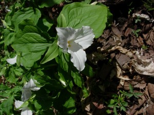
White trillium, Earth Day 2010. Photograph by Richard Brewer.


When I agreed to give a talk at Earth Day, I asked my wife what I should talk about. She said, “It’s Earth Day. Talk about positive, forward-looking things.”

“What should I call the talk?” I said.

“Use the title of the last chapter in your book.”

So today I’m talking about positive, forward-looking things going on in the area or the state, and the title is “A Cleaner, Greener Land.”

I added the subtitle myself.

A few months ago, I heard Dave Poulson speak just across the hall in KVCC’s Eye on Environment series. Poulson spent several years as the environmental reporter for the Booth newspapers, the only environmental reporter in the state as far as I know. He had just left that job to join an environmental journalism center at Michigan State University when he spoke here.

In his talk Poulson said that of all the issues he had reported on in his years of covering the environment in Michigan, he had concluded that the most important one, the central one where all the rest came together, was land use. As someone with a special interest in land conservation, I think that’s a sound conclusion, at least for the local and state level.

Today I’m going to mention a few hopeful land use actions that have been done or begun or at least been mentioned. I’ll also add a couple of other hopeful things that ought to be started.

1. First, I think this Earth Day is an encouraging sign in itself. I remember the first Earth Day in 1970 in Kalamazoo. Lew Batts spoke to a large audience at Nazareth College. [At the talk, I probably mentioned that there were smaller gatherings around the same time at Western Michigan University and Kalamazoo College.]

For the last several years, there has been no evident continuing civic commitment to Earth Day in Kalamazoo. Nevertheless, every year some group has stepped forward and put on something. I remember a couple of years ago, the Food Co-op, seeing that nobody else had planned anything, did the best they could in the space next to Kraftbrau.

2010–Continuing in the positive mode, it’s worth mentioning that the Kalamazoo People’s Food Co-op in these past few years has a remarkable record of success.  I would say this is largely a result of (1) very good management and (2) the existence of a large constituency in and around Kalamazoo who want organic and  local foods and who prefer to support this kind of organization instead of pouring their dollars into the pockets of large corporations.  The success of the small Co-op store on Burdick St. has shown the need for larger quarters and, after long study, the Co-op is planning to build at the north edge of the downtown area, next to MacKenzie’s Bakery.

To the Co-op’s great credit, the new building will be on a brownfield site, which it is joining with the city in remediating.  Also, the new downtown Kalamazoo link between the Kal-Haven trail and the Kalamazoo Riverfront trail will run right by it.  Potentially, people could walk or bike to the new store from Portage, Battle Creek, or South Haven.  (Unfortunately, people living in downtown Kalamazoo will have a longer walk than they do to the Burdick store.)

The Co-op is raising money for the project starting with its members.  It’s a worthy cause.

The groups that I know of that have been working on Earth Day this year are the Kalamazoo Environmental Council and KVCC. I’m sure representatives of other groups and just plain individual environmentalists have contributed also. Today gives every indication of being one of the best celebrations in a long time, but just the fact that official neglect hasn’t managed to kill off Earth Day in Kalamazoo has to be seen as a hopeful sign.

2010–More recent Earth Days have had, as far as I could tell, little or none of the coordination of events among the various groups that was evident in 2004.  This is unfortunate but perhaps understandable considering the absence of any city or county sponsorship.  However, the number of events and activities have continued to expand, with more and more groups doing their bit for Earth Day.

Earth Day is, strictly speaking, 22 April, but Earth Day events have spread to the weekends before and after the 22nd, and even beyond.   Nevertheless 22 April is the date in 1970 that the first of these national teach-in on the environment was held.  Senator Gaylord Nelson (D-Wisconsin) was the originator.  I hadn’t remembered until I read a little Earth Day history recently, that his inspiration came from the Viet Nam war teach-ins that had begun around 1965.

2. The biggest story on the front page of the Kalamazoo Gazette a month or so ago (28 March 2004) had the headline “Highway Upgrades Bypass Schoolcraft.” It’s one of those typical newspaper headings that don’t tell you what the article is about. What the story said was that the Michigan Department of Transportation has for the time being given up any plans to study, then plan and build a 4-lane $250 million 131 bypass around Schoolcraft.

This was not news; MDOT had made the announcement in December 2003. The reason is that there’s no money for new highway projects these days because of the poor economy. The Gazette article admits this but also spins the story to blame the people in the region for not embracing the idea of a bypass years ago.

The postponement is good land use news. Any of the bypass routes would eat up farmland that is probably the best in the state. Most of the routes would also destroy woods and marshes and would obliterate landmarks and relicts of Prairie Ronde, the 20-odd square miles of tall-grass prairie that once occupied the land around Schoolcraft. The bypass itself, depending on the exact route, could be four miles long and would occupy perhaps 600 acres and disturb much more in the construction. Interchanges and later business development would knock out additional acreages of farmland and natural land.

Only total cancellation of the whole idea of having a four-lane expressway all the way from Cadillac to the Indiana border would be better news for farmers and all opponents of sprawl.

2010–The Michigan Department of Transportation has not given up its dreams of a 4-lane highway to Nowhere, Indiana, as yet. Most recently, it has been talking about a bypass around Constantine.  The only thing lacking is the money–well, the money and a legitimate reason for spending it this way.  The project would cost $22 million, or probably more, which MDOT doesn’t have.  But by using other money, MDOT has started environmental impact studies, preliminary engineering, and land acquisition.  About 50 parcels of land will need to be bought, just to get around Constantine.

The economic downturn and lower gasoline usage mostly because of high gas prices have again spared Michigan the additional environmental degradation that would occur with a conversion of US-131 to an expressway all the way from Petoskey to the Indiana line.  But we’ll never be safe from the threat as long as Michigan retains, where a Department of Transportation ought to be, a Department of Concrete Six Lanes Wide.

If  “transportation” was really MDOT’s mission, its public statements would not be 98% about yet one more new highway or one more highway widening.  Rather it would also be busily dealing with questions of mass transit, bike trails, sidewalks, passenger trains, and how best to achieve transportation objectives without damaging natural areas and farmland. When it did talk about highways, it would talk about keeping the ones we have in good repair.

3. Today’s Gazette had more good news. After a long process, a Declaration of Conservation Restrictions and Management Framework for the Asylum Lake Preserve was approved last Friday (16 April) by the Western Michigan University (WMU) Board of Trustees. This way of protecting such land is not as strong as a conservation easement held by a land trust provided with an adequate defense endowment. But all in all, I’d say that the Asylum Lake property is now more secure than at any time since 1985. Continued vigilance by area citizens will still be needed. In the long run, their outrage at proposed violations is the only permanent protection.

2010–I’ll update the Asylum Lake/Colony Farm Orchard situation in my next post.  In it or later posts I’ll also cover points 4-7 of the original talk.


Land Trusts and The Land Trust Movement

Masthead of the newsletter of the Trustees of Reservations, the first land trust

This is an updated version of a page from the first version of my website.  It will be moved to the Pages section in a few days.

For classification purposes, we can separate land conservation by government and land conservation by private organizations. Two models of private land conservation exist–land trusts and land advocacy organizations. Land trusts protect land by direct action. They buy it or accept it as a gift or acquire a partial interest called a conservation easement that allows them to protect the conservation values of the land. Land advocacy groups, on the other hand, protect land indirectly by persuading government to buy or set aside land for parks or preserves and to regulate privately held land in ways that prevent its degradation. The Nature Conservancy is an example of a land trust; the Sierra Club is an example of an advocacy organization.

Land conservation by government has been important since the early years of the 20th century, beginning with Teddy Roosevelt. A few scattershot efforts, such as Yellowstone and Yosemite, occurred earlier. For 75 years or so, federal, state, and local governments did a fairly satisfactory job of land conservation.

This progressive era came to a halt in 1981. Since that time, governmental land protection efforts have been weak or absent, occasionally rising to near adequacy in a few places for brief periods. The slack left in the vital task of land conservation has increasingly been taken up by land trusts.

The first land trust was the Trustees of Reservations, formed in Massachusetts in 1891 through the efforts of Charles Eliot. Several more organizations that followed what we now recognize as the land trust model were begun in the next several decades. Examples include the Society for the Protection of New Hampshire Forests, formed in 1901, Save-the-Redwoods League (1917), Western Pennsylvania Conservancy (in 1932 as the Greater Pittsburgh Parks Association), and Michigan Nature Association (1951 as the St. Clair Metropolitan Beach Sanctuary Association). Nevertheless, the rate of land trust formation was slow, and fewer than 50 bona fide land trusts were in operation by the middle of the 20th century. Rapid growth began with the emergence of the popular environmental movement in the late 1950s-early 1960s. By 1980, more than 400 land trusts were in existence.

Formation of new land trusts shifted into high gear in the 1980s as public-minded citizens became aware of two unhealthy trends: the near-abandonment of land protection by government and the escalating loss of natural and agricultural lands to sprawl. By 1990, there were nearly 900 land trusts in existence and by 2000, 1263. A renewed growth spurt took the number to 1667 in 2005 in the most recent complete census.

It probably makes sense to think of the land trust “movement” beginning during a few months from the fall of 1981 to the spring of 1982. Even though about 430 organizations that we would now call land trusts were in operation by 1981, few had any information about what the others were doing. Most were probably unaware that so many other groups with similar aims existed. Two national meetings in 1981, one in Cambridge MA and one in San Francisco, helped to spread the word. The Cambridge meeting, in particular, led to the formation of the Land Trust Exchange, renamed Land Trust Alliance in 1990. These meetings and the activities of the LTE as a clearinghouse and umbrella organization helped to turn the separate local groups into a community.

Today every state except North Dakota has at least one land trust. The density varies greatly. California has (as of 2005 by the Land Trust Alliance census) 198. Massachusetts has 161 and Connecticut, 128. The other states have numbers in the tens or–for much of the South, the Rocky Mountain region and the Plains region–in single digits.

As for results, land trusts have protected about 11.9 million acres, as of 2005. Nearly half of these acres were protected in just the 5 years from 2000 to 2005.

Much more about the history of the land trust movement, its connection with the broader conservation and environmental movements, current practices of land trusts, and prospects for the future are discussed in Conservancy: The Land Trust Movement in America. The website of the Land Trust Alliance is informative, as are its many publications including its journal Exchange.

Field Trip to Big Island Woods (Cooper’s Island) Coming Up

Hackberry, a frequent canopy tree at Big Island Woods. Photograph by Richard Brewer.

Saturday 24 April I’m leading a field trip to the Big Island Woods, also referred to as Cooper’s Island.  It’s a trip for the Kalamazoo Wild Ones chapter.

“Big Island Woods” refers to an “island” of forest in the middle of Prairie Ronde, southwest Michigan’s largest mesic (tall-grass) prairie. The village of Schoolcraft was founded just east of the Island.  Of the Island’s original 300 acres or more, about 20 acres now remain.  The site is probably the natural area in southwest Michigan most worthy of permanent protection, for its combination of ecological, botanical, and historic values.

Historically, Prairie Ronde and the Big Island are interesting because of their connection with the earliest settlers in Kalamazoo County (such as Bazel Harrison), with James Fenimore Cooper (whence “Cooper’s Island”), and with Clarence and Florence Hanes, authors of The Flora of Kalamazoo County.

Ecologically, the remnant of the Big Island that survives is of interest because of its unusual species composition, its similarity to prairie groves of Illinois, and several rare plant species.  The forest could perhaps be called wet mesic and has a diverse canopy, despite a windstorm about ten years ago that blew down many large trees.

Probably the most unusual plant species is the white trout lily, known from only one other site in Kalamazoo County.  Two other rare plants are the trees Ohio buckeye and blue ash.  There are, in addition, many other plants of mesic forest and southern swamp forest, including a relatively rich complement of spring ephemerals.

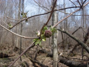
Red-berried elder in bud, early April, at Big Island Woods. Photograph by Richard Brewer.

Down trunks and woody debris from the wind storm about a decade ago make travel somewhat difficult in some parts of the woods.

Relatively little work has been done on the biota other than plants.  However, as a wooded island surrounded by agricultural fields and village streets, it could be an important stopover site for migratory  birds.  In less than two afternoon hours on 11 May 1996 three observers found 42 bird species including 14 species of warblers.

The trip will leave from the I-94 car-pool parking lot at Oakland Drive, Kalamazoo, at 9:15 AM Saturday.  Because parking at the field trip site is limited to about five cars, car-pooling is essential.  The field trip will conclude about noon.

Later on, after the trip, I’ll try to write something about what we saw and talked about at Cooper’s Island.

Kalamazoo County Spring 2010, Second Installment

I wrote the following last night.  Today, temperatures jumped into the 70s–77 as I write this at 6 PM.  The forecast is for highs in the 70s and 80s for the next three days.  So much for stretching out the spring.

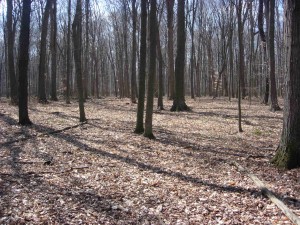
Beech-maple forest in early spring, Pavilion Township. Photograph by Richard Brewer.

A stretch of chilly weather, especially some cool nights below freezing, has kept spring from racing ahead the way it sometimes does.  This is good; summer is a fine time, but there are lots of things to experience in spring and it’s more fun to have them spread out rather than all happen in a week.

When I wrote my last post, no frogs had been calling as yet, but soon after, the afternoon of 17 March, wood frogs were calling in the small kettles such as the one shown in the preceding post.

Finding another sound to match any animal’s voice is difficult.  But saying that wood frog calls sound like the feeding chuckle of ducks is not a bad comparison. The frog calls are a little louder, I think, and each one sounds quite fervent, unlike the kind of absent-minded noodling of a bunch of dabbling ducks. But the comparison is a pretty good way to give other people an idea of what wood frogs sound like.

I have heard no chorus frogs or spring peepers yet.  We usually think of these two as the earliest frogs here in eastern North America, but some years wood frogs have been earlier in my experience.  I’m not sure, though, that–for whatever reason–peepers and chorus frogs aren’t rarer than they used to be.

Another animal that I believe was decidedly less common the past few months than in preceding years is the white-footed mouse.  I don’t go out and census mice in the woods; I base this impression on how many mice I trap each winter in the house.  The house here in Oshtemo Township is in oak forest. Beginning when the nights start to get cold, the mice start to find ways to get inside.  I trap them with ordinary mouse traps baited with a little peanut butter with a couple of sunflower seeds stuck in the peanut butter or inserted elsewhere on the trigger of the trap.  Most winters I trap a couple of dozen white-footed mice.  This winter I caught a couple of mice early on and then no more through most of November, December, January, and February.  I also set traps in my house in the southeast part of Kalamazoo County, in beech-maple forest.  Most years I catch several mice through the winter, but this past winter only a couple.

I don’t know what may have happened to the mice this winter and I don’t know whether it’s temporary or a permanent decline.  Next fall and winter may give me a clue.

Floerkea proserpinacoides, False Mermaid Weed, Big Island Woods, March 30, 2010. Photograph by Richard Brewer.

But that’s getting ahead of ourselves.  It’s early spring.  The wood frogs are calling.  In the beech-maple forest, harbinger of spring, our earliest spring wild flower is finishing up (a blog called Kalamazoo Seasons has a nice photo of the flower). The very first spring beauty flowers have opened. Wild leek is up.

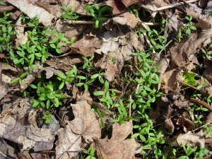
And the little annual Floerkea proserpinacoides with its pale-green narrow leaflets is spread profusely over the ground in the few woodlots where it occurs, but is not quite in bloom yet.  This odd mesic forest specialist deserves a better vernacular name than the obscure, bookish “false mermaid weed.”  Maybe we need a contest for a new, better-fitting name for it.

Anyway it’s spring and will be for a good month yet, maybe longer.  Let’s enjoy it.

Leaves of wild leek, March 2010, Pavilion Township. Photograph by Richard Brewer.

Signs of Spring

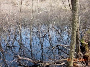
Open water in March in a buttonbush swamp, Oshtemo Township. Photo by Richard Brewer.

Spring began in southwest Michigan in the past few days.   One sign has been the Sandhill Cranes overhead, giving their loud rattle.  They could be on their way north or they could be local birds; several pairs now nest in Kalamazoo County.

Because snow cover was so continuous, and thick, some birds that are usually here by February were mostly delayed into early March.  The cranes are one species, Red-winged Blackbirds are another. I saw my first redwing a few days ago and they’re now pretty well scattered over the countryside.

In Pavilion Township Saturday, Song Sparrows were singing, Horned Larks were on territory in the open fields, and sailing overhead was my first Turkey Vulture of the new year. First in Michigan anyway; we saw Turkey and Black Vultures every day in Costa Rica. Most were probably resident there, but some could have been wintering birds from North America. This morning I saw my second Turkey Vulture sailing above West Main in Oshtemo Township.

I haven’t heard any frogs calling yet, and chilly as it is I don’t expect any tonight, but warmer weather is predicted for tomorrow.

As soon as bare patches began to appear around houses, the early spring bulbs were visible, some flowering.  I’ve already seen winter aconite, snow drops, and crocuses in bloom without hunting very hard.  Our native early spring wildflowers grow mostly in the mesic deciduous forests, and many of them are spring ephemerals–they come up, bloom, and then die back, so for most of the year they’re invisible above ground.  Right now the beech-maple forests probably have harbinger-of-spring in flower, and in the wooded low spots currently occupied by temporary vernal pools, skunk cabbage flowers will be out, though perhaps not producing pollen quite yet.

Acute-leaved hepatica, an early spring wild flower, but not a spring ephemeral. Photographed in an Oshtemo Township oak forest by Richard Brewer.

Our native early spring flowers take advantage of the brief window of full sun that opens between the arrival of warmer weather and the closing of the forest canopy by sugar maples.  It would make sense that the cultivated spring bulbs we buy and plant might be the early spring flowers from the deciduous forests of other parts of the Earth, but that isn’t the case.  Rather, most of the spring bulbs blooming in our front yards come from the steppes or the alpine and sub-alpine meadows of the Middle East and Asia.

The seasons follow one another in a continuous cycle.  A year has no natural beginning and no end.  Several groups of ancients gave the winter solstice, around December 21, special significance because it was the day they were reassured that the sun was actually coming back for another year. Our New Year’s Day, January 1 is arbitrary but since it comes not too long after the solstice, it’s not wholly unsatisfactory as a starting point in the cycle.

To me, though, the first definite signs of spring in nature, the sorts of things that have happened in the past week or so, feel like the engine of the year starting up.  In our temperate latitudes, this is the start of the year’s organic production; photosynthesis really gets underway, storing sunlight that, passed on along the food chain, runs nearly the totality of the living world. For a high percentage of the creatures here, spring is the time for beginning reproduction as well as production.  Eggs hatch and babies are born, and young of the year having new combinations  of genes not quite the same as either parent go out to become part of a later generation–or not.

Spring has arrived in southwest Michigan–I think–and a new year has started.  Happy New Year!