Category Archives: Michigan (including Kalamazoo)

Landscape and Vegetation of Oshtemo Township at the time of Settlement

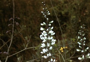
False Wild Indigo growing on land of the former Grand Prairie.  Photo copyright Richard Brewer 2009.

False Wild Indigo growing on land of the former Grand Prairie. Photo copyright Richard Brewer 2009.

This is a short version of a talk I gave at the Oshtemo Historical Society, Kalamazoo County, Michigan, this spring (March 2009) on the original vegetation of the township.

I’m using 1830 as the beginning date. There are good reasons for choosing that year. One of Kalamazoo County’s famous early settlers, Benjamin Drake, arrived with his wife, Maria, on Grand Prairie in 1830. The family settled in the Oshtemo part of the prairie (which extended across the line into Kalamazoo Township). Enoch and Deborah Harris, the county’s first black settlers, arrived about the same time, maybe a little earlier, on Genesee Prairie in the southern part of Oshtemo Township. For the settlers, the tall-grass (mesic) prairies were destinations, like islands in the ocean.

Also,1830 was the year that the General Land Office Survey for Oshtemo Township was conducted. The survey produced data that allows us to form a pretty good idea of what the vegetation was like at the time. The survey and settlement are connected, of course, because the purpose of the survey was to establish the sections,townships, and ranges that provided the framework for the sales of land to the immigrants.

Even though the purpose of the survey was not botanical, it collected information as to species and diameters of trees at section corners and quarter sections, along with their distances from these points, allowing a relatively accurate reconstruction of the vegetation. Using this data and other sorts of information from the original land survey along with topographic information, a map of the vegetation of Kalamazoo County in 1830 was prepared (T. W. Hodler, Richard Brewer, L. G. Brewer, and H. A. Raup. 1981. Pre-settlement vegetation of Kalamazoo County, Michigan [map]. WMU Geography Department, Kalamazoo.

Of course, Oshtemo history doesn’t start at 1830. We know that LaSalle with a band of four men went through southern Michigan in 1680, and it’s likely that his route went through Oshtemo, probably right through Grand Prairie. It was about this time of year, probably the last week of March.

But the Potawatomi were already here, having arrived about 1700 from Wisconsin. As far as vegetation and animals go, Oshtemo history starts around 14,000 years ago when Pleistocene glacial ice disappeared from Oshtemo and adjacent areas to the south and east. Paleo-Indians followed the mammoths and other now-extinct large mammals into an open grassy, sedgy landscape that also contained a few species of plants related to today’s tundra.

If we compare Oshtemo Township with the rest of Kalamazoo County, Oshtemo was one of the less diverse townships vegetationally. Most of the land was occupied by the related communities of oak savanna, oak forest, and prairie. Here are the percentages of the total land area and the geological land form each community occupied :
Oak savanna                                 61%      Outwash, moraine
Oak forest                                     27 %      Moraine
Bur oak opening                            3%      Outwash, moraine
Mesic Prairie                                  2%       Outwash
Beech-sugar maple forest         6.5%    Moraine
Marsh and other wetlands        0.5%   Moraine

Several other plant communities, especially wetlands like bogs, fens, and tamarack swamps, were almost absent from Oshtemo.

What is the explanation for this pattern? A major reason is that most of the township consists of high lands often with sandy soils, formed by the Kalamazoo moraine and associated outwash plains. Oshtemo seems to be a made-up Indian name. Henry R. Schoolcraft, the 19th century geologist and ethnologist, evidently derived it from a couple of Ojibwa words that mean, more or less, head-waters (Virgil J. Vogel, 1986. Indian Names in Michigan. The University of Michigan Press, Ann Arbor. ISBN 0-472-10069-6). It’s unlikely the Potawatomi of Grand or Genesee prairie ever described themselves as being from Oshtemo.

Wherever the word came from, it describes the Oshtemo topography pretty well. It’s high ground with few lakes and no named rivers. Some water runs off above ground a little way, but most soaks into the sandy soils and is carried away underground in various directions eventually ending up either in the Paw Paw River or the Kalamazoo River.

A second major factor, working in conjunction with topography and soil, was fire.  Most fires in this region were probably Indian set.

Oak savanna was the predominant plant community of the township. Savanna refers to wide-spaced trees in a landscape that otherwise has grasses and herbs. As an arbitrary dividing line between forest and savanna, the Kalamazoo County map of original vegetation used 50% canopy cover. That is, if we measured at solar noon, the shadows of the tree crowns on the ground would cover about 50%.

Kim Chapman, a former student, and I wrote a long article on the savannas and prairies of Michigan that appeared in the Michigan Botanist (K. A. Chapman and Richard Brewer. 2008. Prairie and savanna in southern lower Michigan: History, classification, ecology. Michigan Botanist 47(1): 1-48. We see the savannas, prairies, and oak forest as going together to form a dynamic system in time and also space. For example, we see any one patch of land switching from forest toward savanna, or savanna toward prairie during dry and warm periods when fires were frequent . With decreased fire frequencies during moister or cooler periods and also following settlement, the system would shift the other way. The savanna vegetation was patchy because of differences in elevation, soil moisture, and slope exposure.  The patchiness was probably least in extensive flat areas.

The next post will give a few more details about the original plant communities.
Conservation values of natural land vs farmland

Not long ago, a message asking about baseline documentation for conservation easements was posted on the landtrust-L website at Indiana University. The post, which boiled down to a question of how to assure that the baseline document will be admissible in court, drew about three dozen quick responses, several of which were pertinent and authoritative.

An eddy that curled off the main current, however, is what I want to talk about here. A couple of biologists set forth the view that baseline documents ought to include sound, detailed information on the biological basis of the conservation purposes of the easement. These are a part of the justification for the use of government money to buy the easement or, in the case of a donated easement, justification for a charitable deduction for income taxes.

One contributor to the discussion made the point that many farmland conservation easements do little other than remove development rights. Since the basis for such easements is keeping the land available for agriculture, the plants and animals and natural features of the property are irrelevant.

01

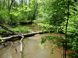
Black River Sanctuary of the Michigan Nature Association, Van Buren County, copyright Richard Brewer 2009

I responded on the listserv that if a land trust is considering a conservation easement on a farm that includes natural ecosystems worthy of protection, the conservation easement should protect these by appropriate restrictions. If the donor is unwilling to allow this protection, I said, the land trust should walk away from the deal. If the property has no conservation value other than maintaining land for crops, the land trust ought to consider whether it couldn’t spend its time better on another project with greater values.

Why, the person posting the farmland observation asked, is the protection of productive agricultural land from development a lesser conservation value than the protection of other conservation values?

It’s a fair question, but a full answer would take a while. I’d make a start on an answer this way: Consider three 120-acre parcels of land for which a conservation easement is contemplated. Parcel A is nearly all relatively undisturbed natural vegetation. Parcel B is prime agricultural land almost completely occupied by row crops. Parcel C is mostly prime farmland but also includes patches of other soils occupied by relatively natural vegetation and a section of stream.

Here’s a partial list of conservation values for Parcel A, some obvious and others a little more obscure: scenic beauty; providing a model or subject for art, literature, landscape architecture, etc.; fulfilling an innate human need for wildness; roles in biogeochemical cycling; soil development and renewal of fertility; purification of air and water; tempering floods and droughts; homes for pollinators and game animals; protection of soils and shores from erosion; maintenance of biodiversity with its many practical and aesthetic effects; sequestering carbon hence moderating global climate change; a classroom for many types of education; providing wild foods such as mushrooms, berries, and nuts.

What is the conservation value of the Parcel B? We know that it may have a conservation purpose because that is the way that the IRS tax code is written: One of the purposes that can justify a charitable deduction for a donation of land for conservation is “the protection of open space (including farmland and forest land) where such preservation is a) for the scenic enjoyment of the general public, or b) pursuant to a clearly delineated federal, state, or local governmental conservation policy and will yield a significant public benefit.”

It’s possible that the general public, or some members, may enjoy the scenery provided by 120 acres of tall corn in Illinois or 120 acres of peppers poking up through shiny black plastic in California. There may well be more-or-less clearly delineated government policies that encourage farmland protection for more-or-less sensible reasons (mostly listed in Chapter 12 of Conservancy: The Land Trust Movement in America).

The public benefit argument is a little tougher. Do the words refer to the existence of any public benefit, or do they mean that a net benefit remains when we add up the pluses and subtract the minuses?

The minuses don’t get a lot of attention anymore, though some of the early commentators on agricultural easements worried about them. Let’s run through a few. One is all but universal: the loss of native vegetation and the accompanying birds, mammals, insects, soil organisms, and all the rest. Two others are extremely widespread: loss of topsoil to erosion and pollution of air, surface water, and ground water from pesticides, herbicides, and fertilizers. Others are more localized; examples are soil salinization, spread of antibiotic-resistant diseases from feedlots, groundwater depletion, and loss of fauna from streams and wetlands caused by water diversion from streams to agriculture.

So it’s not so clear what the net might be, especially when we consider that some of the pluses aren’t really so plus when looked at closely. For example, saving land from development may be listed as one of the pluses, but in some of the less scenic parts of the West the threat of development any time soon is quite remote.

It’s worth mentioning that some agricultural uses may allow elements of the native biota to persist. Examples are grassland birds nesting in hayfields in the East and native flora, birds, and mammals persisting on some grazing lands in the West. These are conservation pluses, but they are tenuous and temporary. Nowadays hayfields are cut several times a year starting early, so that many of the grassland birds attracted to them fail to produce young. Some of the western grazing lands are susceptible to sod-busting, that is, conversion to croplands that will be home to few if any members of the native biota.

A conservationist might think that a conservation easement over farmland which possesses such conservation values should protect them. Why not write the conservation easement so that no hay can be cut on a field in Michigan or Massachusetts before the middle of July? Why not specify that if grazing is halted on an easement property in Montana or the Dakotas, the grassland must not be plowed to plant wheat but instead must be allowed to undergo the rather quick recovery to near-natural vegetation possible on this land if not too badly overgrazed?

And shouldn’t the conservation easement for Parcel C–mostly farmland but some natural–include restrictions that will protect the conservation values of the natural lands? Possibilities are control of purple loosestrife in the marsh, limited single-tree harvest in the woodland, and no livestock on the steep slopes or anywhere near the river.

Some conservationists might ask these questions but not many land trusts will. Rather, a high percentage of today’s land trusts take pride that the farmland easements they write do nothing that will hamper the land remaining in agriculture, no matter how destructive and noxious the activities referred to as agriculture become.

Some people think that the best road to retaining biodiversity and other conservation values in the landscape is to set aside preserves and sanctuaries where human activity is sharply limited while allowing the rest of the countryside to go wherever agriculture, development, and commerce take it. Some think that preserves won’t do the job and that instead we must educate (and regulate) the public so that all the landscape–farms, housing developments, factory lands, etc.– is managed in ways that retain at least patches of natural diversity.

Agricultural easements that take the approaches described in the last few paragraphs would be a modest start down the second road.

The landtrust-L website started by Tom Zeller of IU (and the Sycamore Land Trust) has for several years been an excellent source of information about land-trust operations. It’s probably the best place to go to ask (and answer) nuts-and-bolts types of questions. Those interested in land trusts can subscribe by emailing listserv@indiana.edu the message: subscribe landtrust-L.