Category Archives: Birds

The 2010 American Columbo Census

Last week I finished my annual American columbo census.  Every year in June, I check up on a marked population of American columbo (Frasera caroliniensis) plants in the oak woods near where my wife and I live in Oshtemo Township. Here in southwest Michigan, columbo was an oak savanna plant. I suspect that today this township, which was mostly savanna at settlement, has more columbo remaining than anywhere else in Kalamazoo County.
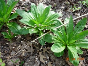
Rosettes of American columbo. Last year's dried flowering stalk from another plant is the diagonal between the two rosettes. Photo by Richard Brewer

Rosettes of American columbo. Last year's dried flowering stalk from another plant is the diagonal between the two rosettes. Photo by Richard Brewer

The usual way a person encounters columbo is to find one or a group of its basal rosettes.  These look rather like the basal rosettes of the well-known biennial weed common mullein except that the elongate oval leaves of columbo are thin, smooth, and green instead of thick, furry, and silvery like mullein.

Occasionally one sees a columbo flowering stalk.  It’s an impressive sight, often six or even eight feet tall, smooth and green, with several whorls of leaves and a great number of branches in the upper whorls bearing dozens or hundreds of small flowers on slim stems.  Though small, the flowers are striking looking, symmetrical with greenish-white, purple-dotted petals.  Long ago, in southern Illinois, when my friend Kenny Stewart and I found a blooming columbo, he described the flower as looking like a botany text book diagram of flower structure.  Calyx, corolla, stamens, a pistil, all the parts are laid out just as they should be, plus in the middle of each petal, a fringed nectar-producing gland.

A single flower of Am. columbo. Photo by Richard Brewer

Seven years ago, I decided to follow the fortunes of one patch of 121 columbo plants spread over an acre or so of oak woods. Two other patches of similar size exist several hundred feet away, one to the east and one to the west.   Ralph Babcock, a friend and former student, joined me to spend a day marking each plant by means of an orange plastic flag on a wire.  We gave each plant a number, written on the flag using a marking pen with super-permanent ink, and I recorded each location using direction and distance to landmarks and nearby plants. A little later in the summer, we recorded size and other information about each rosette.

Giving each plant an identifying number allows me to follow what happens to each one individually, like birds in a banded population.  Every June, I check to see which plants are still there and their size and condition and to replace weathered and missing flags.

Am. columbo plant number 52. On 23 June 2009, the rosette was composed of 30 leaves and had a diameter of 54 cm. Photo by Richard Brewer

The census usually takes me four or five days, a few hours each day.  Last year I postponed replacing  fading and tattered flags because I wanted to record what other plant species were within a meter or so around each plant and to note something about the topography and litter depth for each point.  So this year’s census took a little longer than usual because I had to make 39 new flags and renew the writing on many others.

As to the plants in the neighborhood, the big trees are mostly white oak, black oak, sassafras, wild black cherry, pignut hickory, and red maple  A few of the herbs are sweet cicely (which went from flowers to fruit just in the week when I was censusing), white avens ( in flower now), Indian pipe (not quite up yet this year), rattlesnake fern, spotted wintergreen, and lopseed.  There’s a fair amount of poison ivy and Virginia creeper on the ground too, more every year.

Some of the birds I hear singing or calling while I work on the columbo are Wild Turkey (pretty quiet lately), Ovenbird, Wood Pewee, Great Crested Flycatcher, Black-capped Chickadee, Tufted Titmouse, White-breasted Nuthatch, Rose-breasted Grosbeak, Blue Jay, Red-eyed Vireo, and Scarlet Tanager.

Other vertebrates are sparse.  A few days ago, I saw something hop close to one of my points and was able to find it and see the cross on its back.  It was a spring peeper back from the ponds a few hundred yards away, where they were peeping and mating in April.

There are plenty of deer, though less in evidence now than most of the year. The deer do not eat the columbo and also avoid stepping on them.  Of course, the rosettes die back above ground in the winter, leaving the crown of the large taproot just below the soil surface, so the deer have no visual clues of the columbo from fall to spring.  The deer do blunder into the orange flags, occasionally dislodging them and often bending the wires.  Nothing else seems very interested in the columbo foliage either–not the chipmunks, fox squirrels or even insects. Most plants show little or no sign of insect damage.

Of the original 121 plants, 11 have flowered in 7 years.  The plant then dies, just like the second-year mullein plant.  Some columbo have died without ever flowering, but many of the original plants are still alive, reappearing year after year as a basal rosette.

So, American columbo looks like it could be a biennial like mullein, basal rosette one year, flowering stalk the next, then gone;  but it’s not.  I don’t know how long columbo takes from germination to flowering here in the oak woods, but it’s a good many years at best.

Basal rosette of the biennial common mullein. Photo by Richard Brewer

If you’d like a name for plants with life cycles like columbo you could call them long-lived monocarpic perennials. Long-lived perennial monocarp is OK also. You may think you never heard of such a thing, but you have.  Some species of bamboos and century plants (Agave) act pretty much the same way.  Also a few animals–sockeye salmon and the 17-year cicada, for example.

Why are Yellow-headed Blackbirds rare in Michigan?

Male Yellow-headed Blackbird singing, Wolf Lake Fish Hatchery. Photo 1 May 2010 by Tim Tesar.

A Yellow-headed Blackbird, a rare bird in Michigan, was seen near the end of April at Wolf Lake Fish Hatchery.  The Fish Hatchery is west of Kalamazoo, a few miles over the Kalamazoo-Van Buren County line.  The bird was first reported on 30 April.   I drove out Sunday morning, 2 May, to try to get a look.

It wasn’t hard.  The bird was on territory, hence easy to locate, and also easy to identify with its bold yellow, black, and white plumage.  On the perched bird, the white is seen as a narrow stripe on his side, but when he flies it flashes as a sizable patch on the leading edge of the wing.  Females don’t have the patch, but there were no females evident.

I watched the bird fly back and forth between several perches, singing fairly often, occasionally chasing a Red-winged Blackbird.  Male Yellow-headed Blackbirds are handsome birds, but their song is not handsome exactly, or pretty or melodious–more like odd, but well worth hearing for its oddity.  The recordings readily available on the web don’t quite do justice to the long, loud, vibratory parts of the performance, but you can get a general idea from the example included at the Bird Watcher’s Digest website.

Yellow-headed Blackbirds tend to be polygynous and colonial.  I wasn’t sure whether one lone male would be able to attract a female but I was hoping he’d get lucky.  But as far as I know no female was ever seen, and by some time around the middle of May, the male was gone.

Michigan accounts of the Yellow-headed Blackbird tend to start with a statement to the effect that species is relatively new as a breeding species in the state. It’s true that the first confirmed nesting in the state didn’t occur until 1956.  Four birders visiting the Upper Peninsula in late June followed up a report of Yellow-headed Blackbirds in a large marsh in Gogebic County, a few miles from the Wisconsin border.  They found two males and five females and spent some time hunting for nests but didn’t find any. However, one of the birders returned the next morning and found two nests.

The finder of the nest was Larry Walkinshaw.  Who else would it have been? Walkinshaw was a Battle Creek dentist who was also one of the great field ornithologists of the era. Part of his research repertoire was a seemingly uncanny ability to locate nests.  I wrote about Walkinshaw in an earlier post.

Discovery of the first Lower Peninsula nest followed four years later.  A colony of seven nests at a cat-tail marsh in Saginaw Bay was found in early June 1960 by Bob Grefe and fellow birders in Bay County near Quanicassee.

By the mid-1980s (1983-1988) The Atlas of Breeding Birds of Michigan (Brewer, McPeek, and Adams, 1991, Michigan State University Press) showed confirmed nesting in 13 townships–4 around Saginaw Bay and 2 more not far away, 4 in the Upper Peninsula, and 3 in Muskegon County on the west side of the Lower Peninsula.  Six more townships had summer birds that were probably nesting, but confirmation was lacking, and 10 more townships had birds possibly nesting.  (The uniform breeding codes and criteria for breeding-bird atlases are here.)

These observations could fit a pattern of arrival as a breeding species in Michigan sometime in the 1950s followed by spread and establishment as a regular but rare and local member of the breeding avifauna in the next 30 years or so.  But in preparing the chapter “Original Avifauna and Postsettlement Changes”  (pp 33-58) in the first Michigan breeding-bird atlas, I realized that the view of Yellow-headed Blackbird as a recent immigrant was incorrect or at least incomplete.

The blackbird, I concluded, is one of a small group of Great Plains species that occur in the grasslands and grassland marshes and that extend their geographic ranges when there are severe droughts in the Great Plains. It seems likely that carrying capacities for these birds drop as ponds and marshes shrink and grassland habitats deteriorate. Surplus birds disperse, some coming east.

The important droughts of the 20th century were the Great Drought of 1933-1940 and the 1950s drought, which was most severe in the Great Plains from about 1953-1957.  The first recorded nests of the Yellow-headed Blackbird in Michigan came during the invasion of the 1950s.  What happened in the 1930s drought?

During and just after the drought years of the 1930s, Yellow-headed Blackbirds were seen in the breeding season at a few places around Michigan after being virtually absent through the early part of the 20th century.  No nesting was recorded, but nesting did occur just to the southeast, in Ohio, at a site that has since become much more famous for other reasons–Magee Marsh (Lucas Co.). Nesting was first confirmed there in 1938, but summering birds were present from 1934 to 1941. After that, no summer birds were reported from the area around Sandusky Bay until 1960.

What of other, earlier droughts?  As we go back in time, the ornithological evidence gets scantier but follows the pattern of a bird that, except for occasional stragglers, is only here in the eastern part of the Midwest during tough environmental times in the Great Plains (and for a few years thereafter).

Here’s some more evidence.

Morris Gibbs, one of Michigan’s earliest ornithologists, a Kalamazoo resident, and a very smart guy, wrote in the early 1890s that the Yellow-headed Blackbird occurred in extreme southwestern Michigan and probably bred.  This statement was discounted by most later compilers of Michigan bird lists, although a specimen, the first for Michigan, was taken on 17 May 1890 in the Upper Peninsula adjoining Wisconsin (Dickinson Co.).

What is definitely true is that the species nested commonly in the 1870s-1890s in the large marshes around Chicago, Illinois, including Indiana marshes very close to the southwest corner of Michigan. In the summer of 1871, one egg collector took over a hundred Yellow-headed Blackbird eggs in the marshes along the Calumet River in Indiana southeast of Chicago and within 30 miles of the Michigan line.

This period of relative abundance in northwest Indiana and possible nesting in southwest Michigan was a time of two 19th century  droughts, one in the 1870s, and one from the late 1880s to about 1896. Then, in the early 20th century, populations in the marshes of northwestern Indiana faded to zero.

The second drought, the one from the late 1880s to 1896, was the one that gave rise to the slogan, “In God we trusted, in Kansas we busted” and led to the sod-busters dispersing from their Great Plains farms like Yellow-headed Blackbirds from a dried-up prairie slough.

2.  As we’ve noted, the first Michigan breeding bird atlas documented a substantial Yellow-headed Blackbird population.  But the atlas period included the third and last of the 20th-century droughts (1987-1989).  So the comparative abundance of the bird at that time fits our model very well.

I mentioned that other species seemed to follow a similar pattern of breeding season occurrence in Michigan corresponding to a cluster of drought years in the Great Plains.  The others that I noticed were Wilson’s Phalarope, Western Meadowlark, and perhaps a few more, such as Western Kingbird and Brewer’s Blackbird.

I would add one more thing:  Michigan is as much a part of the geographical range of these birds as it is for the robins and chickadees that are here in numbers every year.  Droughts are an expectable occurrence in the Great Plains.  When habitats deteriorate there, the lakes and marshes of Michigan, Illinois, and Ohio are important refuges for birds that would fail to breed and possibly would perish if the wetlands of the eastern Midwest were unavailable.

Field Trip to Big Island Woods (Cooper’s Island) Coming Up

Hackberry, a frequent canopy tree at Big Island Woods. Photograph by Richard Brewer.

Saturday 24 April I’m leading a field trip to the Big Island Woods, also referred to as Cooper’s Island.  It’s a trip for the Kalamazoo Wild Ones chapter.

“Big Island Woods” refers to an “island” of forest in the middle of Prairie Ronde, southwest Michigan’s largest mesic (tall-grass) prairie. The village of Schoolcraft was founded just east of the Island.  Of the Island’s original 300 acres or more, about 20 acres now remain.  The site is probably the natural area in southwest Michigan most worthy of permanent protection, for its combination of ecological, botanical, and historic values.

Historically, Prairie Ronde and the Big Island are interesting because of their connection with the earliest settlers in Kalamazoo County (such as Bazel Harrison), with James Fenimore Cooper (whence “Cooper’s Island”), and with Clarence and Florence Hanes, authors of The Flora of Kalamazoo County.

Ecologically, the remnant of the Big Island that survives is of interest because of its unusual species composition, its similarity to prairie groves of Illinois, and several rare plant species.  The forest could perhaps be called wet mesic and has a diverse canopy, despite a windstorm about ten years ago that blew down many large trees.

Probably the most unusual plant species is the white trout lily, known from only one other site in Kalamazoo County.  Two other rare plants are the trees Ohio buckeye and blue ash.  There are, in addition, many other plants of mesic forest and southern swamp forest, including a relatively rich complement of spring ephemerals.

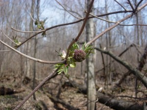
Red-berried elder in bud, early April, at Big Island Woods. Photograph by Richard Brewer.

Down trunks and woody debris from the wind storm about a decade ago make travel somewhat difficult in some parts of the woods.

Relatively little work has been done on the biota other than plants.  However, as a wooded island surrounded by agricultural fields and village streets, it could be an important stopover site for migratory  birds.  In less than two afternoon hours on 11 May 1996 three observers found 42 bird species including 14 species of warblers.

The trip will leave from the I-94 car-pool parking lot at Oakland Drive, Kalamazoo, at 9:15 AM Saturday.  Because parking at the field trip site is limited to about five cars, car-pooling is essential.  The field trip will conclude about noon.

Later on, after the trip, I’ll try to write something about what we saw and talked about at Cooper’s Island.

Signs of Spring

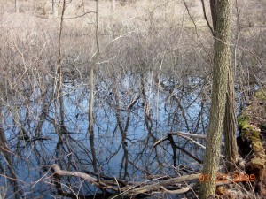
Open water in March in a buttonbush swamp, Oshtemo Township. Photo by Richard Brewer.

Spring began in southwest Michigan in the past few days.   One sign has been the Sandhill Cranes overhead, giving their loud rattle.  They could be on their way north or they could be local birds; several pairs now nest in Kalamazoo County.

Because snow cover was so continuous, and thick, some birds that are usually here by February were mostly delayed into early March.  The cranes are one species, Red-winged Blackbirds are another. I saw my first redwing a few days ago and they’re now pretty well scattered over the countryside.

In Pavilion Township Saturday, Song Sparrows were singing, Horned Larks were on territory in the open fields, and sailing overhead was my first Turkey Vulture of the new year. First in Michigan anyway; we saw Turkey and Black Vultures every day in Costa Rica. Most were probably resident there, but some could have been wintering birds from North America. This morning I saw my second Turkey Vulture sailing above West Main in Oshtemo Township.

I haven’t heard any frogs calling yet, and chilly as it is I don’t expect any tonight, but warmer weather is predicted for tomorrow.

As soon as bare patches began to appear around houses, the early spring bulbs were visible, some flowering.  I’ve already seen winter aconite, snow drops, and crocuses in bloom without hunting very hard.  Our native early spring wildflowers grow mostly in the mesic deciduous forests, and many of them are spring ephemerals–they come up, bloom, and then die back, so for most of the year they’re invisible above ground.  Right now the beech-maple forests probably have harbinger-of-spring in flower, and in the wooded low spots currently occupied by temporary vernal pools, skunk cabbage flowers will be out, though perhaps not producing pollen quite yet.

Acute-leaved hepatica, an early spring wild flower, but not a spring ephemeral. Photographed in an Oshtemo Township oak forest by Richard Brewer.

Our native early spring flowers take advantage of the brief window of full sun that opens between the arrival of warmer weather and the closing of the forest canopy by sugar maples.  It would make sense that the cultivated spring bulbs we buy and plant might be the early spring flowers from the deciduous forests of other parts of the Earth, but that isn’t the case.  Rather, most of the spring bulbs blooming in our front yards come from the steppes or the alpine and sub-alpine meadows of the Middle East and Asia.

The seasons follow one another in a continuous cycle.  A year has no natural beginning and no end.  Several groups of ancients gave the winter solstice, around December 21, special significance because it was the day they were reassured that the sun was actually coming back for another year. Our New Year’s Day, January 1 is arbitrary but since it comes not too long after the solstice, it’s not wholly unsatisfactory as a starting point in the cycle.

To me, though, the first definite signs of spring in nature, the sorts of things that have happened in the past week or so, feel like the engine of the year starting up.  In our temperate latitudes, this is the start of the year’s organic production; photosynthesis really gets underway, storing sunlight that, passed on along the food chain, runs nearly the totality of the living world. For a high percentage of the creatures here, spring is the time for beginning reproduction as well as production.  Eggs hatch and babies are born, and young of the year having new combinations  of genes not quite the same as either parent go out to become part of a later generation–or not.

Spring has arrived in southwest Michigan–I think–and a new year has started.  Happy New Year!

Costa Rica in the Dry Season, February 2010

Friday night sundown, Gulf of Nicoya, from hilltop at La Ensenada. Photo by Richard Brewer.

Katy and I just returned from two weeks in Costa Rica.  As part of an Elderhostel–though the program is now called Exploritas–we visited five sites ranging from mangrove forest along the Pacific Coast to the rather chaparral-like vegetation called paramo around 11,000 feet above sea level on Cerro de la Muerte.  Included were visits to several important conservation areas, including  La Selva (and Selva Verde) and a site in the Savegre River valley.

Spending eight or more hours a day in the field, our group identified, or had identified for it, about 280 species of birds.  On one night excursion we heard and saw the Common Pauraque (but no potoos).  We also saw 2- and 3-toed sloths, howler monkeys, collared peccaries and a few other mammals plus various herp species including crocodiles and caimans, 2 species of iguanas, several other lizards, a few frogs, and the cane toad, native here but with a bad reputation in places where it has been introduced, like St. Croix, US Virgin Islands.

Interest in resource conservation is high in Costa Rica.  For one thing, ecotourism, which is what we were participating in, is a major element in the nation’s economy.  The subjects of ecotourism’s costs and benefits and how sustainable it is are complex, but as an incentive for setting aside natural lands, the impact has been positive and powerful.

At Selva Verde. Photo by Richard Brewer.

I’ll write more about our observations and experiences.  For now, I’ll say just that they involved a lot of interesting and beautiful wildlife and plants, spectacular scenery, lots of good food, and good company.

Conservation Values of the Colony Farm Orchard, Kalamazoo County, Michigan

The following is approximately what I said in my brief remarks at the Save the Colony Farm Orchard Rally last Tuesday night, 8 December 2009.  I have, however, expanded on my thoughts under point 3, adding a consideration of conservation easements.

We need to recognize three aspects to the conservation value of this piece of land.  One is what’s good about the land itself.  Two is its beneficial effects on the adjacent Asylum Lake Preserve, which Western Michigan says is permanently protected.  Three is the broad question of how the conversion of this dedicated conservation land to commercial use affects the status of conservation land all across the state.

Apple tree in old orchard at the Colony Farm Orchard.  Photo by Richard Brewer

Apple tree in old orchard at the Colony Farm Orchard. Photo by Richard Brewer

1. The Land Itself. Although this land has been referred to as the Colony Farm Orchard, the old orchard amounts to only a quarter or so of the approximately 53 acres. The fruit trees are surrounded and in some cases overrun by grape vines.  Box-elder is a common invading tree in the orchard.

The rest of the property is varied habitat with a couple of sizable wooded areas at the north and south ends.  Grasslands dominated by smooth brome grass and goldenrods with invading shrubs and trees surround the wooded areas and the orchard.  The land of the wooded area at the north runs down to a springy area with a couple of ponds.

One part of the conservation value of this piece of land is what used to be here.  The east edge of Genesee Prairie, one of the eight tall-grass prairies in Kalamazoo County, extended to the Orchard site.  This is now the only part of Genesee Prairie in public hands and with any approach to natural vegetation.  The rest is gone, beneath US-131 or occupied by the west edge of Western Michigan University’s BTR park and commercial and residential areas and croplands west of US-131.

It’s unlikely that much of the original prairie flora is left at the Orchard site.  However, there are still bur oaks–a good many, some fairly large and old, others young.  They are all almost certainly descendants of the bur oaks that were part of the savanna fringing this tall-grass prairie. They are a genetic connection extending back 180 years to when the first settlers arrived to homestead on the prairies and savannas of Kalamazoo County.  But the connection extends back much further than that, to long before Europeans reached Michigan or North America, probably to some time in the Hypsithermal interval around 9000-6000 years ago.

Goldenrods, old orchard in background.  Photo by Richard Brewer.

Goldenrods, old orchard in background. Photo by Richard Brewer.

As for animals, we know from various sources that there are coyotes, deer, turkeys, woodcock, Red-tailed Hawks, Green Herons, and many smaller birds in the summer or year-round.  I will shortly put up a list of summer bird species that several observers are supplying.  The spot also has all the attributes of an excellent migratory stopover site for land birds in both spring and fall.  As to the small mammals, reptiles, amphibians, insects, I think it may be time for WMU to fund a serious study to find out just what is here.

2. Benefits to Asylum Lake Preserve. The Colony Farm Orchard is properly part of Asylum Lake Preserve.  From the edge of the Preserve vegetation to the edge of the Orchard vegetation is about the same distance as between third base and home plate on a baseball field. The Orchard makes the preserve a larger sanctuary by about 20 percent.  This is good; bigger is better in sanctuaries, mainly because local extinction of species is rarer on bigger sanctuaries.

We could also think of the Orchard as an island near to the Preserve. It serves as a stepping stone that wandering animals not currently living on the Preserve can find and, from there, reach the sanctuary.  The end result of all  this is that the Orchard makes the Asylum Lake Preserve more diverse and less prone to fluctuations in populations, hence more stable.

Bur oak at Colony Farm Orchard.  Photo by Richard Brewer

Bur oak at Colony Farm Orchard. Photo by Richard Brewer

There are of course the other beneficial effects of buffering against the noise, noxious fumes, and bright artificial lights coming from US-131 and the commercial land beyond it.

3. Threats to Conservation Land Elsewhere in Michigan. The Colony Farm Orchard has a protective conservation covenant that many Kalamazoo residents now know by heart: “The conveyance shall provide that Western Michigan University may utilize the property solely for public park, recreation, or open space purposes, except that the legislature, by statute, may authorize Western Michigan University to utilize the property for some other public purpose.” The restrictions were placed on the land by the legislature at the time of its transfer from the state to WMU in 1977.  If Representative Jones (D-Kalamazoo) and WMU can persuade the legislature to strip away this restriction, as  HB 5207 provides, and if Governor Granholm signs it, WMU will be able to use the land for anything.  This land, bought with taxpayer dollars and now designated for public use–specifically some variety of public open space–would be available to use as an Annex to WMU’s BTR park.  But it could also be used any other way WMU chose.

If HB 5207 is passed and signed into law, what state or university land dedicated for conservation–or any kind of public use–is safe?  What of the state parks? What of the arboretums, botanical gardens, and natural areas of the rest of the Michigan public universities?

What, in fact, of conservation easements?  These are now the most popular way to protect land in perpetuity, widely used by land trusts and government agencies.  They are discussed in many places in Conservancy: The Land Trust Movement in America but especially chapters 7 and 8.  Very briefly, a conservation easement is a binding agreement that permanently restricts the development and future use of land so as to protect its conservation values.  Conservation easements are held by conservation organizations or units of local, state, or federal government.  The easement holders are charged with defending against violations of the easement provisions. As of 2005, land trusts in Michigan held conservation easements on about 55,000 acres.  The amount of land in conservation easements held by government agencies is hard to determine but substantial.  Conservation easements are a relatively new way to conserve land, rarely used before 1960. Most states have statutes providing the legal foundation for conservation easements; Michigan’s is Act 451 of 1954, called NREPA.

But we have seen what the state legislature, or the House at least, has done with statutes in the case of the Colony Farm Orchard.  Suppose some well-connected land owner found that a conservation easement held by some land trust had become inconvenient to him.  Might the Michigan legislature be willing to pass a statute saying the conservation easement on his land was rescinded?  Maybe, maybe not.  Suppose that this situation came up two or three times.  Might the Michigan legislature decide that NREPA as currently written was becoming an unnecessary burden to worthy land owners who had changed their minds about the easements on their acreages.  In that case, might the Michigan legislature amend the statute to make backing out easier–like, for example, by coming to the legislature with what seemed like a good argument, such as using the land to create jobs?  Maybe, maybe not.

The land owners might still have a few hurdles remaining, with the IRS for example.  But that’s what attorneys and accountants are for.

If the legislature did either of these things, a judge or two or more would decide whether what the legislature did was legally OK.  Probably the judges wouldn’t say whether it was right or wrong or how much it damaged the cause of land conservation.

It is a dangerous path that Representative Jones and WMU are trying to steer the Michigan legislature towards.

A Conservation Plan for the Colony Farm Orchard (=Enchanted Forest)

Button from the Facebook group

Button from the Facebook group

As we all know,  HB 5207  put forth by Representative Bob Jones (D–Kalamazoo) is designed to strip the conservation/public use restrictions from the Colony Farm Orchard as a first step in turning the 54 acres into an Annex to Western Michigan University’s BTR Park.  Here are the stated restrictions: “The conveyance shall provide that Western Michigan University may utilize the property solely for public park, recreation, or open space purposes, except that the legislature, by statute, may authorize Western Michigan University to utilize the property for some other public purpose.” The bill, introduced in mid-July with no public notice, made its way quickly to the Senate but there progress has slowed.

This delay has given conservationists and other opponents of the measure a chance to make their views known, and they have done so in large numbers.  As of now, we cannot know what will happen.  But we should talk about what ought to be done with the property as conservation land.  I made a start on this subject earlier and concluded that the best role for the land was exactly what it’s doing now, but better.

In that post, I discussed some important ecological functions of the Colony Farm Orchard.  I won’t repeat them in detail, but here’s a quick list.  It’s worth taking note that all these would be diminished or lost altogether by development as a BTR installation.

Many are beneficial effects that the Orchard exerts on the Asylum Lake Preserve, such as

  • Reducing noise from M-131
  • Filtering noxious fumes from trucks and automobiles on M-131
  • Reducing artificial lighting coming from M-131 and buildings across the highway to the west.  Research on the dangerous effects that bright artificial lights have on insects, bats, amphibians in the breeding season, and other forms of wildlife is accumulating rapidly.
  • By serving as a very near island of similar but not identical habitats, the Orchard adds species, lowers extinctions and enhances immigration, all of which lead to higher biodiversity and ecosystem stability at Asylum Lake.

Other positive conservation roles the Orchard plays, not necessarily involving the Asylum Lake Preserve directly, include

  • Allowing for the presence and reproduction of  shy animals, such as foxes and American woodcock, that are likely to be disturbed on the more heavily visited Asylum Lake Preserve.
  • Serving as a migratory bird stopover site well-supplied with cover, water, and food supplies in both spring and fall.
  • Preserving land within the historic  Genesee tall-grass prairie and the adjacent bur oak opening.  Perhaps few herbaceous species survive from those pre-settlement plant communities, but numerous bur oaks of various ages and sizes are present that are almost certainly descended from the oaks of the original savanna.

This is just a good start on a listing of the conservation values of the Orchard.  There are, for example, the marvelous asparagus patches along the west edge.  Not for nothing was Euell Gibbons’s first book named Stalking the Wild Asparagus.  “When I am out along the hedgerows and waysides gathering wild asparagus,” he wrote, “I am twelve years old again and all the world is new and wonderful as the spring sun quickens the green things into life….”

There are also the old trees–horse chestnut, tulip tree, maples–planted by the original farm family or by the staff or patients of the Colony Farm.  Big and open grown but surrounded now by many trees of smaller diameters, these are probably what suggested the “Enchanted Forest” name to the Facebook Group.  They ought to be kept as a way of conserving human history as well as natural history.

Then there is the carbon sequestration that has gone on and is going on in the accumulation of tree biomass, which acts to temper the greenhouse effect and slow global climate change.  Turning this land into a BTR park extension would almost certainly mean cutting most of the trees and brush and releasing the stored carbon into the atmosphere as carbon dioxide  either by burning or by the slow fire of decomposition.

It’s not possible yet to come up with a complete conservation design, but here are some things we might want to do when the Colony Farm Orchard is devoted to conservation.

1. Construct a self-guided loop trail going through the property’s major habitats with the trailhead on the east side of the property next to Drake Road.
2. Next to the trailhead, construct a small bicycle parking space.  Too much space for automobile parking has already been subtracted from the Asylum Lake Preserve to allow more to be lost for auto parking here.
3. Provide for safe passage of pedestrians from somewhere south of the Asylum Lake parking lot at the top of the hill on Drake by means of pedestrian on-demand lights, or an overpass.
4. Stop the dumping of leaves and yard waste from Kalamazoo.  It’s a public service of a sort, but on a parcel of only 54 acres it takes up space that ought to be available for natural revegetation or restoration.  The area of thick leaf mulch can be seen in one of the fine low-level aerial photographs of the Colony Farm Orchard by JaySeaAre. Locate the metal pole barn (“Butler building”) on the west border (toward the highway); the heavy leaf mulch is the unvegetated area east of the Butler building and running south toward the electric substation and north toward the old orchard. Several years accumulation are involved, ringed with rank growths of barnyard weeds.
5. Erect a signboard facing M-131 that says something like this: 

Asylum Lake Preserve of Western Michigan University

A sanctuary of 320 acres protected for all time

that by education, research, and as green and open space

benefits the public and the Earth

Before describing what the trail could be like, it’s worth considering why we need a trail at all. People who are highly enough motivated have always made their way onto the Orchard for bird-watching, asparagus hunting, photography, and contemplation. And no trail is needed for the Orchard to continue its services to the Asylum Lake Preserve.  But there are good reasons for the trail: One, it will make it much handier to visit the site, especially for education–classes, but also groups interested in natural history, and any strolling autodidact.

Two, if the Orchard is left as is, there will be those who say, as some connected with WMU have said,  that the land is not utilized.  Of course, the charge was and is bogus. But the trail is one way to demonstrate utilization.  It will show  most people that the land is utilized, though perhaps not that segment of humanity for whom the only meaningful way a piece of property can be utilized is to generate income.

What should the trail be like?  I’d say most of it should be narrow, just wide enough for one person to walk comfortably, and unimproved.  No dogs, I’d say.  It’s nice that people can walk their pets on the Asylum Lake property, but the Orchard ought to continue to be a dog-free refuge, a place for the woodcocks and turkeys and other ground nesters.

There would be plenty to see along the trail, including many of the features already mentioned.  Any trip would find dozens of things to look at and discourse on, as the changing seasons brought forth something new every day.

The trail should loop through the south part of the WMU Foundation property.  In fact, I’d say that the south half of the Foundation land ought to be reunited with the Enchanted Forest. The eight acres extending up to Stadium Drive were regrettably severed from the Orchard property in 1957 and sold into commerce.  The Foundation did Kalamazoo a service by acquiring it in 2007.

Pond with Mallards on WMU Foundation land just north of Colony Farm Orchard.  Photo by R. Brewer

Pond with Mallards on WMU Foundation land just north of Colony Farm Orchard. Photo by R. Brewer

Having the trail run through the south part of what is now Foundation property would include a small pond and the ducks and aquatic life that could be seen there and also an area of great hydrological interest as the main source of ground water flow into Asylum Lake.

These are just some ideas of mine. I haven’t discussed them in detail with anybody.  No charette was held.  Nobody paid me a consulting fee; my work was all pro bono publico Publico has been given short shrift in WMU’s proposals for the Orchard, so I’m glad to bring a little of it back.

Will the Colony Farm Orchard be allowed to fulfill these conservation aims?  That depends on the Michigan Senate, or perhaps Governor Granholm.  But, of course, it depends most of all on Western Michigan University, which could at any time, decide to let the Orchard live up to the purposes for which it was conveyed from state to university in 1977.  That WMU has not already asked the Michigan legislature to withdraw the section of HB 5207 dealing with the Colony Farm Orchard reveals an anti-conservation, anti-environment, anti-sustainability mindset that may foretell a troubled future.

Labor Day, West Lake Bog

Mid-morning I looked out the window and saw a small bird in the shrubs, moving about pretty actively.  It was an American Redstart, not in the black and orange adult male plumage, but rather the olive-backed, gray-headed plumage with yellow wing and tail patches that at this time of year could be a female or a young male.

We had no breeding redstarts in the vicinity this summer, so this was most likely a migrant. Perhaps Katy and I would have done to well stay home and see what else had arrived, but today was a holiday, hence worth a small excursion.

Marsh east of Westnedge Avenue at West Lake Bog .   Photo by Richard Brewer

Marsh east of Westnedge Avenue at West Lake Bog . Photo by Richard Brewer

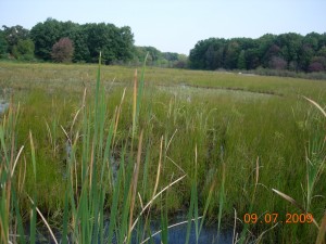
We drove to the West Lake Preserve in Portage.  It has trails, including boardwalks (of green plastic) that run out into marshes east of Westnedge Avenue. The marshes have some cat-tails but are mostly sedges plus a great variety of other herbs and a few shrubs.

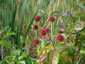
Button-bush is the most common large shrub.  It’s distinctive, easily identified with its whitish ball-like inflorescence in summer which remains ball-like in fruit but turns a rosy color.  Easily identified, as I said, as long as you find it in wet ground and it has flowers or fruits.

Button-bush fruits in marsh at West Lake.  Photo by Richard Brewer.

Button-bush in fruit in marsh at West Lake. Photo by Richard Brewer.

Once at the Michigan Nature Association’s Black River Sanctuary near Breedsville, the sanctuary steward showed me a large shrub or small tree on dry ground–though not far from the river.  It had no flowers or fruits and puzzled both of us for a while.  Having finally identified it, I think I’ll know it in the future even if it has no flowers or fruits. The fact that it has neither alternate or opposite leaves but instead often has three at a node is a quick first clue.

We were hoping for migrating warblers and other small birds, but the first birds we heard were two Sandhill Cranes.  They were coming from the south and we heard the rolling rattle they make while flying a minute or so before they came in sight over the trees behind us.  They might have been planning to land in the large patch of marsh through which the boardwalk runs if we hadn’t been there.

As it was, they flapped a little harder, regained altitude, passed over a line of trees and came down out of sight ahead of us. Not long afterward, a Great Blue Heron, another big bird though not as big as the crane, flew in from the east.  It did park in the patch of marsh we were passing through, but out of sight in a strip of water on the far side.

It turned out that we saw and heard only a few song birds.  The birds that bred here this year are mostly quiet, some still completing their fall molts.  A few Red-winged Blackbirds were still noticeable in the marshes.  The largest concentration of birds we saw was in a black gum tree.  Its leaves were already red and the ripe dark blue fruits were being visited by a good many largish songbirds.  We saw Blue Jays and catbirds, but may have missed other species.

Relatively undisturbed wetlands are always interesting botanically. There are often a lot of species, and some are in groups that present some identification difficulties. But the set of species that can handle really wet ground and especially standing water is circumscribed.  You don’t have to look through the whole plant manual to identify hydrophytes; instead you can pretty much confine your search to the specialized books on aquatics.

I don’t know what the best such manuals are today.  I still have a copy of Norman Fassett’s  A Manual of Aquatic Plants from 1957 and it serves the purpose.  A little updating of scientific names may be necessary, but that could be true if you use a manual published six months ago.

Several plants were blooming in the marshes.  In fact, flowering late in the season characterizes the wetland flora.  Among plants in flower were pickerel-weed with blue flowers, white-flowered arrowheads, and yellow-flowered bur-marigolds.

The water level was lower than we had seen in recent years, when it had come up to or over the flexible boardwalks.  Bladderworts were growing and flowering on the exposed peaty surface alongside the boardwalks.  They were tiny plants. Some species of bladderworts have purple flowers and some yellow. These plants had tiny bright yellow flowers.  I thought they might be Utricularia gibba, but I wasn’t in a serious plant-identifying mood today.

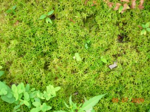
A blanket of sphagnum moss in West Lake Bog. Photo by Richard Brewer

A blanket of sphagnum moss in West Lake Bog. Photo by Richard Brewer

We continued to where the boardwalk loops back to the dirt path and followed that to the boardwalk that runs out into the sphagnum bog fringing West Lake.  The flora of bogs is even smaller and more specialized than most other wetlands, but includes many striking and beautiful species that can be seen in no other habitat.  The West Lake boardwalk is probably the best local opportunity to see this community with such things as tamarack, leatherleaf, cottongrass, pitcher plant, and sundew.

After the bog, we hiked back out to the parking lot.  It was 12:30 and we had plans to continue our holiday with lunch at the Lebanese buffet.

Tamarack bog with leatherleaf and cottongrass.  Photo by Richard Brewer

Tamarack bog with leatherleaf and cottongrass. Photo by Richard Brewer

What Is The Colony Farm Orchard Good For?

A bur oak at the west edge of the Colony Farm Orchard with US-131 in the background

A bur oak at the west edge of the Colony Farm Orchard with US-131 in the background

From statements by Western Michigan University’s PR guy, we know what WMU thinks the Colony Farm Orchard is good for–expansion of the University’s business park.

The motivation for such an action is unclear, as are the need for it and what the expansion would involve. But none of these needs to concern us here.  We want to talk about how the property ought to be used, in keeping with the restrictions on the land contained in the original transfer to WMU in 1977.  Public Act 316 (Sec. 1.2) said

The conveyance shall provide that Western Michigan University may utilize the property solely for public park, recreation, or open space purposes, except that the legislature, by statute, may authorize Western Michigan University to utilize the property for some other public purpose.

The Colony Farm Orchard is at the upper left in this diagrammatic map which appears on the Asylum Lake website

The Colony Farm Orchard is at the upper left in this diagrammatic map which appears on the WMU website

To situate ourselves, the 54-acre property lies across Drake Road from the main body of the Asylum Lake Preserve.  The right-of-way for the expressway US-131 is the west boundary, Parkview Avenue is the south boundary, and Stadium Drive is the north boundary.  Actually, nine acres just south of Stadium Drive is owned by the Western Michigan University Foundation (the old trailer park land) but evidently would be included in the Business Park expansion, bringing the total to about 63 acres.

WMU has done very little with the land.  It allowed Consumers Energy and other utilities to use land for the very visible transmission installations in the southwest corner.  These service the current business park, but whether it was wise or prudent to use part of the protected Colony Farm Orchard for them is debatable.

Also, a large leaf composting operation for part of the city of Kalamazoo is located a little north of the utility transmission facilities.  A large-scale composting operation is better environmentally than landfilling yard waste, but whether this use meets the public park/recreation/open space criterion is doubtful. The utility installation and composting operation each have separate service roads coming in from Drake Road.

We should also mention that Michigan State University holds a lease that provides that its Department of Entomology has use of the orchard for as long as it “conducts experimental fruit pest research on the land.” (In preparation for selling the property as part of its business park operations, WMU has indicated that it will pay MSU up to $985,000 to cancel the lease.)

WMU’s main action in recent times has been to erect a fence along the Drake Road boundary making entrance difficult for anyone not willing or able to climb over it.  Access from the south next to the big Consumers Energy facility is possible–and perfectly legitimate since the justification for WMU having the land is, as we know, for public park, recreation, or open space.  But many people, seeing the fence and the locked gate at the composting entrance, would conclude that WMU wanted to prevent access to the property.

The role I’d like to see this property play is exactly what it’s doing now, but better.

What it’s doing now is, for one thing, buffering the main body of the preserve from the noise and noxious fumes of the expressway. That’s good, but it’s not the land’s most important function. The land functions ecologically as an integral part of Asylum Lake Preserve.

The Declaration of Conservation Restrictions adopted by the WMU Board in 2004 says that its first goal is to promote ecosystem integrity by, among other things, maintaining the Preserve as green space and wildlife habitat and protecting natural features from further degradation.  The existence of the Colony Farm Orchard next to the other property contributes to this goal.

The Asylum Lake property itself is not large.  At one time it was 274 acres, but that was before land was carved out for widening Parkview and Drake, for sidewalks on two sides, and for parking spaces. Biodiversity, the number of species, is strongly dependent on the size of a preserve. The Colony Farm Orchard site only a few tens of feet from the Asylum Lake property effectively adds 63 acres, bringing the total size of the protected area to something on the order of 320 acres.

Grape vines covering trees in abandoned orchard

Grape vines covering trees in abandoned orchard

How does adding these 63 acres add diversity? One way is by adding new habitats.  The old orchard itself, a dense thicket type of vegetation, is different from any vegetation on the east side of the preserve.  Also the area of springs lying partly on the Orchard property and partly on the south portion of the Foundation property is a different and rather unusual habitat.

Biodiversity on a preserve is lowered by local extinctions of species and raised by immigration of individuals of new species. Simply the additional acreage is important in preventing extinctions–or reversing them. Suppose that all three breeding pairs of the black-capped chickadee, a year-round resident on the Asylum Lake Preserve, die one winter from some combination of causes and their offspring also disappear by dispersing elsewhere or by death from predation, starvation, etc.  One species has been lost from the preserve.

Now suppose that on the combination of Preserve plus Orchard we start with six pairs.  The chance that all six and all their young will be lost in the same winter is perhaps half the likelihood that three will disappear.  Next year, the survivors may be able to breed and thrive and replenish the chickadee population.  This replenishment, or rescue effect, is an important way in which species diversity is maintained on larger preserves or ones located in close proximity to one another.

This is the role in biodiversity that the Colony Farm Orchard plays–not just for birds, but mammals and insects, turtles and frogs, and other organisms. It’s possible that the WMU business park may also function in this same way interacting with the restored grassland on the southwest side of the Asylum Lake Preserve for grassland birds–though probably not for birds of other habitats.

Another effect that the Colony Farm Orchard enhances is the role that the Asylum Lake Preserve has as a migratory stopover site.  Retaining habitat where migratory birds can rest and refuel on their migratory flights south and north is a new focus in conservation.  Recent studies have looked at what traits make good stopover sites.  For fall migration, fleshy fruits–eaten in late summer and fall even by insectivorous birds–are favorable.  The old orchard has these in abundance in the form of grapes, blackberries, and others.

For spring bird migration, insects, especially such forms as midges hatching from ponds and streams are important food sources.  The springs and spring-fed pond at the north end of the property would provide this steadily renewed food for the northward migrants.

Young acorns on bur oak at Colony Farm Orchard August 2009

Young acorns on bur oak at Colony Farm Orchard August 2009

The Orchard property has other habitat features that add to its value as a part of the Asylum Lake Preserve.  I’ll mention only one more here.  The western part of the property was within the historic Genesee Prairie.  The rest of it was bur oak plain, a closely related community.  This tells us that the spring area lying at the north end of the Orchard and the south end of the ten acres owned by the WMU Foundation was almost certainly prairie fen. In years of low water in the past, I have identified fen plant species in the wetlands at the west edge of Asylum Lake directly opposite. Prairie fen is a remarkably attractive and diverse ecosystem that The Nature Conservancy and the Michigan Natural Features Inventory have given high priority for protection in Michigan.

It would make good conservation sense to restore tall-grass prairie in a wide band along the western fence of the Orchard property and to restore prairie fen on the springy wetlands at the north.  Southwest Michigan genotypes of plants should be used.

I’ll try to make other specific suggestions as to how the land might be used in a later post.

Woodcock at Colony Farm Orchard

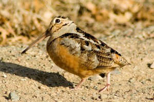
American Woodcock in Carlos Avery Wildlife Management Area. Minnesota.  Photo by Paco Lyptic.

American Woodcock in Carlos Avery Wildlife Management Area. Minnesota. Photo by Paco Lyptic.

I saw an American woodcock at the Colony Farm Orchard Monday afternoon.  It flew up from a little patch of woods as I approached.  I only got a quick look, but woodcock are easy to identify, with the big head and the large dark eye nearly centered as you see it from the side.  The bird flies almost in the same posture as it walks, head up and the long beak angling down.

Seeing a woodcock in mid-August means the bird probably bred nearby in spring or early summer, or else was hatched nearby.  I have a feeling that woodcock would be unlikely to nest successfully on the Asylum Lake property across the road.  The habitat mix there is not quite as good for woodcock as on the orchard, but the main weakness of the Preserve is the high number of dogs.  They are supposed to be kept on a leash, but dogs like to run and owners are indulgent.  I suspect that nests of most ground-nesting birds are sniffed out by roaming dogs often enough that many are abandoned.

There is a much greater diversity of habitat at the orchard property than is obvious from Drake Road.  I have some thoughts about what ought to happen to this part of the Asylum Lake Preserve that I’ll try to deal with in a later post.

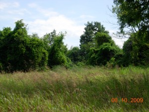
Field with invading trees at Colony Farm Orchard.  Copyright ©Richard Brewer 2009.

Field with invading trees at Colony Farm Orchard. Copyright ©Richard Brewer 2009.