Category Archives: Plants and Plant Communities

What Is The Colony Farm Orchard Good For?

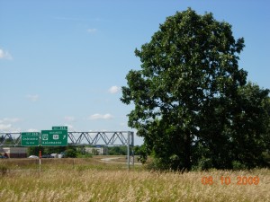
A bur oak at the west edge of the Colony Farm Orchard with US-131 in the background

A bur oak at the west edge of the Colony Farm Orchard with US-131 in the background

From statements by Western Michigan University’s PR guy, we know what WMU thinks the Colony Farm Orchard is good for–expansion of the University’s business park.

The motivation for such an action is unclear, as are the need for it and what the expansion would involve. But none of these needs to concern us here.  We want to talk about how the property ought to be used, in keeping with the restrictions on the land contained in the original transfer to WMU in 1977.  Public Act 316 (Sec. 1.2) said

The conveyance shall provide that Western Michigan University may utilize the property solely for public park, recreation, or open space purposes, except that the legislature, by statute, may authorize Western Michigan University to utilize the property for some other public purpose.

The Colony Farm Orchard is at the upper left in this diagrammatic map which appears on the Asylum Lake website

The Colony Farm Orchard is at the upper left in this diagrammatic map which appears on the WMU website

To situate ourselves, the 54-acre property lies across Drake Road from the main body of the Asylum Lake Preserve.  The right-of-way for the expressway US-131 is the west boundary, Parkview Avenue is the south boundary, and Stadium Drive is the north boundary.  Actually, nine acres just south of Stadium Drive is owned by the Western Michigan University Foundation (the old trailer park land) but evidently would be included in the Business Park expansion, bringing the total to about 63 acres.

WMU has done very little with the land.  It allowed Consumers Energy and other utilities to use land for the very visible transmission installations in the southwest corner.  These service the current business park, but whether it was wise or prudent to use part of the protected Colony Farm Orchard for them is debatable.

Also, a large leaf composting operation for part of the city of Kalamazoo is located a little north of the utility transmission facilities.  A large-scale composting operation is better environmentally than landfilling yard waste, but whether this use meets the public park/recreation/open space criterion is doubtful. The utility installation and composting operation each have separate service roads coming in from Drake Road.

We should also mention that Michigan State University holds a lease that provides that its Department of Entomology has use of the orchard for as long as it “conducts experimental fruit pest research on the land.” (In preparation for selling the property as part of its business park operations, WMU has indicated that it will pay MSU up to $985,000 to cancel the lease.)

WMU’s main action in recent times has been to erect a fence along the Drake Road boundary making entrance difficult for anyone not willing or able to climb over it.  Access from the south next to the big Consumers Energy facility is possible–and perfectly legitimate since the justification for WMU having the land is, as we know, for public park, recreation, or open space.  But many people, seeing the fence and the locked gate at the composting entrance, would conclude that WMU wanted to prevent access to the property.

The role I’d like to see this property play is exactly what it’s doing now, but better.

What it’s doing now is, for one thing, buffering the main body of the preserve from the noise and noxious fumes of the expressway. That’s good, but it’s not the land’s most important function. The land functions ecologically as an integral part of Asylum Lake Preserve.

The Declaration of Conservation Restrictions adopted by the WMU Board in 2004 says that its first goal is to promote ecosystem integrity by, among other things, maintaining the Preserve as green space and wildlife habitat and protecting natural features from further degradation.  The existence of the Colony Farm Orchard next to the other property contributes to this goal.

The Asylum Lake property itself is not large.  At one time it was 274 acres, but that was before land was carved out for widening Parkview and Drake, for sidewalks on two sides, and for parking spaces. Biodiversity, the number of species, is strongly dependent on the size of a preserve. The Colony Farm Orchard site only a few tens of feet from the Asylum Lake property effectively adds 63 acres, bringing the total size of the protected area to something on the order of 320 acres.
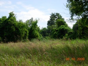
Grape vines covering trees in abandoned orchard

Grape vines covering trees in abandoned orchard

How does adding these 63 acres add diversity? One way is by adding new habitats.  The old orchard itself, a dense thicket type of vegetation, is different from any vegetation on the east side of the preserve.  Also the area of springs lying partly on the Orchard property and partly on the south portion of the Foundation property is a different and rather unusual habitat.

Biodiversity on a preserve is lowered by local extinctions of species and raised by immigration of individuals of new species. Simply the additional acreage is important in preventing extinctions–or reversing them. Suppose that all three breeding pairs of the black-capped chickadee, a year-round resident on the Asylum Lake Preserve, die one winter from some combination of causes and their offspring also disappear by dispersing elsewhere or by death from predation, starvation, etc.  One species has been lost from the preserve.

Now suppose that on the combination of Preserve plus Orchard we start with six pairs.  The chance that all six and all their young will be lost in the same winter is perhaps half the likelihood that three will disappear.  Next year, the survivors may be able to breed and thrive and replenish the chickadee population.  This replenishment, or rescue effect, is an important way in which species diversity is maintained on larger preserves or ones located in close proximity to one another.

This is the role in biodiversity that the Colony Farm Orchard plays–not just for birds, but mammals and insects, turtles and frogs, and other organisms. It’s possible that the WMU business park may also function in this same way interacting with the restored grassland on the southwest side of the Asylum Lake Preserve for grassland birds–though probably not for birds of other habitats.

Another effect that the Colony Farm Orchard enhances is the role that the Asylum Lake Preserve has as a migratory stopover site.  Retaining habitat where migratory birds can rest and refuel on their migratory flights south and north is a new focus in conservation.  Recent studies have looked at what traits make good stopover sites.  For fall migration, fleshy fruits–eaten in late summer and fall even by insectivorous birds–are favorable.  The old orchard has these in abundance in the form of grapes, blackberries, and others.

For spring bird migration, insects, especially such forms as midges hatching from ponds and streams are important food sources.  The springs and spring-fed pond at the north end of the property would provide this steadily renewed food for the northward migrants.

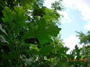
Young acorns on bur oak at Colony Farm Orchard August 2009

Young acorns on bur oak at Colony Farm Orchard August 2009

The Orchard property has other habitat features that add to its value as a part of the Asylum Lake Preserve.  I’ll mention only one more here.  The western part of the property was within the historic Genesee Prairie.  The rest of it was bur oak plain, a closely related community.  This tells us that the spring area lying at the north end of the Orchard and the south end of the ten acres owned by the WMU Foundation was almost certainly prairie fen. In years of low water in the past, I have identified fen plant species in the wetlands at the west edge of Asylum Lake directly opposite. Prairie fen is a remarkably attractive and diverse ecosystem that The Nature Conservancy and the Michigan Natural Features Inventory have given high priority for protection in Michigan.

It would make good conservation sense to restore tall-grass prairie in a wide band along the western fence of the Orchard property and to restore prairie fen on the springy wetlands at the north.  Southwest Michigan genotypes of plants should be used.

I’ll try to make other specific suggestions as to how the land might be used in a later post.
Synopsis of Oshtemo Township Original (1830) Vegetation Types

Bur Oak at the Colony Farm Orchard, a protected area threatened by expansion of the WMU Business Park

Bur Oak at the Colony Farm Orchard, a protected area threatened by expansion of the WMU Business Park

Following are brief descriptions of the major vegetation types in Oshtemo Township (Kalamazoo County, Michigan) about the time of settlement. This is the second and concluding installment of a talk given at the March 2009 meeting of the Oshtemo Historical Society.

Information is also provided about what settlement, agriculture, and development have done to original plant communities.  Some protection and restoration possibilities are mentioned under “Current Status.”  Major invasive species are listed. Invasives are plants or animals, usually non-native, that invade and spread, usually at the expense of native species.  Control of invasives may be necessary for conservation.

1. Oak Savanna and Oak Forest (together occupied 88% of Township)
These are treated together because they are similar except for crown coverage.  Areas where the canopy coverage was more than 50% are termed forest.

Tree species–The widespread oak savannas that the settlers usually termed “openings” were dominated by white oak.  Chinkapin (yellow chestnut) oak, bur oak, and hickory (mostly pignut) were  present but not common. Black oak was also present but was common only on the driest soils and was often associated with dry sand prairie. Shrubs included flowering dogwood, hazelnut, New Jersey tea, and shadbush.

Herbs–A great variety, depending on the specifics of the site and also its fire history.  The species ranged from herbs we would now think of as mesic prairie species to ones that now are mostly in forest, even beech-maple forest.

What happened to it?–Much of it was cut over for timber and charcoal which was used in large quantities by blacksmiths. Large areas were also cleared for agriculture, including orchards. More recently remnants are being lost to residential development.  Sites not cut over became brushy and denser owing to invasion of other trees and shrubs in the absence of fire.

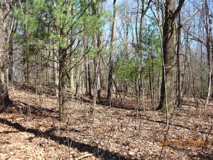
Oak forest in Oshtemo Township shows recent invasion by white pine and red maple.  Photo copyright 2009 Richard Brewer

Oak forest in Oshtemo Township shows recent invasion by white pine and red maple. Photo copyright 2009 Richard Brewer

Current status–No intact examples are left, but a fair amount of land exists occupied by more or less disturbed remnants.  In the past 30 years these have been heavily invaded by red maple and white pine.  Both species were almost absent from uplands in 1830.  Because of the dense shade these trees cast, less shade-tolerant herbs and shrubs are reduced.  To provide a demonstration of what most of the township was originally like, a few sites of considerable acreage should be set aside. Invading maples and pines should be removed and a continuing fire management regime should be started.

Invasives–Tartarian honeysuckle, Common privet, garlic mustard, dame’s rocket, and recently money plant.

2. Other-than-mesic Prairie
These prairie types ranging from wet to dry mostly tended to be associated with oak savanna on sites of appropriate soil moisture and fire history.

For example, on south- and west-facing slopes especially next to lakes or broad valleys occurred hill prairies, also called goat prairies.  These shared some species with the adjoining forest or savanna and some with other prairie types; they also had a few distinctive species.

Wet prairie occurred on lowlands associated with wetland herbaceous communities.

Current status–Few if any sites left because of development and absence of fire; any sites that contain a sampling of the characteristic species are worth preservation.  Searches should be made of the appropriate slopes for hill prairie remnants and of the few wetlands for wet prairie species.

3. Mesic or Tall-grass Prairie (Grand and Genesee Prairies were 2% of Township)
Tree species–Mesic prairies were treeless.  Bur oak might occur at the edge.

Herbs and grasses–Big bluestem and Indian grass were the most important tall grasses, but several other species of lesser stature were present.  Important herbs included bird’s foot violet, compass plant and two other species of Silphium, culver’s root, various asters, goldenrods, sunflowers, and legumes.

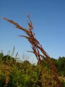
Indian grass, one of the dominant tall grasses in mesic prairie.  Photo copyright 2009 Richard Brewer

Indian grass, one of the dominant tall grasses in mesic prairie. Photo copyright 2009 Richard Brewer

What happened to it?–Mesic prairie was the first land settled and nearly all was plowed.  The only parcels that escaped were in the earliest cemeteries and perhaps some land along the earliest railroads.  However, some remnants of bur oak plains and white oak openings on better soils included plants that also were prominent on mesic prairie. In the past 30 or 40 years, disturbance and lack of fire have reduced or obliterated the few remnants in these categories.

Current status–All sites containing any combination of mesic prairie species are worthy of preservation; however, most sites dominated by mesic prairie species will be the result of restoration.

4. Bur Oak Plains (3% of Township)
This savanna was usually adjacent to mesic prairie.  It shared many of the same herbs and grasses and probably originated (and was eliminated) in the same way.  No remnants that include bur oaks and characteristic ground layer vegetation are known.

5. Beech-sugar maple Forest (6.5% of Township)
Trees–Beech, sugar maple, basswood, tulip tree, white ash, slippery elm (now nearly gone from Dutch elm disease), red oak, bitternut hickory.

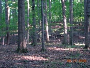
A fall view of beech-sugar maple forest in the Mildred Harris Sanctuary (Audubon Society of Kalamazoo) in Alamo Township.  Photo copyright 2009 Richard Brewer

A fall view of beech-sugar maple forest in the Mildred Harris Sanctuary (Audubon Society of Kalamazoo) in Alamo Township. Photo copyright 2009 Richard Brewer

In understory–Blue beech, hophornbeam.  Spice bush and red-berried elder are the most important large shrubs; running strawberry bush (genus Euonymus) and gooseberry also occur.

Herbs–A large variety including the spring ephemerals such as spring beauty, toothwort, large-flowered trillium, Dutchman’s breeches.  Non-ephemerals and summer-flowering species fewer; examples are nettles, putty-root, water-leafs, wild leek, May-apple, blue cohosh, doll’s-eyes.

What happened to it?–Mostly cut over and converted to agriculture.  Beech-maple forest in Oshtemo was the south end of the same patch that extended northeast all the way to Cooper Township, where relict stands persist in Markin Glen Park and the Kalamazoo Nature Center.

Current status–Virtually gone.  Elsewhere in Kalamazoo county, a few remnants were preserved by land owners because of their beauty and the spring flowers; some of these have been permanently protected.  If any patch of even five or ten acres still existed in Oshtemo Township, it should be conserved. In many preserved sites, the invasive garlic mustard is a serious threat to the herb layer.

6. Wetlands (0.5 present of township)

Small amounts of swamp forest and marsh were evident from the original land survey.  A few kettles with perched water tables held buttonbush swamps. As far as now known, no bog, tamarack forest, fen, or other specialized types of wetlands occurred.  Likewise, no floodplain forest was present.

Current status–If any of the seemingly absent types such as fen, bog, or wet prairie were found in the township, the sites would be worth conserving.  Perhaps the small wedge of swamp forest in the northwest corner should be considered for protection.

[Added 15 November 2009. Over the past week or two I noticed a tamarack tree in the wetland at the west edge of the Lilian Anderson Arboretum not far south of West Main (M-43) in Section 15.  In the fall, tamarack needles turn a gold color, so a tamarack is easily noticed at this time.  I finally stopped by yesterday, by which time many of the leaves had fallen and the few remaining ones were dull brown.  The situation where the tamarack is growing is consistent with the possibility of fen, though I have not noticed fen species at other places along the edge of the wetland on many other trips to the Arboretum.  The site is at the base of a slope where ground water feeds a sizable wetland northeast of Bonnie Castle Lake.  There are more wetlands across M-43 to the north.  I tried to walk around in the vicinity of the tamarack without sinking too deep, and I didn’t see any obvious fen indicator species.  But it’s not a good time of year.  I’ll have another look or two next spring and summer.]

Conservation Overview

Little natural land is currently preserved in Oshtemo Township.  The two township parks are mostly devoted to active recreation.  A few years ago the Township lost an opportunity to create a contiguous protected area of at least 200 acres when it voted to convert most of the larger park (Oshtemo Township Park on West Main Street behind the township hall and the library) into an 18-hole disc golf course. A color map available at the township website gives a clear picture of how much of the park was removed from natural processes and devoted to disc golf.

Adjoining the Oshtemo Township disk golf park on the west is more than 130 acres of conserved land owned by Kalamazoo College.  The Kalamazoo College land has been dedicated as the Lillian Anderson Arboretum; however, only about 30 acres of the land is, in fact, permanently protected (by a conservation easement held by the Southwest Michigan Land Conservancy).

Another protected tract is a short segment of the Kal-Haven Trail (owned by the state of Michigan) cutting across the northeast corner of the township.  Adjoining this section of the Kal-Haven Trail is about 100 acres owned by the Kalamazoo Nature Center as the result of a bequest from Mildred Harris.

A part of Western Michigan University’s Asylum Lake property lies in Oshtemo Township between Drake Road and U.S.-131 .  It is, to a degree, protected since it was conveyed to WMU by the state to be used “solely for public park, recreation or other open-space purposes unless otherwise authorized by public act.”  Part of the 55-acre site was used as an orchard by the Kalamazoo State Hospital’s Colony Farm from the 1880s into the 1950s.  The now-abandoned orchard supports a number of forest and thicket bird species. The land is also of historical and archaeological interest because of its use in the farm operations of the state hospital and also because of its location within the savanna complex immediately surrounding Genesee Prairie.  See the next (earlier) post for a current threat to the continued existence of this protected land.

Few other protected sites exist.  Most of the land holdings in the township are small parcels of 40 acres or less. Consequently, establishment of preserves large enough to be suitable habitat for birds and larger mammals will in most cases require acquisition (or protection by conservation easement) of two to several parcels.

Landscape and Vegetation of Oshtemo Township at the time of Settlement

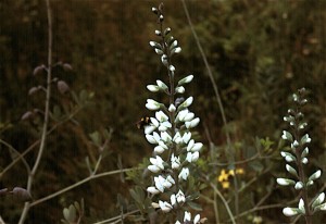
False Wild Indigo growing on land of the former Grand Prairie.  Photo copyright Richard Brewer 2009.

False Wild Indigo growing on land of the former Grand Prairie. Photo copyright Richard Brewer 2009.

This is a short version of a talk I gave at the Oshtemo Historical Society, Kalamazoo County, Michigan, this spring (March 2009) on the original vegetation of the township.

I’m using 1830 as the beginning date. There are good reasons for choosing that year. One of Kalamazoo County’s famous early settlers, Benjamin Drake, arrived with his wife, Maria, on Grand Prairie in 1830. The family settled in the Oshtemo part of the prairie (which extended across the line into Kalamazoo Township). Enoch and Deborah Harris, the county’s first black settlers, arrived about the same time, maybe a little earlier, on Genesee Prairie in the southern part of Oshtemo Township. For the settlers, the tall-grass (mesic) prairies were destinations, like islands in the ocean.

Also,1830 was the year that the General Land Office Survey for Oshtemo Township was conducted. The survey produced data that allows us to form a pretty good idea of what the vegetation was like at the time. The survey and settlement are connected, of course, because the purpose of the survey was to establish the sections,townships, and ranges that provided the framework for the sales of land to the immigrants.

Even though the purpose of the survey was not botanical, it collected information as to species and diameters of trees at section corners and quarter sections, along with their distances from these points, allowing a relatively accurate reconstruction of the vegetation. Using this data and other sorts of information from the original land survey along with topographic information, a map of the vegetation of Kalamazoo County in 1830 was prepared (T. W. Hodler, Richard Brewer, L. G. Brewer, and H. A. Raup. 1981. Pre-settlement vegetation of Kalamazoo County, Michigan [map]. WMU Geography Department, Kalamazoo.

Of course, Oshtemo history doesn’t start at 1830. We know that LaSalle with a band of four men went through southern Michigan in 1680, and it’s likely that his route went through Oshtemo, probably right through Grand Prairie. It was about this time of year, probably the last week of March.

But the Potawatomi were already here, having arrived about 1700 from Wisconsin. As far as vegetation and animals go, Oshtemo history starts around 14,000 years ago when Pleistocene glacial ice disappeared from Oshtemo and adjacent areas to the south and east. Paleo-Indians followed the mammoths and other now-extinct large mammals into an open grassy, sedgy landscape that also contained a few species of plants related to today’s tundra.

If we compare Oshtemo Township with the rest of Kalamazoo County, Oshtemo was one of the less diverse townships vegetationally. Most of the land was occupied by the related communities of oak savanna, oak forest, and prairie. Here are the percentages of the total land area and the geological land form each community occupied :
Oak savanna                                 61%      Outwash, moraine
Oak forest                                     27 %      Moraine
Bur oak opening                            3%      Outwash, moraine
Mesic Prairie                                  2%       Outwash
Beech-sugar maple forest         6.5%    Moraine
Marsh and other wetlands        0.5%   Moraine

Several other plant communities, especially wetlands like bogs, fens, and tamarack swamps, were almost absent from Oshtemo.

What is the explanation for this pattern? A major reason is that most of the township consists of high lands often with sandy soils, formed by the Kalamazoo moraine and associated outwash plains. Oshtemo seems to be a made-up Indian name. Henry R. Schoolcraft, the 19th century geologist and ethnologist, evidently derived it from a couple of Ojibwa words that mean, more or less, head-waters (Virgil J. Vogel, 1986. Indian Names in Michigan. The University of Michigan Press, Ann Arbor. ISBN 0-472-10069-6). It’s unlikely the Potawatomi of Grand or Genesee prairie ever described themselves as being from Oshtemo.

Wherever the word came from, it describes the Oshtemo topography pretty well. It’s high ground with few lakes and no named rivers. Some water runs off above ground a little way, but most soaks into the sandy soils and is carried away underground in various directions eventually ending up either in the Paw Paw River or the Kalamazoo River.

A second major factor, working in conjunction with topography and soil, was fire.  Most fires in this region were probably Indian set.

Oak savanna was the predominant plant community of the township. Savanna refers to wide-spaced trees in a landscape that otherwise has grasses and herbs. As an arbitrary dividing line between forest and savanna, the Kalamazoo County map of original vegetation used 50% canopy cover. That is, if we measured at solar noon, the shadows of the tree crowns on the ground would cover about 50%.

Kim Chapman, a former student, and I wrote a long article on the savannas and prairies of Michigan that appeared in the Michigan Botanist (K. A. Chapman and Richard Brewer. 2008. Prairie and savanna in southern lower Michigan: History, classification, ecology. Michigan Botanist 47(1): 1-48. We see the savannas, prairies, and oak forest as going together to form a dynamic system in time and also space. For example, we see any one patch of land switching from forest toward savanna, or savanna toward prairie during dry and warm periods when fires were frequent . With decreased fire frequencies during moister or cooler periods and also following settlement, the system would shift the other way. The savanna vegetation was patchy because of differences in elevation, soil moisture, and slope exposure.  The patchiness was probably least in extensive flat areas.

The next post will give a few more details about the original plant communities.