Category Archives: Land Trusts (& other private land conservation)

Probably the last review of Conservancy: The Land Trust Movement in America

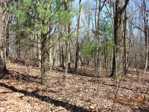
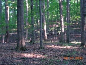
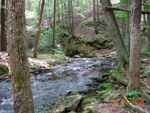
Stream at Rock House Reservation, West Brookfield MA, a preserve of The Trustees of Reservations, the first land trust.  Photo by Richard Brewer.

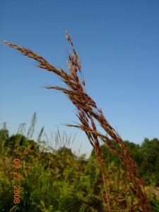
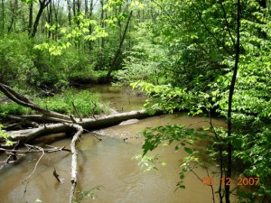
Swift River at Bear's Den Reservation, New Salem MA, a preserve of The Trustees of Reservations, the first land trust. Photo by Richard Brewer.

In the earlier version of my website, I had a page where I posted reviews of Conservancy: The Land Trust Movement In America, or links to them.  The last count was a dozen.  Posted here for the sake of completeness is the last one, as far as I know. It appeared in 2006, by which time I was not spending a lot of time on the old version of the website.

CONSERVANCY: The Land Trust Movement in America. By Richard Brewer. Lebanon, NH: University Press of New England. 2003

Reviewed by Donna Luckey, University of Kansas
Published in American Studies 2006,
47 (3-4): 244-245

[p. 244] Richard Brewer has given us a thorough review of land preservation and conservancy history in the United States. He provides a comprehensive treatment of land trusts, focused specifically on those trusts with the “intent to preserve land” as their stated mission. There are three main sections: the early chapters cover background for land preservation, the middle section serves as an excellent handbook for those involved with land trusts, and additional chapters provide case studies of major conservancies and local land trusts in this country.

Beginning with strong arguments for preserving biodiversity, Brewer provides species-specific examples, like the role of Running Buffalo Clover relative to ecological communities and ecosystem succession. He clarifies the differences between early advocacy groups and land preservation groups, explaining how that distinction has carried into the present. A key point is the growth of conservancies since 1980s, cited by Brewer as the true beginning of the land trust movement in America. He explains this well, illustrating the connections to environmental awareness, changes in the federal government’s policies, and other aspects of that era.

The middle section, chapters 3-8, is very useful for landowners, land trust staff, and board members. It addresses questions of land protection: why, who, which lands, how, and what is “land stewardship”? Brewer builds directly on the earlier material, grounded in his extensive background and experience as a biologist and land trust board member. It is here that he answers explicit questions, including how to distinguish forms of land protection. For example, there is a very good section (114ff.) clarifying the actual costs of protecting land, and how to estimate them. Brewer describes the complexities of Conservation Easements, currently very popular (as verified through statistics from the Land Trust Alliance [LTA] workshops, journal articles, etc.). He examines landowner benefits for those who protect land using Conservation Easements, while also raising the “non-economic” values that motivate landowners. He emphasizes ongoing stewardship as most vital; this is key among emerging issues of the conservancy movement today. Education of future generations of land-

[p. 245] owners with property protected by Conservation Easements is also raised as critical. These examples and detail, educating the public as well as current and potential land trust board members, is the gift of Brewer’s work. More images and graphics would nicely enhance this powerful text. On p. 11 Brewer describes the powerful impact four Wisconsin maps compiled by Curtis in 1956 had on him; his own readers would similarly benefit.

Additional acknowledgement of some early key players might be appropriate. These include Ralph Borsodi (father of “trustery” and the International Independence Institute) and Robert Swann. In 1972 the latter, with others, wrote The Community Land Trust – A Guide To A New Model For Land Tenure In America. The Community Land Trust (CLT) movement is indebted to these pioneers, and Brewer explains on p. 11 that CLTs focus on low-income housing. The common roots however are significant. The California State Coastal Conservancy (CCC) also provided timely and significant assistance to California land trusts forming during the critical years Brewer describes. The Humboldt North Coast Land Trust is but one example (cited by Brewer in the chapter on TPL, [222-223]) of a coastal land trust receiving CCC assistance, including financial, political, and organizational instruction.

The Lincoln Institute of Land Policy, referenced by Kingsbury Browne on p. 35 for funding his 1977 report “Case Studies in Land Preservation,” continues to contribute to this field. Jeff Pidot’s timely paper, “Reinventing Conservation Easements: A Critical Examination and Ideas for Reform,” is from the Lincoln Institute (2005). Like the CCC, the Lincoln Institute has many programs, yet each organization has played important roles for many land trusts throughout the country.

Overall, Brewer’s history is thorough and the cases detailed and well documented. He provides a good range of different types of preservation organizations and their structures, with lessons from both success and failure through many examples. This book serves the land trust movement well in each realm–as a history, as a handbook, and for general education. He is right on target with current issues in the final chapter: stewardship, public perceptions and education, and organizational relationships. Brewer gives us hope for the future of land preservation in the USA.

Senate Passes HB 5207; Governor next step

Sticky trap for insects possibly the property of MSU, Colony Farm Orchard, spring 2009.  Photo by Richard Brewer

Sticky trap for insects possibly the property of MSU, Colony Farm Orchard, spring 2009. Photo by Richard Brewer

Friday night, 18 December 2009, between 10:30 and 11:00 PM, not long before adjournment, the Michigan Senate passed HB 5207, which would strip the open space/public use restrictions from the Colony Farm Orchard land, allowing Western Michigan University to put it to any use.

Most of the senators voting yes probably bought WMU’s claim that passing the bill would create jobs by using it to expand the BTR park. If it would, none of the jobs would come on line until at least 2013, since any expansion of the BTR park would occur after the current park is full. It still has three unused lots, at least two vacancies, and the temporary soccer facility of 20 acres.

I’m working on a longer post, but it’s worth pointing out now that the next step is for the bill to go to Governor Jennifer Granholm, who will sign it or veto it.

For those interested in commenting on the legislation, here is some contact information for the governor.  It’s likely that there is time to reach her by any means including US Postal letters but the sooner, the better. Phone calls, letters, Faxes, and emails are all useful.

Contact information for Governor Jennifer Granholm:

Phone: (517) 373-3400
Phone: (517) 335-7858 – Constituent Services
Fax: (517) 335-6863

PO Box 30013
Lansing, MI 48909

Here is a link to an email citizen opinion forum

Here is a link to governor’s standard email.

Conservation Values of the Colony Farm Orchard, Kalamazoo County, Michigan

The following is approximately what I said in my brief remarks at the Save the Colony Farm Orchard Rally last Tuesday night, 8 December 2009.  I have, however, expanded on my thoughts under point 3, adding a consideration of conservation easements.

We need to recognize three aspects to the conservation value of this piece of land.  One is what’s good about the land itself.  Two is its beneficial effects on the adjacent Asylum Lake Preserve, which Western Michigan says is permanently protected.  Three is the broad question of how the conversion of this dedicated conservation land to commercial use affects the status of conservation land all across the state.

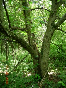
Apple tree in old orchard at the Colony Farm Orchard.  Photo by Richard Brewer

Apple tree in old orchard at the Colony Farm Orchard. Photo by Richard Brewer

1. The Land Itself. Although this land has been referred to as the Colony Farm Orchard, the old orchard amounts to only a quarter or so of the approximately 53 acres. The fruit trees are surrounded and in some cases overrun by grape vines.  Box-elder is a common invading tree in the orchard.

The rest of the property is varied habitat with a couple of sizable wooded areas at the north and south ends.  Grasslands dominated by smooth brome grass and goldenrods with invading shrubs and trees surround the wooded areas and the orchard.  The land of the wooded area at the north runs down to a springy area with a couple of ponds.

One part of the conservation value of this piece of land is what used to be here.  The east edge of Genesee Prairie, one of the eight tall-grass prairies in Kalamazoo County, extended to the Orchard site.  This is now the only part of Genesee Prairie in public hands and with any approach to natural vegetation.  The rest is gone, beneath US-131 or occupied by the west edge of Western Michigan University’s BTR park and commercial and residential areas and croplands west of US-131.

It’s unlikely that much of the original prairie flora is left at the Orchard site.  However, there are still bur oaks–a good many, some fairly large and old, others young.  They are all almost certainly descendants of the bur oaks that were part of the savanna fringing this tall-grass prairie. They are a genetic connection extending back 180 years to when the first settlers arrived to homestead on the prairies and savannas of Kalamazoo County.  But the connection extends back much further than that, to long before Europeans reached Michigan or North America, probably to some time in the Hypsithermal interval around 9000-6000 years ago.

Goldenrods, old orchard in background.  Photo by Richard Brewer.

Goldenrods, old orchard in background. Photo by Richard Brewer.

As for animals, we know from various sources that there are coyotes, deer, turkeys, woodcock, Red-tailed Hawks, Green Herons, and many smaller birds in the summer or year-round.  I will shortly put up a list of summer bird species that several observers are supplying.  The spot also has all the attributes of an excellent migratory stopover site for land birds in both spring and fall.  As to the small mammals, reptiles, amphibians, insects, I think it may be time for WMU to fund a serious study to find out just what is here.

2. Benefits to Asylum Lake Preserve. The Colony Farm Orchard is properly part of Asylum Lake Preserve.  From the edge of the Preserve vegetation to the edge of the Orchard vegetation is about the same distance as between third base and home plate on a baseball field. The Orchard makes the preserve a larger sanctuary by about 20 percent.  This is good; bigger is better in sanctuaries, mainly because local extinction of species is rarer on bigger sanctuaries.

We could also think of the Orchard as an island near to the Preserve. It serves as a stepping stone that wandering animals not currently living on the Preserve can find and, from there, reach the sanctuary.  The end result of all  this is that the Orchard makes the Asylum Lake Preserve more diverse and less prone to fluctuations in populations, hence more stable.

Bur oak at Colony Farm Orchard.  Photo by Richard Brewer

Bur oak at Colony Farm Orchard. Photo by Richard Brewer

There are of course the other beneficial effects of buffering against the noise, noxious fumes, and bright artificial lights coming from US-131 and the commercial land beyond it.

3. Threats to Conservation Land Elsewhere in Michigan. The Colony Farm Orchard has a protective conservation covenant that many Kalamazoo residents now know by heart: “The conveyance shall provide that Western Michigan University may utilize the property solely for public park, recreation, or open space purposes, except that the legislature, by statute, may authorize Western Michigan University to utilize the property for some other public purpose.” The restrictions were placed on the land by the legislature at the time of its transfer from the state to WMU in 1977.  If Representative Jones (D-Kalamazoo) and WMU can persuade the legislature to strip away this restriction, as  HB 5207 provides, and if Governor Granholm signs it, WMU will be able to use the land for anything.  This land, bought with taxpayer dollars and now designated for public use–specifically some variety of public open space–would be available to use as an Annex to WMU’s BTR park.  But it could also be used any other way WMU chose.

If HB 5207 is passed and signed into law, what state or university land dedicated for conservation–or any kind of public use–is safe?  What of the state parks? What of the arboretums, botanical gardens, and natural areas of the rest of the Michigan public universities?

What, in fact, of conservation easements?  These are now the most popular way to protect land in perpetuity, widely used by land trusts and government agencies.  They are discussed in many places in Conservancy: The Land Trust Movement in America but especially chapters 7 and 8.  Very briefly, a conservation easement is a binding agreement that permanently restricts the development and future use of land so as to protect its conservation values.  Conservation easements are held by conservation organizations or units of local, state, or federal government.  The easement holders are charged with defending against violations of the easement provisions. As of 2005, land trusts in Michigan held conservation easements on about 55,000 acres.  The amount of land in conservation easements held by government agencies is hard to determine but substantial.  Conservation easements are a relatively new way to conserve land, rarely used before 1960. Most states have statutes providing the legal foundation for conservation easements; Michigan’s is Act 451 of 1954, called NREPA.

But we have seen what the state legislature, or the House at least, has done with statutes in the case of the Colony Farm Orchard.  Suppose some well-connected land owner found that a conservation easement held by some land trust had become inconvenient to him.  Might the Michigan legislature be willing to pass a statute saying the conservation easement on his land was rescinded?  Maybe, maybe not.  Suppose that this situation came up two or three times.  Might the Michigan legislature decide that NREPA as currently written was becoming an unnecessary burden to worthy land owners who had changed their minds about the easements on their acreages.  In that case, might the Michigan legislature amend the statute to make backing out easier–like, for example, by coming to the legislature with what seemed like a good argument, such as using the land to create jobs?  Maybe, maybe not.

The land owners might still have a few hurdles remaining, with the IRS for example.  But that’s what attorneys and accountants are for.

If the legislature did either of these things, a judge or two or more would decide whether what the legislature did was legally OK.  Probably the judges wouldn’t say whether it was right or wrong or how much it damaged the cause of land conservation.

It is a dangerous path that Representative Jones and WMU are trying to steer the Michigan legislature towards.

Save the Enchanted Forest (aka Colony Farm Orchard)!

DSCN3142About a week ago, a group of students opposing the demolition of Western Michigan University’s Enchanted Forest, invited me to one of their meetings. The Enchanted Forest is what they call the land that is sometimes known as the Colony Farm Orchard. Enchanted Forest is a much better name.
This was a Thursday night and they were planning a letter writing session for the following evening.  I talked for a little while about past and current threats to the Enchanted Forest.  Andy Weissenborn and a dark-haired young woman whose name I didn’t get asked a few questions that I tried to answer. I gave them my take on how best to get in touch with members of the Michigan Senate, where the bill stripping the restriction that the land be kept as open space for public use was then, and still resides today (30 October).

The student group is on facebook.  Here are the first few lines of the group’s description:

Western Michigan University is moving ahead with a plan to expand the Business Technology and Research Park. In order to do this, they are going to flatten the woods at the northwest corner of the Drake and Parkview intersection, the “Enchanted Forest.”  Don’t get us wrong, we’re not against development in general. And we’re not against new business and new jobs.

The facebook group is open and the content is public.

The students have evidently put on a very effective campaign to reach members of the Senate.  Check out Chelsea Thorpe’s comments for 29 October on the group’s Wall.  Among other things, she says, “Call, write, my babies! Let’s save the dadgum Enchanted Forest!” and includes the phone number for the person to call in Lansing about postponing the vote (Senate majority leader Michael Bishop at 517 373 2417.)

I’ve heard that other actions to save the Enchanted Forest are being planned or contemplated.

In my opinion this effort is the greenest and most biospherically useful thing that’s happened at WMU at least since Dok Stevens left and maybe since Huey Johnson graduated.

Save the dadgum Enchanted Forest!

The Colony Farm Orchard is Not Trade Land

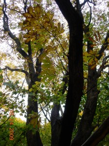
Horse chestnut tree at Colony Farm Orchard.  Photo copyright October 2009 by Richard Brewer.

Horse chestnut tree at Colony Farm Orchard. Photo copyright October 2009 by Richard Brewer.

I’ve always wondered if there was one fundamental difference between conservationists and those other people whose disposition is exactly opposite–the  exploiters, polluters, clear-cutters, mountaintop blasters, and all the other ill-users and abusers of the land and waters. In recent experiences with the case of the Colony Farm Orchard, I think I have an inkling of what the fundamental difference might be.

Several years ago The Nature Conservancy coined the term “trade land” to refer to real estate given to the organization merely as an asset, like a used car or shares of stock, rather than as land meant for preservation. In earlier days, people had sometimes been unhappy, even irate, when they heard of TNC selling land, thinking that sanctuary land was being sold. The term was invented to refer to lands with minor conservation value that are donated mainly for the money that TNC can raise by selling them.

The 54-acre Colony Farm Orchard (henceforth, just Orchard) in Oshtemo Township, Michigan, has certain features that make it desirable for conservation. I’ve listed these in more detail in earlier posts (such as this one), but they include a variety of habitats, historical interest from being located within the tall-grass Genesee Prairie and bur oak opening, and prime habitat as a migratory bird stopover site.  Perhaps more important is that the Orchard contributes to increased biodiversity and stability of the 270-acre Asylum Lake Preserve which is adjacent to the east, across Drake Road.  The Orchard serves as a very near island of similar but not identical habitat.

The State of Michigan gave the Orchard to Western Michigan University in 1977 for the purposes stated in the original legislative conveyance: “Western Michigan University may utilize the property solely for public park, recreation, or open space purposes, except that the legislature, by statute, may authorize Western Michigan University to utilize the property for some other public purpose.”

The intent is perfectly clear; this is land conveyed as dedicated open space for public use. The Orchard is not trade land.

Nevertheless, in the 1990s, WMU sought to develop the Orchard as part of a proposed BTR (Business Technology Research) Park.  A long battle ensued between WMU, elements of Kalamazoo City government, and certain corporations on one side and various environmental and neighborhood groups plus a high percentage of the citizenry on the other.  The first major skirmish was an attempt by WMU to get around the quoted restriction.  WMU persuaded a local Michigan House member, Dale Shugars, to introduce legislation changing the permitted uses to “1. For a public park, recreation area, or open space area.  2. For a business, technology and research park…” The bill with the altered language passed the House, but a Senate committee concluded that a BTR park was not a public purpose,  The Senate did not act on the bill, and in 1993 it died. The Orchard was saved.

Many things happened between 1993 and now.  One was a compromise of sorts, by which land south of Parkview Avenue, which had come from the state to WMU with no restrictions, was opened to the development of a BTR park. Such a development was begun in 2001. The Asylum Lake parcel north of Parkview and east of Drake that had come to WMU in 1975 with exactly the same restrictions as the Orchard was designated as a Preserve.  It was further protected in 2004 by a Declaration of Restrictions, meant to serve the same function as a conservation easement.

The Colony Farm Orchard is at the upper left in this diagrammatic map which appears on the Asylum Lake website

The Colony Farm Orchard is at the upper left in this diagrammatic map which appears on the Asylum Lake website

During the years between 1993 and 2004, agreement had been reached on a variety of topics. The conservationist participants in the discussions believed that the Orchard, north of Parkview and with the same legislative restrictions as the Asylum Lake property was a part of the Preserve.  The WMU participants, however, rebuffed all attempts at explicit inclusion of the Orchard in the Declaration of Restrictions.  Probably this should have been a signal that WMU was not giving up its plan to violate the restrictions on the Orchard, but the participants were comforted by the fact that the land was still protected by the original restriction. Perhaps they were also tired after the years-long debates.

Faint signals of a renewed attempt on the Orchard could have been noticed in late February 2009.  WMU Vice-President Robert Miller emerged from WMU’s five-year Orchard dormancy to tell one of the Asylum Lake neighborhood groups: “There are no plans to develop that area, but it is one of the options we are looking at. I can tell you, should a decision be made to expand the Business, Technology, and Research Park, we would come to you, to the entire community with our plans and share them. [But] we have none.”

By 2 July, the signal was much stronger.  The WMU Board of Trustees at its July meeting empowered the admistration to spend up to $985,000 to buy out a long-standing Michigan State University lease to conduct pest insect research on the Orchard.  Greg Rosine, another WMU Vice President, made it all explicit; he mentioned the deed restrictions and said that WMU was “seeking to get those restrictions changed.” Local Representative Robert Jones introduced House Bill 5207 to strip the restrictions on 16 July, though the first local public notice was not until 1 August.

Local adverse reactions were evident as early as 14 July at a meeting of the Oshtemo Township Board. Numerous letters and phone calls followed in later days and weeks, to the Kalamazoo Gazette, WMU administrators and board members, and local members of the legislature.  Much of this is related in earlier posts at this website.  As of the day I write, 28 October 2009, the bill has passed the House and been approved by the Senate Appropriations Committee.  Tardy and prolonged debate on the state budget, typical of the Michigan legislature, has delayed immediate action in the Senate.

Proponents of removing the restrictions and making the Orchard an annex to the current BTR park have said little publicly and have been unwilling to engage in any public forum or debate.  Apparently, their arguments are that the BTR is full, that it created more than 1,300 jobs “directly or indirectly” and an expansion would create many more, and that it is a logical site for expansion because it is already owned by WMU, is adjacent to the current park, and is not utilized.

Some of the claims are questionable and the rest are wrong.  The BTR park isn’t full.  Were the jobs “created” or were they jobs that, in the absence of the BTR park, would still have lodged somewhere in the Kalamazoo area? Considering the current job market, how soon will a BTR Park annex actually be needed?  Plenty of other sites exist for expansion, if expansion should ever be necessary. Included are other unrestricted properties owned by WMU as well as remediated brownfield sites in Kalamazoo that are going begging.  Although WMU’s early, obfuscatory statements in February mentioned that expansion to the CFO was “one option,” evidence is lacking than any other site was considered.

In fact, the main argument in favor of the Orchard is money. The Orchard is land bought with taxpayer dollars and given to WMU by the state for public use as open space.  Expansion of the BTR park would consist of dividing the parcel into a few lots and selling them for commercial use at market value.  Estimates for total income from the sales start at around $3 million.  With a cost basis of zero, WMU could reap a handsome profit.

In a rational accounting, the justification for converting this public open space to a BTR park annex fails.  To me and a good many others, there is little need even to do the accounting.  Here is land that in the transfer from state to university was set aside for the public good in language as plain as can be written.

I believe that here we are coming close to the fundamental distinction between conservationists and exploiters.  The difference is the unwillingness or perhaps the constitutional inability of the exploiters to understand and honor a perfectly explicit covenant.  They see it as nothing more than an obstacle to making money from the land, to be gotten around or over.  To them, conserved land is not utilized; conserved land does not perform.

To the exploiters, all land is trade land.

Private Options: The Leading Edge in Conservation Today

This review was published in 2005 as the second entry in my Land Trust Reading List on the earlier version of this website.  Slightly revised and updated, it’s republished here on the occasion of the 2009 Land Trust Alliance Rally.

privateoptions5

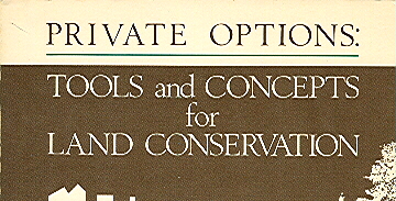
Private Options: Tools and Concepts for Land Conservation. Barbara Rusmore, Alexandra Swaney, and Allan D. Spader, Editors. 1982.  Island Press.

This proceedings volume brought together a great fund of information about land trusts at an important time in the development of the movement. Nearly thirty years later, the book is still useful to anyone trying to learn about land trust operations. Other than some specifics of tax law and regulations, little of the material is outmoded.

The approximately 75 papers came from the first two conferences aiming to take a national view of  private land conservation by local organizations.  Both were held around this time of year 28 years ago, in the fall of 1981.  The first, the National Consultation on Local Land Conservation, was held in Cambridge MA October 14-16 under the auspices of the Lincoln Institute of Land Policy. The second a month later, November 13-15, was Private Options for Land Preservation, A Conference for Practitioners.  It was held in San Francisco, though under the sponsorship of the Montana Land Reliance.

The Lincoln Institute, a land use policy group, was relatively new, founded in 1974. The Montana Land Reliance, a local land trust, was still newer, formed in 1976 and awarded non-profit status in 1978.

Land trusts formed since the later 1980s have mostly been named “land trusts” or “land conservancies,” but those formed in the hundred years between 1891 (the Trustees of Reservations) and the early 1980s used a variety of names, sometimes “trusts” or “conservancies” with various modifiers, but also many “associations,” “societies,” or “foundations.” As far as I know, the Montana organization is still the only “reliance.” Perhaps it was called a “reliance” from the rarely used definition of “one relied on.” There may be more to it than that or, possibly, less.

The book combines material from the two conferences; that from the National Consultation amounts to about 60 percent to the Private Option’s 40 percent. A separate proceedings for the National Consultation had been quickly assembled and published by the Land Trust Exchange (later, Land Trust Alliance), the national umbrella organization to which the conference gave rise. The National Consultation material included in this book is virtually identical to the separately published proceedings. Proceedings from the Private Options conference were advertised but evidently never produced, probably being incorporated directly into the joint volume.

Two conflicting emotions dominated the conferences. One was gloom over the threat to conservation and environmental protection that came from the new (January 1981) administration in Washington, that is, from Ronald Reagan and George H. W. Bush and their appointees. “Somewhere between Teddy Roosevelt and James Watt, the Industrial Revolution won out over the purple mountains’ majesty,” wrote Maggie Hurchalla, a representative of a Florida land trust to the National Consultation. “Land trusts are largely an answer to government failure. As a result, they are an accusation.”

But there was also a feeling of excitement at the great potential of private land conservation. Cecil Andrus, governor of Idaho and Secretary of the Interior under Jimmy Carter, gave the keynote address at the Private Options conference. He called the blossoming land trust movement the “leading edge” and the “third wave” of conservation in the U.S. The first wave was the rise of government protection of land, wildlife, and forests–the National Parks, National Forests, game protective laws, and conservation advocacy groups. The second was the popular environmental movement of the late 1950s, 1960s, and early 1970s with its accompanying federal and state regulatory legislation. “I call you the third wave,” Andrus said to the gathering.

In a section of comments from participants of the National Consultation, Allan D. Spader, the organizer of the conference, said, “The relatively spontaneous accomplishments and growth of the local land trust movement [are] unique in a world where success is measured in terms of media hype…or a government program grant.” And Robert Augspurger of the Peninsula Open Space Trust (CA), wrote of the conference itself, “[O]ne might compare [it] to an old-fashioned revival meeting. Here we had a group of ‘circuit-riders’ from all over the country, coming together to refresh, reinspire and reeducate each other. The results were indeed electric.”

Authors include a good many persons still active in the land trust movement–after all, it was less than 30 years ago. Among these are Mark Ackelson, Joan Vilms, Martin Zeller, Jean Hocker, and William Hutton. Some figures important in the exponential growth phase of land trusts are gone or less engaged now. Among these are Kingsbury Browne, Jr., Russell L. Brenneman, Gordon Abbott, Jr., and Benjamin R. Emory. Several more who contributed to the discussions were active for a time but are no longer connected with land trusts or, at least, not in any very visible way. Where, for example, is Maggie Hurchalla, author of the provocative quote a couple of paragraphs back?

[Added 14 August 2009.  I now know where Maggie Hurchalla is.  I was put on the trail by a column in Parade magazine.  (I make it a point to spend at least 30 seconds every Sunday reading Parade.)  Her name came up in an answer to a question concerning former Attorney General Janet Reno.

I must have failed to google Maggie when I wrote the original review, because over five thousand entries came up when I tried the other day.  In addition to being Janet Reno’s younger sister, she has been involved in environmental battles throughout her life.  Among her causes have been growth management in Florida and wetlands protection and restoration, including the Everglades.  She served as a Martin County commissioner for 20 years (1974-94), was chosen Florida Audubon’s Environmentalist of the year in 1981 and was a National Wetlands award recipient in 2003.  As far as I can tell from material on the web, Hurchalla has little if any recent connection with the land trust movement.  But she has continued to fight the good fight.]

Most topics of importance to land trusts are at least mentioned in the volume. Among other subjects, we read about marketing, preservation of agricultural and historic lands, community land trusts, negotiation skills, tax policy and income tax incentives, conservation easements (including some early comments on possible problems), partial development, cooperation with government (pros and cons), some summary material from the first real census of land trusts, a bit of history, some regional perspectives, organizational development, and ideas about forming a national umbrella organization.

Although there is material on fee acquisition and stewardship of natural lands, an emphasis on conservation easements and agricultural lands is evident. This emphasis was unrepresentative of what the majority of the more than 400 land trusts in existence were actually doing as of 1981. It was, however, prophetic of the shifts in emphasis that characterized much of the 1980s and 1990s and prevail today.

Colony Farm Orchard: New documentary film and a response to John Dunn Viewpoint

Matt Clysdale, from his website

Matt Clysdale, from his website

Matt Clysdale, a local film-maker (Animals Among Us), will be screening the first part of a two or more part film about Western Michigan University’s planned conversion of the Colony Farm Orchard open space to Business Park annex.  Here is his announcement.

Greetings everyone,

Please join me this Tuesday at 9 pm on Channel 19 for the
premiere broadcast of  “The Colony Farm Orchard – Part 1:
Here We Go Again”
, a video essay I recently produced on a
controversial, 54 acre piece of property adjacent to Asylum Lake.

The video is the first part in a series examining major issues
surrounding Western Michigan University’s plans to expand
the Business, Technology and Research Park onto the Orchard.

Part 1 explores the tumultuous history of the Orchard, previous
attempts to develop the property, and an earlier attempt to remove the restrictions on the property. Interviews with representatives from WMU, the Asylum Lake Preservation Association, and the Oakland Drive/Winchell Neighborhood Association, as well as former State Senator Jack Welborn and current State Representative Robert Jones, shed light on the inner workings behind this controversial, and necessary, community debate.

Matt Clysdale
HorsePower Pictures


Response to John Dunn Viewpoint

Richard Brewer

After a long silence, President John Dunn of Western Michigan University provided some public commentary on the Colony Farm Orchard by way of a Kalamazoo Gazette Viewpoint on Wednesday 23 September 2009. Following is a response I submitted Sunday to the Gazette.  I tried to keep it close to the 500-word Viewpoint limit the Gazette requests, so there was no space to deal with several other questionable statements.  I will try to address these later.

By mid-July, people were writing letters to the Gazette warning about WMU’s attempt to strip deed restrictions from the Colony Farm Orchard. The restrictions would have to be killed for WMU to expand its BTR park operations onto the Orchard.  The restrictions say WMU “may utilize the property solely for public park, recreation, or open space purposes, except that the legislature, by statute, may authorize Western Michigan University to utilize the property for some other public purpose.”  Last week, Western Michigan University President Dunn wrote a Viewpoint about the Orchard.

It is well that President Dunn has finally spoken up.  Until now the only WMU statements came from subordinates.

The version of Asylum Lake history given by President Dunn will seem strangely light-hearted and his representation of WMU’s role improbably altruistic to anyone who kept track of the bitter controversies of the 1990s-early 2000s.  These came out of an earlier attempt by WMU to turn the Orchard, the University Farm, and part of the Asylum Lake property into a business park.

But then President Dunn was not here during that time; he took office in July 2007.  His knowledge comes from staff, associates, and the WMU Board. I fear they have not given him a full picture of the long  battle–or the dedication it created in those who still fight to protect this special place.

President Dunn states that the Orchard is a logical choice for development because WMU already owns it.  What he neglects to say is that by the restriction, WMU holds it as a public trust–to keep for all of us as open space.

Among several misleading statements, President Dunn claims that the development would be beneficial because it would provide space for retention ponds that would improve water quality in Asylum Lake.  This is a red herring.  There are other places for such ponds, including the old trailer park at the north end of the Orchard.  The WMU Foundation owns this property, and it is unrestricted.  Work on the retention ponds could begin tomorrow.

President Dunn commends the legislators who wrote the original conveyance of the Orchard for recognizing that “community needs could change and included a mechanism to make such needed changes.” Exactly! We have already seen the language: “the legislature, by statute, may authorize Western Michigan University to utilize the property for some other public purpose.” It is just this language that Representative Robert Jones’s bill would remove.

The reason for the Jones-WMU bill is that all of this played out once before, in 1993.  The House passed altered language that would have allowed the Colony Farm Orchard to be used as a research and business park.  When the bill reached the Senate, careful debate led the Senate to conclude that this was not a public use.  They refused to act on the bill, and the door slammed shut on that first misguided effort to turn this property into a business park.

But now a new bill is back, in the Senate Appropriations Committee. If the Senate of 2009 is less wise than the Senate of 1993, the bill may pass and the Colony Farm Orchard will be lost.  Even worse, the legislature will have gone on record that conservation restrictions for the public good are meaningless, to be wiped out whenever they are inconvenient for any group with a powerful constituency.  I emailed Senator Tom George asking him not to allow this. Other citizens unhappy with WMU’s attempt to sell this land bought with taxpayer money to private interests might wish to contact their own senators.

Synopsis of Oshtemo Township Original (1830) Vegetation Types

Bur Oak at the Colony Farm Orchard, a protected area threatened by expansion of the WMU Business Park

Bur Oak at the Colony Farm Orchard, a protected area threatened by expansion of the WMU Business Park

Following are brief descriptions of the major vegetation types in Oshtemo Township (Kalamazoo County, Michigan) about the time of settlement. This is the second and concluding installment of a talk given at the March 2009 meeting of the Oshtemo Historical Society.

Information is also provided about what settlement, agriculture, and development have done to original plant communities.  Some protection and restoration possibilities are mentioned under “Current Status.”  Major invasive species are listed. Invasives are plants or animals, usually non-native, that invade and spread, usually at the expense of native species.  Control of invasives may be necessary for conservation.

1. Oak Savanna and Oak Forest (together occupied 88% of Township)
These are treated together because they are similar except for crown coverage.  Areas where the canopy coverage was more than 50% are termed forest.

Tree species–The widespread oak savannas that the settlers usually termed “openings” were dominated by white oak.  Chinkapin (yellow chestnut) oak, bur oak, and hickory (mostly pignut) were  present but not common. Black oak was also present but was common only on the driest soils and was often associated with dry sand prairie. Shrubs included flowering dogwood, hazelnut, New Jersey tea, and shadbush.

Herbs–A great variety, depending on the specifics of the site and also its fire history.  The species ranged from herbs we would now think of as mesic prairie species to ones that now are mostly in forest, even beech-maple forest.

What happened to it?–Much of it was cut over for timber and charcoal which was used in large quantities by blacksmiths. Large areas were also cleared for agriculture, including orchards. More recently remnants are being lost to residential development.  Sites not cut over became brushy and denser owing to invasion of other trees and shrubs in the absence of fire.

Oak forest in Oshtemo Township shows recent invasion by white pine and red maple.  Photo copyright 2009 Richard Brewer

Oak forest in Oshtemo Township shows recent invasion by white pine and red maple. Photo copyright 2009 Richard Brewer

Current status–No intact examples are left, but a fair amount of land exists occupied by more or less disturbed remnants.  In the past 30 years these have been heavily invaded by red maple and white pine.  Both species were almost absent from uplands in 1830.  Because of the dense shade these trees cast, less shade-tolerant herbs and shrubs are reduced.  To provide a demonstration of what most of the township was originally like, a few sites of considerable acreage should be set aside. Invading maples and pines should be removed and a continuing fire management regime should be started.

Invasives–Tartarian honeysuckle, Common privet, garlic mustard, dame’s rocket, and recently money plant.

2. Other-than-mesic Prairie
These prairie types ranging from wet to dry mostly tended to be associated with oak savanna on sites of appropriate soil moisture and fire history.

For example, on south- and west-facing slopes especially next to lakes or broad valleys occurred hill prairies, also called goat prairies.  These shared some species with the adjoining forest or savanna and some with other prairie types; they also had a few distinctive species.

Wet prairie occurred on lowlands associated with wetland herbaceous communities.

Current status–Few if any sites left because of development and absence of fire; any sites that contain a sampling of the characteristic species are worth preservation.  Searches should be made of the appropriate slopes for hill prairie remnants and of the few wetlands for wet prairie species.

3. Mesic or Tall-grass Prairie (Grand and Genesee Prairies were 2% of Township)
Tree species–Mesic prairies were treeless.  Bur oak might occur at the edge.

Herbs and grasses–Big bluestem and Indian grass were the most important tall grasses, but several other species of lesser stature were present.  Important herbs included bird’s foot violet, compass plant and two other species of Silphium, culver’s root, various asters, goldenrods, sunflowers, and legumes.

Indian grass, one of the dominant tall grasses in mesic prairie.  Photo copyright 2009 Richard Brewer

Indian grass, one of the dominant tall grasses in mesic prairie. Photo copyright 2009 Richard Brewer

What happened to it?–Mesic prairie was the first land settled and nearly all was plowed.  The only parcels that escaped were in the earliest cemeteries and perhaps some land along the earliest railroads.  However, some remnants of bur oak plains and white oak openings on better soils included plants that also were prominent on mesic prairie. In the past 30 or 40 years, disturbance and lack of fire have reduced or obliterated the few remnants in these categories.

Current status–All sites containing any combination of mesic prairie species are worthy of preservation; however, most sites dominated by mesic prairie species will be the result of restoration.

4. Bur Oak Plains (3% of Township)
This savanna was usually adjacent to mesic prairie.  It shared many of the same herbs and grasses and probably originated (and was eliminated) in the same way.  No remnants that include bur oaks and characteristic ground layer vegetation are known.

5. Beech-sugar maple Forest (6.5% of Township)
Trees–Beech, sugar maple, basswood, tulip tree, white ash, slippery elm (now nearly gone from Dutch elm disease), red oak, bitternut hickory.

A fall view of beech-sugar maple forest in the Mildred Harris Sanctuary (Audubon Society of Kalamazoo) in Alamo Township.  Photo copyright 2009 Richard Brewer

A fall view of beech-sugar maple forest in the Mildred Harris Sanctuary (Audubon Society of Kalamazoo) in Alamo Township. Photo copyright 2009 Richard Brewer

In understory–Blue beech, hophornbeam.  Spice bush and red-berried elder are the most important large shrubs; running strawberry bush (genus Euonymus) and gooseberry also occur.

Herbs–A large variety including the spring ephemerals such as spring beauty, toothwort, large-flowered trillium, Dutchman’s breeches.  Non-ephemerals and summer-flowering species fewer; examples are nettles, putty-root, water-leafs, wild leek, May-apple, blue cohosh, doll’s-eyes.

What happened to it?–Mostly cut over and converted to agriculture.  Beech-maple forest in Oshtemo was the south end of the same patch that extended northeast all the way to Cooper Township, where relict stands persist in Markin Glen Park and the Kalamazoo Nature Center.

Current status–Virtually gone.  Elsewhere in Kalamazoo county, a few remnants were preserved by land owners because of their beauty and the spring flowers; some of these have been permanently protected.  If any patch of even five or ten acres still existed in Oshtemo Township, it should be conserved. In many preserved sites, the invasive garlic mustard is a serious threat to the herb layer.

6. Wetlands (0.5 present of township)

Small amounts of swamp forest and marsh were evident from the original land survey.  A few kettles with perched water tables held buttonbush swamps. As far as now known, no bog, tamarack forest, fen, or other specialized types of wetlands occurred.  Likewise, no floodplain forest was present.

Current status–If any of the seemingly absent types such as fen, bog, or wet prairie were found in the township, the sites would be worth conserving.  Perhaps the small wedge of swamp forest in the northwest corner should be considered for protection.

[Added 15 November 2009. Over the past week or two I noticed a tamarack tree in the wetland at the west edge of the Lilian Anderson Arboretum not far south of West Main (M-43) in Section 15.  In the fall, tamarack needles turn a gold color, so a tamarack is easily noticed at this time.  I finally stopped by yesterday, by which time many of the leaves had fallen and the few remaining ones were dull brown.  The situation where the tamarack is growing is consistent with the possibility of fen, though I have not noticed fen species at other places along the edge of the wetland on many other trips to the Arboretum.  The site is at the base of a slope where ground water feeds a sizable wetland northeast of Bonnie Castle Lake.  There are more wetlands across M-43 to the north.  I tried to walk around in the vicinity of the tamarack without sinking too deep, and I didn’t see any obvious fen indicator species.  But it’s not a good time of year.  I’ll have another look or two next spring and summer.]

Conservation Overview

Little natural land is currently preserved in Oshtemo Township.  The two township parks are mostly devoted to active recreation.  A few years ago the Township lost an opportunity to create a contiguous protected area of at least 200 acres when it voted to convert most of the larger park (Oshtemo Township Park on West Main Street behind the township hall and the library) into an 18-hole disc golf course. A color map available at the township website gives a clear picture of how much of the park was removed from natural processes and devoted to disc golf.

Adjoining the Oshtemo Township disk golf park on the west is more than 130 acres of conserved land owned by Kalamazoo College.  The Kalamazoo College land has been dedicated as the Lillian Anderson Arboretum; however, only about 30 acres of the land is, in fact, permanently protected (by a conservation easement held by the Southwest Michigan Land Conservancy).

Another protected tract is a short segment of the Kal-Haven Trail (owned by the state of Michigan) cutting across the northeast corner of the township.  Adjoining this section of the Kal-Haven Trail is about 100 acres owned by the Kalamazoo Nature Center as the result of a bequest from Mildred Harris.

A part of Western Michigan University’s Asylum Lake property lies in Oshtemo Township between Drake Road and U.S.-131 .  It is, to a degree, protected since it was conveyed to WMU by the state to be used “solely for public park, recreation or other open-space purposes unless otherwise authorized by public act.”  Part of the 55-acre site was used as an orchard by the Kalamazoo State Hospital’s Colony Farm from the 1880s into the 1950s.  The now-abandoned orchard supports a number of forest and thicket bird species. The land is also of historical and archaeological interest because of its use in the farm operations of the state hospital and also because of its location within the savanna complex immediately surrounding Genesee Prairie.  See the next (earlier) post for a current threat to the continued existence of this protected land.

Few other protected sites exist.  Most of the land holdings in the township are small parcels of 40 acres or less. Consequently, establishment of preserves large enough to be suitable habitat for birds and larger mammals will in most cases require acquisition (or protection by conservation easement) of two to several parcels.

Conservation values of natural land vs farmland

Not long ago, a message asking about baseline documentation for conservation easements was posted on the landtrust-L website at Indiana University. The post, which boiled down to a question of how to assure that the baseline document will be admissible in court, drew about three dozen quick responses, several of which were pertinent and authoritative.

An eddy that curled off the main current, however, is what I want to talk about here. A couple of biologists set forth the view that baseline documents ought to include sound, detailed information on the biological basis of the conservation purposes of the easement. These are a part of the justification for the use of government money to buy the easement or, in the case of a donated easement, justification for a charitable deduction for income taxes.

One contributor to the discussion made the point that many farmland conservation easements do little other than remove development rights. Since the basis for such easements is keeping the land available for agriculture, the plants and animals and natural features of the property are irrelevant.

01

Black River Sanctuary of the Michigan Nature Association, Van Buren County, copyright Richard Brewer 2009

I responded on the listserv that if a land trust is considering a conservation easement on a farm that includes natural ecosystems worthy of protection, the conservation easement should protect these by appropriate restrictions. If the donor is unwilling to allow this protection, I said, the land trust should walk away from the deal. If the property has no conservation value other than maintaining land for crops, the land trust ought to consider whether it couldn’t spend its time better on another project with greater values.

Why, the person posting the farmland observation asked, is the protection of productive agricultural land from development a lesser conservation value than the protection of other conservation values?

It’s a fair question, but a full answer would take a while. I’d make a start on an answer this way: Consider three 120-acre parcels of land for which a conservation easement is contemplated. Parcel A is nearly all relatively undisturbed natural vegetation. Parcel B is prime agricultural land almost completely occupied by row crops. Parcel C is mostly prime farmland but also includes patches of other soils occupied by relatively natural vegetation and a section of stream.

Here’s a partial list of conservation values for Parcel A, some obvious and others a little more obscure: scenic beauty; providing a model or subject for art, literature, landscape architecture, etc.; fulfilling an innate human need for wildness; roles in biogeochemical cycling; soil development and renewal of fertility; purification of air and water; tempering floods and droughts; homes for pollinators and game animals; protection of soils and shores from erosion; maintenance of biodiversity with its many practical and aesthetic effects; sequestering carbon hence moderating global climate change; a classroom for many types of education; providing wild foods such as mushrooms, berries, and nuts.

What is the conservation value of the Parcel B? We know that it may have a conservation purpose because that is the way that the IRS tax code is written: One of the purposes that can justify a charitable deduction for a donation of land for conservation is “the protection of open space (including farmland and forest land) where such preservation is a) for the scenic enjoyment of the general public, or b) pursuant to a clearly delineated federal, state, or local governmental conservation policy and will yield a significant public benefit.”

It’s possible that the general public, or some members, may enjoy the scenery provided by 120 acres of tall corn in Illinois or 120 acres of peppers poking up through shiny black plastic in California. There may well be more-or-less clearly delineated government policies that encourage farmland protection for more-or-less sensible reasons (mostly listed in Chapter 12 of Conservancy: The Land Trust Movement in America).

The public benefit argument is a little tougher. Do the words refer to the existence of any public benefit, or do they mean that a net benefit remains when we add up the pluses and subtract the minuses?

The minuses don’t get a lot of attention anymore, though some of the early commentators on agricultural easements worried about them. Let’s run through a few. One is all but universal: the loss of native vegetation and the accompanying birds, mammals, insects, soil organisms, and all the rest. Two others are extremely widespread: loss of topsoil to erosion and pollution of air, surface water, and ground water from pesticides, herbicides, and fertilizers. Others are more localized; examples are soil salinization, spread of antibiotic-resistant diseases from feedlots, groundwater depletion, and loss of fauna from streams and wetlands caused by water diversion from streams to agriculture.

So it’s not so clear what the net might be, especially when we consider that some of the pluses aren’t really so plus when looked at closely. For example, saving land from development may be listed as one of the pluses, but in some of the less scenic parts of the West the threat of development any time soon is quite remote.

It’s worth mentioning that some agricultural uses may allow elements of the native biota to persist. Examples are grassland birds nesting in hayfields in the East and native flora, birds, and mammals persisting on some grazing lands in the West. These are conservation pluses, but they are tenuous and temporary. Nowadays hayfields are cut several times a year starting early, so that many of the grassland birds attracted to them fail to produce young. Some of the western grazing lands are susceptible to sod-busting, that is, conversion to croplands that will be home to few if any members of the native biota.

A conservationist might think that a conservation easement over farmland which possesses such conservation values should protect them. Why not write the conservation easement so that no hay can be cut on a field in Michigan or Massachusetts before the middle of July? Why not specify that if grazing is halted on an easement property in Montana or the Dakotas, the grassland must not be plowed to plant wheat but instead must be allowed to undergo the rather quick recovery to near-natural vegetation possible on this land if not too badly overgrazed?

And shouldn’t the conservation easement for Parcel C–mostly farmland but some natural–include restrictions that will protect the conservation values of the natural lands? Possibilities are control of purple loosestrife in the marsh, limited single-tree harvest in the woodland, and no livestock on the steep slopes or anywhere near the river.

Some conservationists might ask these questions but not many land trusts will. Rather, a high percentage of today’s land trusts take pride that the farmland easements they write do nothing that will hamper the land remaining in agriculture, no matter how destructive and noxious the activities referred to as agriculture become.

Some people think that the best road to retaining biodiversity and other conservation values in the landscape is to set aside preserves and sanctuaries where human activity is sharply limited while allowing the rest of the countryside to go wherever agriculture, development, and commerce take it. Some think that preserves won’t do the job and that instead we must educate (and regulate) the public so that all the landscape–farms, housing developments, factory lands, etc.– is managed in ways that retain at least patches of natural diversity.

Agricultural easements that take the approaches described in the last few paragraphs would be a modest start down the second road.

The landtrust-L website started by Tom Zeller of IU (and the Sycamore Land Trust) has for several years been an excellent source of information about land-trust operations. It’s probably the best place to go to ask (and answer) nuts-and-bolts types of questions. Those interested in land trusts can subscribe by emailing listserv@indiana.edu the message: subscribe landtrust-L.