Author Archives: rbrewer

Larry Walkinshaw and Michigan’s Golden Age of Ornithology

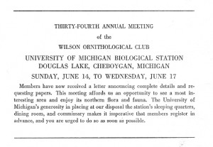
Wilson meetingWhen I arrived at Western Michigan University in 1959, Michigan was in the midst of an ornithological Golden Age.  Dozens of ornithologists were practicing their science in the state or had recent (or soon-to-come) connections.  Nearly every college and university had one to several faculty members with a special interest in birds.
My first exposure to Michigan had come in 1953 while I was still an undergraduate at Southern Illinois University. I attended the 34th annual Wilson Ornithological Society meeting held at the University of Michigan Biological Station at Douglas Lake.  Among the 123 Michigan residents at that meeting (out of 350 total attendees) were many faculty members including Andy Berger, Harry Hann, Bob Storer, Josselyn Van Tyne, George Wallace, Miles Pirnie, Lew Batts, and Nick Cuthbert. Such redoubtable graduate students as Philip Humphrey, Peter Stettenheim, Dale Zimmerman, and John William Hardy were also registered.

Hardy, my friend since childhood, was doing a master’s degree with George Wallace at Michigan State and had arranged a ride for us from East Lansing to the Bio Station with T. Wayne Porter.  Porter was an invertebrate zoologist but also had broad natural history interests that included birds.

Also at the meeting were Sewall Pettingill, who most summers between 1938 and 1974 taught ornithology at the Bio Station; S. Charles Kendeigh who had filled in for Pettingill in 1946 and who would be my graduate advisor at the University of Illinois  a couple of years later; and Theodora Nelson of Hunter College, Pettingill’s assistant 1938-1940. At this meeting she led off the first papers session with a history of ornithology at the station.

These ornithologists were at colleges and universities, though the Michigan Department of Conservation also had some academically trained ornithologists. But Michigan at this time also had a large contingent of amateurs with strong and essentially professional interests in birds. Larry Walkinshaw was one of these.  Larry was at the 1953 meeting and in fact on the program not long after Teddy Nelson, giving the participants an introduction to northern Michigan birding areas.

All this history is the preamble to mentioning a new book, On the Wings of Cranes: Larry Walkinshaw’s Life Story. The biography was written by Walkinshaw’s son-in-law, Lowell M. Schake.  I reviewed the book for the Wilson Journal of Ornithology (formerly Wilson Bulletin) in the June issue 2009 (vol. 121, no. 2): 445-447.

Walkinshaw was a student of birds from boyhood, but when the time for college arrived, he decided it would be wiser to study teeth instead.  While at dental school at the University of Michigan, he often talked with Josselyn VanTyne, curator of birds at the Museum of Zoology.  Van Tyne was only two years older but was Larry’s mentor, encouraging his interest in ornithological research.  He did the same with others, notably Harold Mayfield (who also attended the 1953 meeting).

In 1929, Walkinshaw got his DDS and opened a dental office in Battle Creek not many miles west of where he grew up in Calhoun County.  Over the years until he closed his practice in 1968, he combined dentistry with ornithology in a way that did not slight one in favor of the other, though the combination was not wholly satisfying either.

In summer, Wallkinshaw would get up early, make a couple of hours of observations on whatever local bird species was occupying his attention, get to his office for his first appointment at 8 AM, put in a full day, and then spend much of the time after dinner making more observations or working on manuscripts.  He was dedicated not just to learning the details of avian life history but also to putting the knowledge into print.  By the end of his life in 1993, he had published 9 books and something over 300 articles, chapters, and reviews.  Many of these are research papers based on his painstaking observations of Field Sparrows, Sandhill Cranes, Kirtland’s Warblers, Prothonotary Warblers, and Empidonax flycatchers, among other species.

In Larry’s proposal of marriage to Clara May Cartland, he asked her if she thought she could love birds as much as he did.  Whether she did or not, her abilities in running the household, helping in the dental office, and taking care of the children were probably essential to many of Larry’s ornithological accomplishments.

Besides his basic research in ornithology, Larry was heavily involved in bird conservation.  He helped establish the Michigan Audubon Society’s Baker Sanctuary in Calhoun County, which brought back the Sandhill Crane as a nesting bird in southern Michigan.  His observations on crane life history were important in starting the species on its road to recovery throughout its range.  He was also heavily involved–much more so than the standard literary sources show– in recovery efforts for the Whooping Crane.  And his observations on Kirtland’s Warblers provided many of the life history and ecology keys needed to bring that species back from near extinction.

The book provides information on these and other ornithological and conservation topics along with facts about Larry and Clara’s life in Battle Creek and at the summer cabins they had on the Lake Michigan shore near Muskegon.

Not long after my review of the book appeared, I received an email from a Canadian birder with a Walkinshaw anecdote. As a teenager 58 years ago, Fred Helleiner along with a friend had stopped at Walkinshaw’s dental office, needing directions to Baker Sanctuary.  “Although we came in unannounced and decidedly scruffy, Dr. Walkinshaw’s receptionist was obviously expected to call him out to the waiting room whenever a birder arrived.  On that occasion, he interrupted the treatment that he was administering to his patient…while he spent twenty or more minutes with us in his ‘gentle and patient’ (to use your words) manner providing us with the information that we needed.”

Larry Walkinshaw was gentle and patient.  Helpful also. And he loved birds.  A lot.
What is the Colony Farm Orchard and What Should Happen to it?

Mark Hoffman, mentioned in an earlier post as the person who knows the most about the history of the Asylum Lake (Kalamazoo, Michigan) property, gave permission to post this white paper on the current situation.  He prepared it for the Asylum Lake Protection Association, one of the leaders in the conservation battle that occupied much of the 1990s.  Mark was one of the first to call my attention to the undesirability of those early plans of WMU to invade the protected property.  When he first mentioned the conservation and open space value of the protected property some twenty years ago, he spoke to me, not about the larger parcel directly around the lake, but instead the parcel west of Drake Road, with grape tangles and native trees and herbs advancing through the old orchard, forming food-rich, secure cover for birds and mammals.–RB


WESTERN MICHIGAN UNIVERSITY PROPOSES DEVELOPMENT
FOR RESTRICTED PROPERTY – AGAIN

Mark Hoffman

Colony Farm Orchard, a narrow 54-acre tract of wooded open space, is one of three large and contiguous pieces of property along the southwest city limits of Kalamazoo that once sited an extensive farming operation for the Kalamazoo State Hospital from 1888 to 1959 and included a residential “cottage system” for patients that was phased out in 1969.  As the three properties were deemed surplus by the Michigan Department of Mental Health, they were transferred individually to Western Michigan University (WMU).  The Colony Farm Orchard was the last of the three transfers to WMU, with its enabling legislation enacted by the state of Michigan in 1977.  It is now threatened to be developed by Western.  1977 Public Act 158 (section 3) conveys the Orchard to WMU but limits the University to using the property “solely for public park, recreation, or open space purposes, except that the legislature, by statute, may authorize western Michigan university to utilize the property for some other public purpose.”  The legislation also permits MSU’s Department of Entomology to continue its use of the Orchard for fruit pest research until they no longer need the land.  MSU began their research in the Orchard on apples, grapes, and cherries during 1963 – after U.S. 131 split the property and limited its productivity for the State Hospital.

Bordering the Colony Farm Orchard is a 274-acre tract known as the Asylum Lake Preserve.  This property was conveyed to WMU by the state of Michigan in 1975 with the identical restrictive language used to transfer the Orchard property, as stated above.  The Asylum Lake property, with its two connecting lakes, hiking trails, and prairie restoration, was further restricted by WMU Trustees in April 2004 with their adoption of a management framework and additional guidelines that designated it as a “preserve.”  The new status for the land resulted as a compromise with the Kalamazoo community in 1999 to generate support for the controversial development of a Business, Technology, and Research (BTR) Park on 257 acres of adjacent University property (former State Hospital farmland, south of Parkview Avenue, transferred to WMU in 1959 without restrictions). Furthermore a $1.5-million endowment was also established in 1999 to fund the maintenance of the Asylum Lake Preserve for passive recreational opportunities.

Beginning the process to strip the Orchard of its restrictions, WMU’s Board of Trustees, on July 2, 2009, approved an agreement that was negotiated with MSU for the termination of its long-standing lease that has allowed them to conduct fruit pest research on the property.  WMU Trustees also authorized expenditures, not to exceed $985,000, to help relocate MSU’s experimental operation that is presently on the Orchard.  Western next seeks to have the Michigan Legislature eliminate the  “public park, recreation, open space…” transfer-stipulations to enable the expansion of its University-sponsored BTR Park, located on adjacent land (see House Bill 5207, introduced July 16, 2009 by Rep. Robert Jones, Kalamazoo Democrat).  Officials from Western have also announced that after the Orchard is free of its restrictions, the University intends to sell parcels of the property to private businesses to recover the $985,000 spent to relocate MSU’s research.

As the development of the Colony Farm Orchard looms once again, Kalamazoo’s Asylum Lake Preservation Association (ALPA) is seeking to retain the restrictions that were enacted when the 1977 legislative conveyance took place.  While the Orchard itself remains wild and wooded, ALPA believes that developing this tract will also pose a serious risk to the sensitive ecosystem of the neighboring Asylum Lake Preserve and the extensive watershed that is encompassed throughout both properties.  Furthermore, the long and narrow Colony Farm Orchard serves to buffer the Asylum Lake Preserve from further commercial encroachment, while protecting the habitats from the high traffic volume on U.S. 131, which creates the western boundary of the Orchard.

ALPA’s continuing interest in this land was recently expressed through its pursuit to designate the Orchard as a selected site in Kalamazoo County – one with distinct characteristics for agriculture, recreation, history, unique habitats, and buffers.  Subsequently, the property was one of many distinctive natural areas included by a coordinated smart-growth initiative (Convening Our Community and Convening for Action) in their January 2003 publication, Smarter Growth for Kalamazoo County.  Kalamazoo College officials involved in this initiative compiled the booklet to report special places where “preserving them could be a starting point to smarter growth” (p. 26).  They further noted that, “[t]oo many of these sites lay in the path of development … [and] too few resources and incentives exist to encourage developers to incorporate smart growth principles that would not only preserve these sites, but showcase them” (p. 27).

The new threat over losing the Colony Farm Orchard to development is shaping up to be the repeat of a prior attempt to change the status of the restricted land.  Following a long and bitter fight from 1990-93, Western Michigan University withdrew its attempt to change the conveyance restrictions on the Orchard in May 1993 after it failed to convince a Senate committee that private / for-profit businesses constituted a “public purpose,” as stipulated in the 1977 conveyance legislation (1977 Public Act 158).  This decision followed three years of tumultuous community debate that started when WMU announced in April 1990 that it would begin developing the Colony Farm Orchard with its Business – Research Park.

Throughout the deliberations, the Asylum Lake Preservation Association and the Kalamazoo Environmental Council (KEC) united with neighborhoods and community leaders in Kalamazoo and Oshtemo Township to protect the three properties from the business and industrial development that WMU was proposing.  The KEC, at that time, believed that it was important for Western to “hold and maintain parcels of land containing natural ecosystems for purposes of research and instruction.”  And while the need to build upon this parcel of land was not demonstrated, especially in light of alternative sites that were available, the organization further believed that the sensitive ecosystem in this area could be destroyed by the development that was being proposed.  ALPA concurred at that time, and it has not altered its position.

ALPA is now seeking assistance and asking others to voice their objections to House Bill 5207 by letting state legislators know that WMU’s Colony Farm Orchard in Oshtemo Township needs to be retained for “public park, recreation, or open space purposes,” as the 1977 conveyance legislation mandates.

Synopsis of Oshtemo Township Original (1830) Vegetation Types

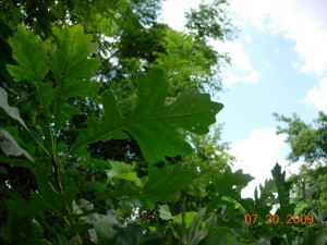
Bur Oak at the Colony Farm Orchard, a protected area threatened by expansion of the WMU Business Park

Bur Oak at the Colony Farm Orchard, a protected area threatened by expansion of the WMU Business Park

Following are brief descriptions of the major vegetation types in Oshtemo Township (Kalamazoo County, Michigan) about the time of settlement. This is the second and concluding installment of a talk given at the March 2009 meeting of the Oshtemo Historical Society.

Information is also provided about what settlement, agriculture, and development have done to original plant communities.  Some protection and restoration possibilities are mentioned under “Current Status.”  Major invasive species are listed. Invasives are plants or animals, usually non-native, that invade and spread, usually at the expense of native species.  Control of invasives may be necessary for conservation.

1. Oak Savanna and Oak Forest (together occupied 88% of Township)
These are treated together because they are similar except for crown coverage.  Areas where the canopy coverage was more than 50% are termed forest.

Tree species–The widespread oak savannas that the settlers usually termed “openings” were dominated by white oak.  Chinkapin (yellow chestnut) oak, bur oak, and hickory (mostly pignut) were  present but not common. Black oak was also present but was common only on the driest soils and was often associated with dry sand prairie. Shrubs included flowering dogwood, hazelnut, New Jersey tea, and shadbush.

Herbs–A great variety, depending on the specifics of the site and also its fire history.  The species ranged from herbs we would now think of as mesic prairie species to ones that now are mostly in forest, even beech-maple forest.

What happened to it?–Much of it was cut over for timber and charcoal which was used in large quantities by blacksmiths. Large areas were also cleared for agriculture, including orchards. More recently remnants are being lost to residential development.  Sites not cut over became brushy and denser owing to invasion of other trees and shrubs in the absence of fire.

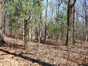
Oak forest in Oshtemo Township shows recent invasion by white pine and red maple.  Photo copyright 2009 Richard Brewer

Oak forest in Oshtemo Township shows recent invasion by white pine and red maple. Photo copyright 2009 Richard Brewer

Current status–No intact examples are left, but a fair amount of land exists occupied by more or less disturbed remnants.  In the past 30 years these have been heavily invaded by red maple and white pine.  Both species were almost absent from uplands in 1830.  Because of the dense shade these trees cast, less shade-tolerant herbs and shrubs are reduced.  To provide a demonstration of what most of the township was originally like, a few sites of considerable acreage should be set aside. Invading maples and pines should be removed and a continuing fire management regime should be started.

Invasives–Tartarian honeysuckle, Common privet, garlic mustard, dame’s rocket, and recently money plant.

2. Other-than-mesic Prairie
These prairie types ranging from wet to dry mostly tended to be associated with oak savanna on sites of appropriate soil moisture and fire history.

For example, on south- and west-facing slopes especially next to lakes or broad valleys occurred hill prairies, also called goat prairies.  These shared some species with the adjoining forest or savanna and some with other prairie types; they also had a few distinctive species.

Wet prairie occurred on lowlands associated with wetland herbaceous communities.

Current status–Few if any sites left because of development and absence of fire; any sites that contain a sampling of the characteristic species are worth preservation.  Searches should be made of the appropriate slopes for hill prairie remnants and of the few wetlands for wet prairie species.

3. Mesic or Tall-grass Prairie (Grand and Genesee Prairies were 2% of Township)
Tree species–Mesic prairies were treeless.  Bur oak might occur at the edge.

Herbs and grasses–Big bluestem and Indian grass were the most important tall grasses, but several other species of lesser stature were present.  Important herbs included bird’s foot violet, compass plant and two other species of Silphium, culver’s root, various asters, goldenrods, sunflowers, and legumes.

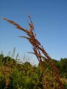
Indian grass, one of the dominant tall grasses in mesic prairie.  Photo copyright 2009 Richard Brewer

Indian grass, one of the dominant tall grasses in mesic prairie. Photo copyright 2009 Richard Brewer

What happened to it?–Mesic prairie was the first land settled and nearly all was plowed.  The only parcels that escaped were in the earliest cemeteries and perhaps some land along the earliest railroads.  However, some remnants of bur oak plains and white oak openings on better soils included plants that also were prominent on mesic prairie. In the past 30 or 40 years, disturbance and lack of fire have reduced or obliterated the few remnants in these categories.

Current status–All sites containing any combination of mesic prairie species are worthy of preservation; however, most sites dominated by mesic prairie species will be the result of restoration.

4. Bur Oak Plains (3% of Township)
This savanna was usually adjacent to mesic prairie.  It shared many of the same herbs and grasses and probably originated (and was eliminated) in the same way.  No remnants that include bur oaks and characteristic ground layer vegetation are known.

5. Beech-sugar maple Forest (6.5% of Township)
Trees–Beech, sugar maple, basswood, tulip tree, white ash, slippery elm (now nearly gone from Dutch elm disease), red oak, bitternut hickory.

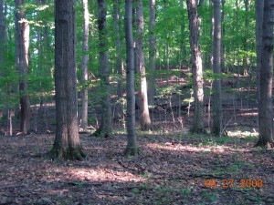
A fall view of beech-sugar maple forest in the Mildred Harris Sanctuary (Audubon Society of Kalamazoo) in Alamo Township.  Photo copyright 2009 Richard Brewer

A fall view of beech-sugar maple forest in the Mildred Harris Sanctuary (Audubon Society of Kalamazoo) in Alamo Township. Photo copyright 2009 Richard Brewer

In understory–Blue beech, hophornbeam.  Spice bush and red-berried elder are the most important large shrubs; running strawberry bush (genus Euonymus) and gooseberry also occur.

Herbs–A large variety including the spring ephemerals such as spring beauty, toothwort, large-flowered trillium, Dutchman’s breeches.  Non-ephemerals and summer-flowering species fewer; examples are nettles, putty-root, water-leafs, wild leek, May-apple, blue cohosh, doll’s-eyes.

What happened to it?–Mostly cut over and converted to agriculture.  Beech-maple forest in Oshtemo was the south end of the same patch that extended northeast all the way to Cooper Township, where relict stands persist in Markin Glen Park and the Kalamazoo Nature Center.

Current status–Virtually gone.  Elsewhere in Kalamazoo county, a few remnants were preserved by land owners because of their beauty and the spring flowers; some of these have been permanently protected.  If any patch of even five or ten acres still existed in Oshtemo Township, it should be conserved. In many preserved sites, the invasive garlic mustard is a serious threat to the herb layer.

6. Wetlands (0.5 present of township)

Small amounts of swamp forest and marsh were evident from the original land survey.  A few kettles with perched water tables held buttonbush swamps. As far as now known, no bog, tamarack forest, fen, or other specialized types of wetlands occurred.  Likewise, no floodplain forest was present.

Current status–If any of the seemingly absent types such as fen, bog, or wet prairie were found in the township, the sites would be worth conserving.  Perhaps the small wedge of swamp forest in the northwest corner should be considered for protection.

[Added 15 November 2009. Over the past week or two I noticed a tamarack tree in the wetland at the west edge of the Lilian Anderson Arboretum not far south of West Main (M-43) in Section 15.  In the fall, tamarack needles turn a gold color, so a tamarack is easily noticed at this time.  I finally stopped by yesterday, by which time many of the leaves had fallen and the few remaining ones were dull brown.  The situation where the tamarack is growing is consistent with the possibility of fen, though I have not noticed fen species at other places along the edge of the wetland on many other trips to the Arboretum.  The site is at the base of a slope where ground water feeds a sizable wetland northeast of Bonnie Castle Lake.  There are more wetlands across M-43 to the north.  I tried to walk around in the vicinity of the tamarack without sinking too deep, and I didn’t see any obvious fen indicator species.  But it’s not a good time of year.  I’ll have another look or two next spring and summer.]

Conservation Overview

Little natural land is currently preserved in Oshtemo Township.  The two township parks are mostly devoted to active recreation.  A few years ago the Township lost an opportunity to create a contiguous protected area of at least 200 acres when it voted to convert most of the larger park (Oshtemo Township Park on West Main Street behind the township hall and the library) into an 18-hole disc golf course. A color map available at the township website gives a clear picture of how much of the park was removed from natural processes and devoted to disc golf.

Adjoining the Oshtemo Township disk golf park on the west is more than 130 acres of conserved land owned by Kalamazoo College.  The Kalamazoo College land has been dedicated as the Lillian Anderson Arboretum; however, only about 30 acres of the land is, in fact, permanently protected (by a conservation easement held by the Southwest Michigan Land Conservancy).

Another protected tract is a short segment of the Kal-Haven Trail (owned by the state of Michigan) cutting across the northeast corner of the township.  Adjoining this section of the Kal-Haven Trail is about 100 acres owned by the Kalamazoo Nature Center as the result of a bequest from Mildred Harris.

A part of Western Michigan University’s Asylum Lake property lies in Oshtemo Township between Drake Road and U.S.-131 .  It is, to a degree, protected since it was conveyed to WMU by the state to be used “solely for public park, recreation or other open-space purposes unless otherwise authorized by public act.”  Part of the 55-acre site was used as an orchard by the Kalamazoo State Hospital’s Colony Farm from the 1880s into the 1950s.  The now-abandoned orchard supports a number of forest and thicket bird species. The land is also of historical and archaeological interest because of its use in the farm operations of the state hospital and also because of its location within the savanna complex immediately surrounding Genesee Prairie.  See the next (earlier) post for a current threat to the continued existence of this protected land.

Few other protected sites exist.  Most of the land holdings in the township are small parcels of 40 acres or less. Consequently, establishment of preserves large enough to be suitable habitat for birds and larger mammals will in most cases require acquisition (or protection by conservation easement) of two to several parcels.

New Threat to Asylum Lake Preserve

I sent the following letter, slightly shortened, to the Kalamazoo Gazette on 15 July 2009.  It deals with a long-standing conservation issue in the Kalamazoo area. [Note added 28 July.  The letter was in fact published with an omission or two of no importance on Sunday 26 July.]

Western Michigan University has the Asylum Lake preserve in its sights again.  This time the target is the 54 acres just across Drake Road called the Colony Farm Orchard.  This Oshtemo Township land is covered by the same state restriction as the rest of the Asylum Lake property; it is to be used “solely for public park, recreation, or open space purposes” unless changed by statute.  Nevertheless WMU proposes to expand their Business Park onto it (according to the Kalamazoo Gazette).

The land with its old, abandoned orchard has value for wildlife and for the public as open space.  It also has historical value because it lies on or very near Genesee Prairie, one of the eight tall-grass prairies in Kalamazoo County at settlement.  WMU aims to persuade the legislature to overturn the restriction and plans to pay Michigan State University $985,000 to give up a lease to do insect research at the orchard. Wouldn’t a more rational approach be to use land remaining within the current boundaries of the Business Park, such as the soccer fields? And if more land is really justified, the $985,000 WMU has available to throw around would buy some other nice Oshtemo property nearby–possibly more than 54 acres.  As for the state legislature, its best course would be to convey the orchard property to Oshtemo Township in exchange for a binding pledge to let it remain forever undeveloped open space.

I posted the following essay to the earlier version of my website as Conservation Letter 1 on 28 April 2003. It had been submitted to the Gazette as a Viewpoint but was not published.  It, and the two updates, give a little of the controversial history of some land that was conveyed in 1975 and (Colony Farm Orchard) 1977 by the state of Michigan to Western Michigan University “solely for public park, recreation, or open space purposes.”

Mark A. Hoffman knows more about the history of the site and of the controversy than anyone else. His project paper submitted for the Master of Public Adminstration degree (2007) is comprehensive but not readily accessible. The full title is Asylum Lake and Colony Farm Orchard (Kalamazoo County, Michigan): The history, legislative intent, and analysis of their conveyances from the Michigan Department of Mental Health to Western Michigan University. Links to many contemporary news articles (especially 1999-2004) are available on the WMU Asylum Lake website.

Asylum Lake

Last Friday gave us a beautiful sample of spring weather. Late in the afternoon, I took a walk at Asylum Lake. Blue-winged teal and gadwall were on the water and a pair of wood ducks flew by. There were cardinals, goldfinches, titmice, and a few other land birds, but 4:00 PM isn’t the peak of bird activity.

I’m a fan of Asylum Lake, so I’ve listened when occasional members of the focus group set up by Western Michigan University to plan the future of the preserve have told me what’s going on. The members have such diverse backgrounds and interests that I’ve been slightly surprised that they seem pretty much to have reached consensus on what’s right for Asylum Lake.

What they recommend–as I understand it–is mostly what’s there right now (including the new prairie planting), with the addition of an assurance that it’ll stay that way except for natural processes.

Other people were also at Asylum Lake last Friday. A man and his son were fishing, several people were walking dogs, two young women were catching some rays on a grassy slope, several people were just enjoying the spring, like me. I counted 23 people during the hour I was there, all involved in suitable passive pursuits .

There may have been a few visitors I missed, because my path took me past all three of the larger parking locations for the preserve, and each had several cars. I thought 23 was a comfortable number, uncrowded but companionable. If there had been twice as many people (and dogs) or more commotion–bikers, for example–the shyer kinds of wildlife would probably find the site unsuitable. Probably I would too.

One aim of the focus group was to identify the values of the property that need to be preserved. It’s reassuring that the values they came up with basically correspond with what the citizenry has said over the past dozen years in letters to the Kalamazoo Gazette and public meetings.

We haven’t heard a lot from the public lately because most people think the issue was settled. In 1998, the city and university seemed to come to an agreement assuring that the Asylum Lake preserve would not be degraded or destroyed. It has now begun to seem that it was too early to relax.

A story in the Gazette toward the end of February foreshadowed what seems to be an attempt by the city to pressure WMU into agreeing to changes that few who know the site will see as appropriate. The city wants paved roads and a large paved parking lot, replacing vegetation and wildlife habitat with impermeable surfaces. It wants bike trails running here and there to off-site locations bringing in people with no interest in the preserve as a preserve. The city envisages a research/education center. Does it really make sense for public agencies to enter into competition with the Kalamazoo Nature Center?

It’s ironic, I guess, that after all the threats to the integrity of the site from WMU the threat now comes from the city. Most of us had thought that the city’s role was to watchdog the university.

Only someone with no knowledge of the past ten years of Asylum Lake history would think that the intrusions being promoted by the city would be welcome. Re-reading the dozens of Asylum Lake letters to the editor would be educational for them. So would sitting down with Dok Stevens’ charming little book Haven : A Treatise on Asylum Lake (Spunky Duck Press: Kalamazoo, 1993) and perhaps a good environmental science or conservation textbook.

The city’s on the wrong side now, but the time may come again when both are on the wrong side, as was the case with the first ill-considered plan for a research park, in 1990-1993. It would be nice if the university and city would hurry up and sign a paper saying that Asylum Lake will be protected, not exploited. Even if they do, the citizens who saved it before must not relax their vigilance. In the long run, the real protection will come from the people who care about Asylum Lake being willing to spend the time, energy, and money to do what it takes to thwart ill-advised, destructive schemes of the future coming from the city or the university, or both.

Note added 19 August 2003: One reason for the Gazette‘s lack of interest in this Viewpoint may be suggested by the title of the front-page Gazette article of 9 August 2003: “Asylum Lake Fight: How a battle over open space nearly stalled Kalamazoo’s economic engine.” Some might say that Kalamazoo’s lack of forward movement hasn’t been engine trouble but the 1950s road map the drivers are still trying to follow. A Viewpoint by Mark A. Hoffman (24 August 2003) corrected some mistakes in the 9 August “Kalamazoo engine” article but could, in justice, have been considerably tougher.

Note added 15 July 2009: “It would be nice” I wrote, “if the university and city would hurry up and sign a paper saying that Asylum Lake will be protected, not exploited.”  This they did on 16 April 2004 when the WMU Board of Trustees approved two documents, one a Declaration of Conservation Restrictions.  The documents come as close to being a conservation easement as the somewhat peculiar nature of WMU’s possession of the land  allows.  Unfortunately, the 54-acre Colony Farm Orchard was not included in these restrictions.  My conclusion from April 2003 is still relevant:  “In the long run, the real protection will come from the people who care about Asylum Lake being willing to spend the time, energy, and money to do what it takes to thwart ill-advised, destructive schemes of the future coming from the city or the university, or both.”

Landscape and Vegetation of Oshtemo Township at the time of Settlement

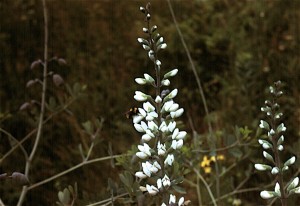
False Wild Indigo growing on land of the former Grand Prairie.  Photo copyright Richard Brewer 2009.

False Wild Indigo growing on land of the former Grand Prairie. Photo copyright Richard Brewer 2009.

This is a short version of a talk I gave at the Oshtemo Historical Society, Kalamazoo County, Michigan, this spring (March 2009) on the original vegetation of the township.

I’m using 1830 as the beginning date. There are good reasons for choosing that year. One of Kalamazoo County’s famous early settlers, Benjamin Drake, arrived with his wife, Maria, on Grand Prairie in 1830. The family settled in the Oshtemo part of the prairie (which extended across the line into Kalamazoo Township). Enoch and Deborah Harris, the county’s first black settlers, arrived about the same time, maybe a little earlier, on Genesee Prairie in the southern part of Oshtemo Township. For the settlers, the tall-grass (mesic) prairies were destinations, like islands in the ocean.

Also,1830 was the year that the General Land Office Survey for Oshtemo Township was conducted. The survey produced data that allows us to form a pretty good idea of what the vegetation was like at the time. The survey and settlement are connected, of course, because the purpose of the survey was to establish the sections,townships, and ranges that provided the framework for the sales of land to the immigrants.

Even though the purpose of the survey was not botanical, it collected information as to species and diameters of trees at section corners and quarter sections, along with their distances from these points, allowing a relatively accurate reconstruction of the vegetation. Using this data and other sorts of information from the original land survey along with topographic information, a map of the vegetation of Kalamazoo County in 1830 was prepared (T. W. Hodler, Richard Brewer, L. G. Brewer, and H. A. Raup. 1981. Pre-settlement vegetation of Kalamazoo County, Michigan [map]. WMU Geography Department, Kalamazoo.

Of course, Oshtemo history doesn’t start at 1830. We know that LaSalle with a band of four men went through southern Michigan in 1680, and it’s likely that his route went through Oshtemo, probably right through Grand Prairie. It was about this time of year, probably the last week of March.

But the Potawatomi were already here, having arrived about 1700 from Wisconsin. As far as vegetation and animals go, Oshtemo history starts around 14,000 years ago when Pleistocene glacial ice disappeared from Oshtemo and adjacent areas to the south and east. Paleo-Indians followed the mammoths and other now-extinct large mammals into an open grassy, sedgy landscape that also contained a few species of plants related to today’s tundra.

If we compare Oshtemo Township with the rest of Kalamazoo County, Oshtemo was one of the less diverse townships vegetationally. Most of the land was occupied by the related communities of oak savanna, oak forest, and prairie. Here are the percentages of the total land area and the geological land form each community occupied :
Oak savanna                                 61%      Outwash, moraine
Oak forest                                     27 %      Moraine
Bur oak opening                            3%      Outwash, moraine
Mesic Prairie                                  2%       Outwash
Beech-sugar maple forest         6.5%    Moraine
Marsh and other wetlands        0.5%   Moraine

Several other plant communities, especially wetlands like bogs, fens, and tamarack swamps, were almost absent from Oshtemo.

What is the explanation for this pattern? A major reason is that most of the township consists of high lands often with sandy soils, formed by the Kalamazoo moraine and associated outwash plains. Oshtemo seems to be a made-up Indian name. Henry R. Schoolcraft, the 19th century geologist and ethnologist, evidently derived it from a couple of Ojibwa words that mean, more or less, head-waters (Virgil J. Vogel, 1986. Indian Names in Michigan. The University of Michigan Press, Ann Arbor. ISBN 0-472-10069-6). It’s unlikely the Potawatomi of Grand or Genesee prairie ever described themselves as being from Oshtemo.

Wherever the word came from, it describes the Oshtemo topography pretty well. It’s high ground with few lakes and no named rivers. Some water runs off above ground a little way, but most soaks into the sandy soils and is carried away underground in various directions eventually ending up either in the Paw Paw River or the Kalamazoo River.

A second major factor, working in conjunction with topography and soil, was fire.  Most fires in this region were probably Indian set.

Oak savanna was the predominant plant community of the township. Savanna refers to wide-spaced trees in a landscape that otherwise has grasses and herbs. As an arbitrary dividing line between forest and savanna, the Kalamazoo County map of original vegetation used 50% canopy cover. That is, if we measured at solar noon, the shadows of the tree crowns on the ground would cover about 50%.

Kim Chapman, a former student, and I wrote a long article on the savannas and prairies of Michigan that appeared in the Michigan Botanist (K. A. Chapman and Richard Brewer. 2008. Prairie and savanna in southern lower Michigan: History, classification, ecology. Michigan Botanist 47(1): 1-48. We see the savannas, prairies, and oak forest as going together to form a dynamic system in time and also space. For example, we see any one patch of land switching from forest toward savanna, or savanna toward prairie during dry and warm periods when fires were frequent . With decreased fire frequencies during moister or cooler periods and also following settlement, the system would shift the other way. The savanna vegetation was patchy because of differences in elevation, soil moisture, and slope exposure.  The patchiness was probably least in extensive flat areas.

The next post will give a few more details about the original plant communities.

Conservation values of natural land vs farmland

Not long ago, a message asking about baseline documentation for conservation easements was posted on the landtrust-L website at Indiana University. The post, which boiled down to a question of how to assure that the baseline document will be admissible in court, drew about three dozen quick responses, several of which were pertinent and authoritative.

An eddy that curled off the main current, however, is what I want to talk about here. A couple of biologists set forth the view that baseline documents ought to include sound, detailed information on the biological basis of the conservation purposes of the easement. These are a part of the justification for the use of government money to buy the easement or, in the case of a donated easement, justification for a charitable deduction for income taxes.

One contributor to the discussion made the point that many farmland conservation easements do little other than remove development rights. Since the basis for such easements is keeping the land available for agriculture, the plants and animals and natural features of the property are irrelevant.

01

Black River Sanctuary of the Michigan Nature Association, Van Buren County, copyright Richard Brewer 2009

I responded on the listserv that if a land trust is considering a conservation easement on a farm that includes natural ecosystems worthy of protection, the conservation easement should protect these by appropriate restrictions. If the donor is unwilling to allow this protection, I said, the land trust should walk away from the deal. If the property has no conservation value other than maintaining land for crops, the land trust ought to consider whether it couldn’t spend its time better on another project with greater values.

Why, the person posting the farmland observation asked, is the protection of productive agricultural land from development a lesser conservation value than the protection of other conservation values?

It’s a fair question, but a full answer would take a while. I’d make a start on an answer this way: Consider three 120-acre parcels of land for which a conservation easement is contemplated. Parcel A is nearly all relatively undisturbed natural vegetation. Parcel B is prime agricultural land almost completely occupied by row crops. Parcel C is mostly prime farmland but also includes patches of other soils occupied by relatively natural vegetation and a section of stream.

Here’s a partial list of conservation values for Parcel A, some obvious and others a little more obscure: scenic beauty; providing a model or subject for art, literature, landscape architecture, etc.; fulfilling an innate human need for wildness; roles in biogeochemical cycling; soil development and renewal of fertility; purification of air and water; tempering floods and droughts; homes for pollinators and game animals; protection of soils and shores from erosion; maintenance of biodiversity with its many practical and aesthetic effects; sequestering carbon hence moderating global climate change; a classroom for many types of education; providing wild foods such as mushrooms, berries, and nuts.

What is the conservation value of the Parcel B? We know that it may have a conservation purpose because that is the way that the IRS tax code is written: One of the purposes that can justify a charitable deduction for a donation of land for conservation is “the protection of open space (including farmland and forest land) where such preservation is a) for the scenic enjoyment of the general public, or b) pursuant to a clearly delineated federal, state, or local governmental conservation policy and will yield a significant public benefit.”

It’s possible that the general public, or some members, may enjoy the scenery provided by 120 acres of tall corn in Illinois or 120 acres of peppers poking up through shiny black plastic in California. There may well be more-or-less clearly delineated government policies that encourage farmland protection for more-or-less sensible reasons (mostly listed in Chapter 12 of Conservancy: The Land Trust Movement in America).

The public benefit argument is a little tougher. Do the words refer to the existence of any public benefit, or do they mean that a net benefit remains when we add up the pluses and subtract the minuses?

The minuses don’t get a lot of attention anymore, though some of the early commentators on agricultural easements worried about them. Let’s run through a few. One is all but universal: the loss of native vegetation and the accompanying birds, mammals, insects, soil organisms, and all the rest. Two others are extremely widespread: loss of topsoil to erosion and pollution of air, surface water, and ground water from pesticides, herbicides, and fertilizers. Others are more localized; examples are soil salinization, spread of antibiotic-resistant diseases from feedlots, groundwater depletion, and loss of fauna from streams and wetlands caused by water diversion from streams to agriculture.

So it’s not so clear what the net might be, especially when we consider that some of the pluses aren’t really so plus when looked at closely. For example, saving land from development may be listed as one of the pluses, but in some of the less scenic parts of the West the threat of development any time soon is quite remote.

It’s worth mentioning that some agricultural uses may allow elements of the native biota to persist. Examples are grassland birds nesting in hayfields in the East and native flora, birds, and mammals persisting on some grazing lands in the West. These are conservation pluses, but they are tenuous and temporary. Nowadays hayfields are cut several times a year starting early, so that many of the grassland birds attracted to them fail to produce young. Some of the western grazing lands are susceptible to sod-busting, that is, conversion to croplands that will be home to few if any members of the native biota.

A conservationist might think that a conservation easement over farmland which possesses such conservation values should protect them. Why not write the conservation easement so that no hay can be cut on a field in Michigan or Massachusetts before the middle of July? Why not specify that if grazing is halted on an easement property in Montana or the Dakotas, the grassland must not be plowed to plant wheat but instead must be allowed to undergo the rather quick recovery to near-natural vegetation possible on this land if not too badly overgrazed?

And shouldn’t the conservation easement for Parcel C–mostly farmland but some natural–include restrictions that will protect the conservation values of the natural lands? Possibilities are control of purple loosestrife in the marsh, limited single-tree harvest in the woodland, and no livestock on the steep slopes or anywhere near the river.

Some conservationists might ask these questions but not many land trusts will. Rather, a high percentage of today’s land trusts take pride that the farmland easements they write do nothing that will hamper the land remaining in agriculture, no matter how destructive and noxious the activities referred to as agriculture become.

Some people think that the best road to retaining biodiversity and other conservation values in the landscape is to set aside preserves and sanctuaries where human activity is sharply limited while allowing the rest of the countryside to go wherever agriculture, development, and commerce take it. Some think that preserves won’t do the job and that instead we must educate (and regulate) the public so that all the landscape–farms, housing developments, factory lands, etc.– is managed in ways that retain at least patches of natural diversity.

Agricultural easements that take the approaches described in the last few paragraphs would be a modest start down the second road.

The landtrust-L website started by Tom Zeller of IU (and the Sycamore Land Trust) has for several years been an excellent source of information about land-trust operations. It’s probably the best place to go to ask (and answer) nuts-and-bolts types of questions. Those interested in land trusts can subscribe by emailing listserv@indiana.edu the message: subscribe landtrust-L.

New Posts Coming

After a period of neglecting my website, I’ve reconstituted it in this form. Most of the material from the original website will be included here under Pages.

Most additions will be in the form of brief discussions, posted fairly often (under Categories) on topics of special interest.  In terms of subject, these will deal mostly with ecology and conservation, both defined broadly.  A conservation subject of special attention will be land trusts.  Biologically, the emphasis will be heavier on birds and vegetation. Geographically, Michigan (where I live) and southern Illinois (where I grew up) will get the most attention.